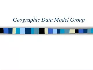
A Geographic Data Model for Representing Ground Water Systems
60 likes | 184 Vues
This paper by Strassberg, Maidment, and Jones presents a novel geographic data model aimed at effectively representing groundwater systems. Acknowledging the absence of standardized GIS data sets for subsurface features, the authors propose a solution leveraging advancements in GIS technology. The expanded ArcHydro model accommodates spatial vector objects and common datasets, including aquifer units and well-related data. It successfully offers structures for depicting 2D and 3D hydrogeologic features, while also addressing the ongoing need for robust analysis in 3D environments. ###

A Geographic Data Model for Representing Ground Water Systems
E N D
Presentation Transcript
A Geographic Data Model for Representing Ground Water Systems • Paper by G. Strassberg, D.R, Maidment, N.L Jones. 2007. Ground Water, 45(4): 515-518 • Presented by David Hamilton Richardson, Environmental Studies, GEOG 370, Feb 26 2008
Representing Ground Water Systems • Problem: Standardized GIS data sets and systematic descriptions simply do not exist for the subsurface. • Hypothesis: With advances in technology and GIS becoming standard practice, a standardized model can be created for describing the subsurface can be created.
Method • Expanded on an earlier version of ArcHydro that was designed for showing surface water systems. • Allowes for spatial vector objects such as points, lines, and polygons. • Represents common data sets such as aquifer units from aquifer maps, and well-related data such as stratigraphy, water levels and water quality samples commonly stored in ground water databases.
Results • Successfully provides data structures for representing 2D and 3D hydrogeologic features such as aquifers and wells and objects for storing tabular or gridded temporal information such as water levels and water quality measurements. • Can be implemented in many different GIS packages but was designed with object classes from ArcGIS
Figures Figure 3.Objects representing a 3D geospatial context. Boundary represents the horizontal extent of an area of interest, GeoRasters represent gridded surfaces such as a digital elevation model, and GeoVolume represents a volume within the subsurface. Image courtesy of: (http://www.blackwell-synergy.com/na102/home/ACS/publisher/synergy/journals/production/gwat/2007/45/4/j.1745-6584.2007.00324.x/images/large/gwat_324_f3.gif
Conclusions • Above the surface work on standardizing GIS data sets has been going on for quite some time and this model fills a glaring hole by offering a way to describe subsurface information • Criticism: The technology for analyzing 3D spatial analysis in GIS is still somewhat weak, putting a greater emphasis on 2D.