Download
1 / 60
610 likes | 634 Vues
Learn the basics of Geographic Information Systems (GIS) and spatial thinking with this informative guide. Explore how maps are models of geographic data, essential for navigation, exploration, and education. Discover the role of spatial vocabulary and map characteristics in cartography. Gain insights into map scales, generalization, data measurements, GIS applications, and map projections.

E N D
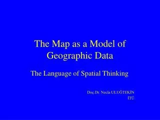
The Map as a Model of Geographic Data The Language of Spatial Thinking Fundamentals of GIS Michael N. DEMERS Assoc.Prof.Dr. Necla ULUGTEKIN ulugtek@itu.edu.tr
Spatial thinking requires us to be able to selectobservemeasurecataloguecharacterisewhat we encounter.
Data are collected • in the field basic (absolute) data • remote sensing basic (absolute) data • existing maps derived data • catalogues derived data • ...
Existing maps into the GIS • Different level of generalisation • Different level of scales • Different projections • Different symbolisation
Cartography is the art, science and technology of making maps together with their study as scientific documents and works of art. (1973, ICA)
Cartography is the organisation, presentation, communication and utilisation of geo-information in graphic, digital or tactile form.(ICA, 1991) A knowledge about cartographic methods will increase a portion of our spatial vocabulary that we have called graphicacy.
Map • an abstraction of reality, it is not reality itself. • the fundamental language of geography. • symbolise image of geographical reality • representing selected feature • representing feature relationships • representing characteristics
Maps can be used • Navigation • Exploration • Discovery • Interactive computer navigation • Education • Forecasting • …
Primary Types of Maps • Topographic Map (General Reference) • Thematic Map
GIS works together • geology • surveying • soil science • other disciplines...
GIS is used in these disciplines,in addition to • Geological maps • Topographic maps • Cadastral Maps • Soil Maps
The thematic context of GIS includes • Vegetation maps • Transportation maps • Animal distribution maps • Utility maps • Urban plans • Zoning maps • ...
GIS is • hardware • software • people (organisation) • data
GIS is about • data integration • spatial analysis • link with application based models
The traditional approach to mapping called the communication paradigm The map was a final product designed to communicate a spatial pattern through the use of symbols, class limit selection and so on. The traditional method was limited because raw, pre-classified data are not readily available to the map user
Communication Paradigm Real World Cartographer Conception Map Map User Conceptions
The alternative approach to cartography which is computer technology calledthe analytical or holistic paradigm Maintains the raw attribute data inside a computer storage device and display data based on user needs and user classifications
Map Scale • Scale is the ratio of distance on the map to the same distance as appears on the earth • Methods of illustrating map scale • verbal scale 1mm = 1000 mm • representation fraction 1:1000 • graphic or bar scale • 1:1000 1:5000 1:10 000 1:25 000
Generalisation • Every map is, in principle, generalised. • Why? • increasing density of the map contents due to scale reduction • limit of sharpness of the eye, printing capabilities • minimum size of symbols on map • the choice of degree of generalisation depends on aim and scale of the map.
1 : 5 000 1:25 000 1:50 000
Map Characteristics • Maps as images of the world, represent the locations of objects, as well as their qualities or magnitudes. • Objects are represented as points, line, areas or surfaces in the computer memory as like in the reality.
Objects Parcel area (value) Parcel owner (text) photo
Levels of data measurements • qualitative or nominal level • ordered or ordinal level • quantitative or interval level
GRID SYSTEMS for MAPPING Geographical Coordinates based on latitude and longitude for the locating of objects or features on the spherical (elipsoidal) earth or its reference globe. Rectangular Coordinates or Plane Coordinates allows us to locate objects correctly on these flat maps.
elevation elevation Sea level
Parallel meridian Geographical Coordinates Prime meridian Equator Prime meridian
Map Projection • The three-dimensional geographic relationships of the Earth surface must be transformed to the two-dimensional plane of the map by any of several procedures called map projections. • Division of map projections according to their properties • conform projections • equivalent (Equal-Area) projections • equidistant projection • others
Division of map projections according to their construction • cylindrical projections • conic projections • azimuthal projections Division of map projections according to their aspect • Polar (regular) • Equatorial (transversal) • oblique
Projection surfaces a tangent conic (cylindirical or azimuthal) projection with one standard parallel Perspective projection!Pseudo Projections
Position of the (earth) rotation axis to surface normal • polar or regular I • equatorial or transverse ___ • oblique /
preserve the property of local shape conformed projections
preserves distances but only along one or a few linesequidistant projectionsthe azimuthal equidistant projections
preserve the property of area equal area or equivalent projections
MARS 2001 Winkel Tripel Projeksiyonu
Arabian Island & Greenland a: original b: equal area projection c: conform projection
UTM (Universal Transverse Mercator) C.S. North northern hemisphere Central meridian for zone 500 000m E Equator (0m N, 10 000 000m S) southern hemisphere South . 1800W-1800E (60of longitude wide- 60 gores(zone)) 800S - 840N (80of latitude wide - 20 latitudinal belts) ? Prime meridian
UNIVERSAL TRANSVERSE MERCATOR PROJECTION (UTM) • cylindrical, equatorial, conform projection • the area is covered by 80° South - 84° North latitude • the earth is divided into 60 zones (each 6° longitude) • 180° West Longitude - 0° - 180° East Longitude • 20 latitudinal belts (each 8° latitude) • scale factor = 0.9996 • origin shifted 500 000 m to east (false easting) • origin shifted 10 000 000 m to south for the southern hemisphere • the Hayford ellipsoid, the ED50 datum
The Cartographic Process • data collection (first step of GIS) • data compilation (classification and symbolism) • map production • map reproduction (output of GIS)
Map symbolism • According to their dimensional characteristics • point symbol (location and identity) • line symbol (linear characteristics) • area symbol (provinces, countries, soil units)
Map symbolism • According to their shape cartographic symbol grouped in three main categories • pictorial or descriptive symbols • geometric or abstract symbols • letter or number symbols • other symbols (pie graph, bar graph etc.)