Download
1 / 33
550 likes | 1.69k Vues
Geospatial-Intelligence Standards: The Basics Part 2: Overview of GEOINT Standards. On-line training modules sponsored by the Geospatial Intelligence Standards Working Group (GWG). Part 2: Overview of GEOINT Standards. Overview

E N D
Geospatial-Intelligence Standards:The BasicsPart 2: Overview of GEOINT Standards On-line training modules sponsored by the Geospatial Intelligence Standards Working Group (GWG)
Part 2: Overview of GEOINT Standards Overview In Part 2, you will learn the basics on geospatial intelligence (GEOINT) standards and the critical role they play in supporting interoperability goals and enabling the sharing of GEOINT across varied systems and communities. GEOINT standards make it possible for the intelligence and war-fighting communities to share essential data and information as they work together with their civil, international, and private sector partners, to carry out their critical missions in today’s world. The National Geospatial-Intelligence Agency (NGA) has key leadership responsibilities for ensuring the availability of GEOINT standards to support activities across the National Systems for Geospatial Intelligence (NSG). In this module you will learn: • What do we mean by the term “GEOINT” • Who creates GEOINT and who uses it • What is the NSG Enterprise Architecture and how is it supported by standards • What do we mean by GEOINT standards • What is the difference between GEOINT and information technology (IT) standards • Where do GEOINT standards come from • How are GEOINT standards are implemented
Part 2: Overview of GEOINT Standards What is Geospatial Intelligence? Geospatial intelligence is a specialized discipline within the defense and intelligence communities. It is defined in Title 10 U.S. Code 467 as: the exploitation and analysis of imagery and geospatial information to describe, assess, and visually depict physical features and geographically referenced activities on the earth. GEOINT is made up of 3 key elements: geospatial information, imagery, and imagery intelligence. Geospatial informationcan be widely defined as any information that has a spatial aspect to it, that is, the information is tied to a position on the earth. Geospatial information comes from a variety of sources, in a variety of forms. It can be transmitted and visually portrayed in diverse ways. The most Figure 1. A visual depiction of GEOINT commonly understood manifestation of geospatial information is the map, a product that delineates, using symbols and text, the location of specific objects on the ground. Imagery, in the context of geospatial information, refers to “pictures” of earth locations that carry geo-positioning information and are produced by a variety of remote sensing equipment, such as aerial photographic cameras and satellite visible and infrared digital imaging instruments. Imagery intelligence is the product of imagery and imagery interpretation processed for intelligence use.
Part 2: Overview of GEOINT Standards What is Geospatial Intelligence? (cont.) Using a combination of advanced technologies, systems, and capabilities, the 3 basic elements of GEOINT, geospatial information, imagery, and imagery intelligence, are integrated to produce standard and specialized GEOINT products. GEOINT products are produced using a wide variety of GEOINT systems and capabilities. Data collection systems incorporate an assortment of still and motion imagery sensors, as well other unique sensing capabilities, carried on national, civil, and commercial satellite and airborne systems. Additional GEOINT support systems range from collection and requirements management systems to systems that support the exploitation, access, dissemination and storage of GEOINT. These critical GEOINT systems support enhanced capabilities, such as the use of multiple and advanced sensors, the fusion of information from multiple intelligence sources, the creation of 3-D and 4-D visualization products, and the ability to achieve greater precision and detail. The integration of GEOINT systems and capabilities provides the powerful underpinning for the creation of GEOINT products. Real-time motion video from UAV
Part 2: Overview of GEOINT Standards What is Geospatial Intelligence? (cont.) GEOINT products range from aeronautical and nautical charts, to topographic maps and digital line graphs, to precision targeting products, to geodesy and geophysical models and systems, and to intelligence reports and briefs. They include standard products and those customized for a specific purpose. Standard GEOINT products are typically 2-D products, such as maps, charts, and ortho-photo images, produced using geospatial data and electro-optical sensors. These products can include “value added” information layers. Standard GEOINT products provide the foundation for building customized products that meet unique user requirements. Specialized GEOINT products are created using unique and advanced capabilities that integrate multi-sensor, -intelligence, and -geospatial data. Dynamic 3 and 4 dimensional displays and interactive products tailored to specific user requirements can be created from these advanced technologies, including fly through visualizations and other mission simulations. Standard Products Specialized Products Two color multi-view, change detection
Part 2: Overview of GEOINT Standards Who Uses and Provides GEOINT? GEOINT supports critical decision making related to national security, military programs and operations, intelligence collaboration, and homeland security, including emergency management and disaster assistance. GEOINT products are used for military and intelligence planning and in carrying out mission operations, including providing a common framework for joint operations. Homeland security agencies, U.S. policy makers, and national and international partners also use GEOINT to support their collaborative missions. The GEOINT user community is a component of the National Systems for Geospatial Intelligence (NSG). The NSG is broadly defined as “…the combination of technology, policies, capabilities, doctrine, activities, people, data, and communities necessary to produce geospatial intelligence in an integrated multi-intelligence, multi-domain environment. (NSG Statement of Strategic Intent, March 2007)
Part 2: Overview of GEOINT Standards Who Uses and Provides GEOINT? Members of the NSG community include the agencies of the Intelligence Community (IC), Joint Staff, Military Departments (to include the Services), and the Combatant Commands (COCOMS). NSG partners include Federal Geographic Data Committee members, International partners, Industry, Academia, Defense Service Providers and Civil Community Service Providers. The NGA has key leadership responsibilities for providing GEOINT within the NSG. The Director, NGA has been assigned by DoD as the Functional Manager for GEOINT and is responsible for managing the end-to-end GEOINT process. This process, carried out by NGA organizations, ranges from source collection to data processing and exploitation to distribution of GEOINT data and products. NGA is responsible for the installation, testing, integration, and life-cycle support for NSG systems and capabilities. For a more detailed description of GEOINT products, systems, and capabilities, and more information on the NGA and the NSG Community read: • NSG Intelligence (GEOINT) Basic Doctrine, Publication 1-0, September 2006 • NSG Statement of Strategic Geospatial Intent, March 2007 • Geospatial Intelligence Support to Joint Operations, March 2007
Part 2: Overview of GEOINT Standards Standards and the NSG Architecture As a discipline, GEOINT “encompasses all activities involved in the planning, collection, processing, analysis, exploitation, and dissemination of spatial information in order to gain intelligence about the national security or operational environment, visually depict this knowledge, and fuse the acquired knowledge with other information through analysis and visualization processes.” (NSG Statement of Strategic Intent, March 2007) All of these GEOINT components need to interoperate and be compatible in order to deliver accurate, timely, and cost-effective GEOINT across the broad NSG community. Here is where the NSG architecture and GEOINT standards come into play.
Part 2: Overview of GEOINT Standards Standards and the NSG Architecture (cont.) Standards support the NSG enterprise architecture and are the basis for systems interoperability and operational efficiency. The NSG architecture defines, at varying levels, the operations and systems that are needed, from data collection to dissemination and storage, to produce the GEOINT required by the NSG community. This architecture is, in essence, a “blueprint” that functionally describes the NSG enterprise and the interconnectivity of its components. The high-level operational architecture depicted here shows the key operational components of the NSG enterprise. Each of these components is realized through a number of technical objectives and capability goals. These objectives and capabilities, in turn, drive the need for standards that support them. A key characteristic of the NSG architecture is that it is being defined within a service-oriented framework. A Service-Oriented Architecture (SOA) is defined in many ways, but, in general, it is an approach to finding business solutions through the use of interfaces that manage service requests and replies in a standardized way. Web services provide one technology for implementing SOAs, and they are critical components of the NSG architecture. As illustrated in the next diagram, the use of standardized web services enables distributed dissemination of GEOINT products. NSG Operational Architecture
Response Enterprise Service Bus Imagery Positioning Targeting Terrain Aero Topo Marine Geodesy More… Part 2: Overview of GEOINT Standards Dissemination of GEOINT Using SOA/Web Services GEOINT Products GEOINT Production Web Map service (WMS) Web Feature Services (WFS) Web Map service (WMS) Web Feature Services (WFS) KML/GML, etc.. KML/GML, etc.. Request Multi-security shared service portals FalconView Google Earth ArcGIS Explorer GeoMedia ArcGIS Web Browsers Etc... Approved for Public Release NGA Case # 06-234
Standards Supporting the NSG Architecture Breadth of Standards Corporate Operations Standards (US Govt.) IT Standards (DISA) GEOINT Standards (NGA) Security Standards (DNI) Part 2: Overview of GEOINT Standards Standards and the NSG Architecture (cont.) Standards are crucial to ensuring the compatibility and interoperability of GEOINT data and systems that make up the NSG architecture. The use of universally accepted and agreed upon standards ensures that NSG system components do what they are required to do and are integrated in a way that allows GEOINT to be exchanged between them. Standards also ensure that GEOINT data is in a form that can be understood by all the varied users and systems. A large number of standards are needed to support all aspects of the NSG architecture. Information technology (IT), GEOINT, security, and operational standards are the main types of standards that provide the foundation for the architecture. GEOINT and IT standards will be further discussed.
Part 2: Overview of GEOINT Standards What Are GEOINT Standards? GEOINT standards support specific elements of the NSG architecture and represent approximately one-fourth of all of the standards relevant to the architecture. They are defined as documented agreements containing technical specifications or other precise criteria to be used consistently as rules, guidelines, or definitions of characteristics to ensure that materials, products, processes, or services are fit for the analysis and visual representation of physical features and geographically referenced activities. GEOINT standards define GEOINT data, data constructs, data services, products, and interfaces. They enable the collection, processing, analysis, and exploitation of GEOINT and govern GEOINT access, dissemination, and storage. The application of GEOINT standards reduces the use of multiple and incompatible sets of data and makes it possible to create and share suitable, accurate, comprehensive, and timely GEOINT. GEOINT standards encompass the following categories: • GEOINT metadata • still and motion imagery content and format • sensor modeling • feature data dictionaries and catalogs • geographic feature encoding • geographic portrayal • geospatial referencing • information transfer • data compression Click on each of the above for a general description. Look for future training modules that explore specific types of GEOINT standards. Types of Standards Supporting the NSG Architecture GEOINT standards 25% Other NSG standards (IT, Corporate, Security, etc.) • GEOINT reporting • GEOINT product specifications • GEOINT web services 75%
Part 2: Overview of GEOINT Standards What Are Information Technology (IT) Standards and How are They Different From GEOINT Standards? Information technology (IT) is defined by the Information Technology Association of America (ITAA) as: "the study, design, development, implementation, support or management of computer-based information systems, particularly software applications and computer hardware." IT standards define how IT systems work and interact with one another. For example, they define operating system and network interfaces, services and protocols. The use of standardized IT systems components within the NSG architecture enhances the interoperability and interchangeability of systems elements. This provides the NSG with more options in the procurement of hardware, software, and network components. Standardized components also decrease costs, as well as the technology risks associated with systems development. Worker productivity is also enhanced when the use of multiple incompatible systems is reduced. GEOINT standards and IT standards work together to ensure successful and efficient implementation of the NSG architecture. In general, GEOINT standards apply to the data or information that is being exchanged, while IT standards govern how IT systems hardware, software, and networks interconnect and interact with one another within the NSG architecture. Standardized IT system components must be able to support the flow of standardized GEOINT data.
Part 2: Overview of GEOINT Standards Where Do GEOINT Standards Come From? The GEOINT standards that support the NSG architecture come from a variety of private sector and government standards bodies. Adopted national and international standards, along with other private sector defacto and de-jure standards are used whenever feasible. The following is a general overview of the key contributors of standards that support the production and use of GEOINT. International Standards NGA and the NSG community actively participate in a number of international standards bodies whose standards are essential to GEOINT. Within International Organization of Standardization (ISO), ISO Technical Committee 211 (TC211), Geographic information/Geomaticswas established to address the needs of standardization in the field of digital geographic information. To that end, it is developing a structured set of abstract standards for information concerning objects or phenomena that are directly or indirectly associated with a location relative to the Earth. The work of TC211 is closely linked to NGA’s core mission for geospatial information and has the greatest potential to support mission needs for coalition interoperability. The following are a few examples of ISO TC211 standards that are directly relevant to the production and use of GEOINT: • ISO 19115:2003 Geographic information – Metadata • ISO 19110:2005 Geographic information – Methodology for feature cataloguing • ISO 19107:2003 Geographic information – Spatial Schema • ISO 19119:2005 Geographic information – Services
Part 2: Overview of GEOINT Standards Where Do GEOINT Standards Come From? (cont.) A joint ISO and International Electrotechnical Commission (IEC) committee, called the ISO/IEC Joint Technical Committee 1 (ISO/IEC JTC 1) on Information Technology,has two subgroups that develop standards of particular interest to the GEOINT community. The Information Technology Standards Subcommittee 24, Computer Graphics and Image Processing (ISO/IEC JTC 1/SC 24) prepares standards for computer graphics and image processing, largely based on consortia or defacto standards with wide commercial/technical use. The Information Technology Standards Subcommittee 29, Coding of Audio, Picture, Multimedia and Hypermedia Information (ISO/IEC JTC 1/SC 29), standardizes coded representation of audio, picture, multimedia and hypermedia information, and sets of compression and control functions for use with audio information, Still Pictures, and Moving Pictures. ISO/IEC JTC 1 standards, such as those listed below, enable the production of advanced GEOINT products. • ISO/IEC 15444-1:2001 JPEG 2000 Imaging Coding System • ISO/IEC 13818 Information Technology - Generic coding of moving pictures and associated audio information • ISO/IEC 12087-5 Basic Image Interchange Format (BIIF) • ISO/IEC 14772 Virtual Reality Modeling Language (VRML)
Part 2: Overview of GEOINT Standards Where Do GEOINT Standards Come From? (cont.) The International Hydrographic Organization (IHO) is another international standards body whose work is important for the sharing of GEOINT between the U.S and its international partners. The IHO is comprised of hydrographic authorities involved in the collection processing, and production of hydrographic information supporting world wide maritime navigation. Their aim is to standardize hardcopy and digital hydrographic information among producing nations. A number of working groups address the standards needs for hydrographic surveys, navigational warnings, and hydrographic requirements for information systems. IHO standards of particular interest to the NSG are: • IHO Standard S-52, Specification for Chart Content and Display Aspects of Electronic Chart Display and Information Systems (ECDIS), and • IHO Standard S-57, Transfer Standard for Digital Hydrographic Data and associated Object Catalog. These IHO standards are being harmonized with U.S. government standards for hydrographic and navigational GEOINT data in order to address interoperability issues between the U.S. Navy and the navies of the NATO nations.
Part 2: Overview of GEOINT Standards Where Do GEOINT Standards Come From? (cont.) The Digital Geographic Information Working Group (DGIWG)is an international coalition standards forum, comprised of defense organizations of member nations, established to address standards that enable the exchange and exploitation of geospatial data between defense communities, in particular standards that enhance the interoperability of NATO and coalition forces. DGIWG developed the suite of Digital Geographic Information Exchange Standard (DIGEST) standards, including the Feature and Attribute Coding Catalogue (FACC) and the DGIWG Feature Data Dictionary (DFDD) , on which existing and future military product and data specifications are based. Current DGIWG activities focus on development of standards based on those of ISO/TC 211 and the building of standards profiles of ISO standards that reflect the military requirements of the member Nations. DGIWG also works with consortia, such as Open Geospatial Consortium (OGC®), to define commercial technologies and toolsets that promote the discovery, access, and transfer of data for military applications. Multinational standardization also takes place under the North Atlantic Treaty Organization ( NATO). Standards working groups develop NATO Standardization Agreements (STANAGS), which are based on product and data specifications of member Nations. These support interoperability and data exchange for coalition operations. Standards experts within the NSG participate in the development and implementation of the NATO STANAGs that support GEOINT products and systems. As an example, NATO’s Air Group IV, addresses interoperability of airborne collection and exploitation systems through standardization in the area of Air Armaments. Key STANAGS work includes: • STANAG 4545, NATO Secondary Image Format (NSIF), • STANAG 4559, NATO Secondary Imagery Library Interface (NSILI)
Part 2: Overview of GEOINT Standards Where Do GEOINT Standards Come From? (cont.) U.S. National Standards GEOINT standards also come from U.S. national standards bodies and private industry consortia. The InterNational Committee for Information Technology Standards (INCITS), accredited by ANSI, develops and promulgates information technology standards at the U.S. national level. The INCITS committee L1 - Geographic Information Systems (GIS) is of particular interest to GEOINT applications because it develops and adopts digital geographic data standards that apply to the unique requirements of geographic information systems. INCITS – L1 also advances American National Standards into the international arena by proposing work items in ISO/TC211. NGA, representing the requirements of the NSG community, is a voting member of and active participant and leader within INCITS – L1. Examples of INCITS-L1 standards relevant to GEOINT are: • INCITS 320:1998 [R2003]Information technology - Spatial Data Transfer • INCITS 353:2004Information technology - Spatial Data Standard for Facilities,Infrastructure, and Environment (SDSFIE) • ANSI INCITS 415-2006Information technology - Homeland Security Mapping Standard - Point symbology for Emergency Management
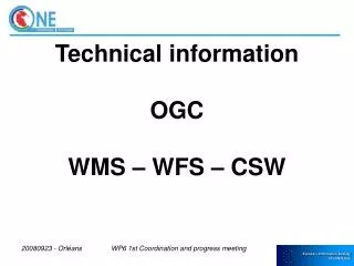
Part 2: Overview of GEOINT Standards Where Do GEOINT Standards Come From? (cont.) Industry Consortia Private industry consortia also play a role in developing standards relevant to GEOINT. For example, the OGC®is a key private sector contributor of standards and specifications that support the sharing of GEOINT. The OGC® promotes interoperability of geospatial data and systems by developing and testing open (publicly available) interface specifications that can be supported by Standards-based Commercial-off-the-Shelf (SCOTS) software packages. NGA supports OGC® initiatives that advance the interoperability of GEOINT such as: • Open Web Services, such as Web Mapping Service (WMS), Web Feature Service (WFS), etc. • Transducer Markup Language (TML) • Geography Markup Language (GML) U.S. Government Standards U.S. government agencies depend on the availability of standards to meet the requirements of their missions. Individual departments and agencies, as well as standards committees may develop new or adapt existing standards to meet their mission requirements.
Part 2: Overview of GEOINT Standards Where Do GEOINT Standards Come From? (cont.) The National Institute of Standards and Technology (NIST), within the Department of Commerce, creates government-wide standards called Federal Information Processing Standards (FIPS) when private-sector standards are not available to meet government requirements. FIPS address a variety of standardization needs for interoperability of government computer systems and data. Many of these standards are relevant to NSG systems development, such as FIPS Pub 10-4:2002, which describes country coding. Individual U.S. government departments or agencies may also develop and mandate standards for agency or department wide use. The Department of Defense (DoD) develops Military Standards and Specifications when existing standards do not meet DoD requirements. These are developed under the Defense Standardization Program(DSP),which assigns agencies to standardization areas of interest. The NGA is responsible for standardization within the GEOINT discipline. DoD standards, such as MIL-STD-2525C, Common Warfighting Symbology, 1 July 2005, support the production and portrayal of GEOINT. U.S. Government inter-agency standards committees that operate within and across the civil, military, and intelligence environments, coordinate and address issues related to government requirements. The Geospatial Intelligence Standards Working Group (GWG), led by the NGA and made up of NSG representatives, addresses GEOINT standards issues. The GWG coordinates its activities with other relevant committees, such as the Intelligence Community Metadata Working Group (IC MWG) and the Federal Geographic Data Committee (FGDC).The GWG endorses standards for placement within the DoD Information Technology Standards Registry (DISR), which defines and mandates the use of IT and GEOINT standards applicable to DoD systems.
Part 2: Overview of GEOINT Standards How Are GEOINT Standards Implemented? Implementation of relevant GEOINT standards begins with defined requirements that articulate the need for specific GEOINT functionality and capabilities. Enterprise architecture development activities identify key areas where standardization is needed. Standards that can potentially fulfill these requirements are identified and analyzed to determine which standards to select. Standards applicability, along with the standards source, development status, degree of market place support, costs, and identified risks are all taken into consideration when selecting the right GEOINT standards. Within NGA, GEOINT standards that have been selected for use by in the NSG enterprise architecture are documented in the Technical Standards View (TV) of the architecture. The TV is the overall base line of standards that is used to select standards for specific systems acquisition and development activities. GEOINT standards are a subset of the standards listed in the TV for the NSG. Standards Selection Abstract Standards Architecture Development TV Development Systems Acquisition Standards Contract Profiles Implementation Profiles Reference Implementations Testing GEOINT standards are ultimately implemented through systems acquisition and engineering processes. The standards components of these processes include the selection of standards for contract profiles and the further development of implementation profiles of abstract standards, reference implementations, and guidelines. Standards and systems testing and verification is also a component of standards implementation that is critical to ensuring project reliability and performance.
Depth the GEOINT Standards GEOINT Standards ds r a d Abstract Standards n a t S f o h Implementation Profiles t p e D Reference Implementations Part 2: Overview of GEOINT Standards How Are GEOINT Standards Implemented? (cont.) The selection of high-level abstract standards does not end the need for standards development. To effectively implement standards, their application most often requires further adaptation of the standard to the specific project. The “depth” of a standard is represented by the implementation profiles and reference implementations that are needed to fully implement the standard.
Part 2: Overview of GEOINT Standards The Language of Standards In this lesson, you have been introduced to a number of standards-related terms. Key fundamental standards terms associated with this module include: Abstract Standard -- a high-level framework that covers a broad range of applications for a general class of data, such as geospatial information. It is generally approved at national or international levels. Contract Profile -- a list of standards that is a subset of a defined Standards Technical View (TV) and relates to a specific acquisition contract DoD Information Technology Standards Registry (DISR) - defines and mandates service areas, interfaces, standards, and standards profiles applicable to the development and acquisition of new or modified IT and national security systems throughout DoD. Geospatial Intelligence (GEOINT) -- the exploitation and analysis of imagery and geospatial information to describe, assess, and visually depict physical features and geographically referenced activities on the earth. GEOINT consists of imagery, imagery intelligence and geospatial information. GEOINT Standards -- a documented agreement containing technical specifications or other precise criteria to be used consistently as rules, guidelines, or definitions of characteristics to ensure that materials, products, processes, or services are fit for the analysis and visual representation of physical features and geographically referenced activities.
Part 2: Overview of GEOINT Standards The language of Standards (cont.) Geospatial Information -- information that is tied to a position on the earth Imagery -- pictures of earth locations produced by remote sensing equipment Imagery Intelligence -- the product of imagery and imagery interpretation processed for intelligence use. Implementation Profile -- detailed implementation compliance guidance written for a single standard or a group of standards that provides guidance on which portions of the standard(s) are to be applied and how. Information Technology (IT) Standard -- defines how IT systems work and interact with each other. National Systems for Geospatial Intelligence (NSG) -- the combination of technology, policies, capabilities, doctrine, activities, people, data, and communities necessary to produce geospatial intelligence in an integrated multi-intelligence, multi-domain environment. NSG Community – consists of members of the Intelligence community, Military Departments and agencies, Joint Staff, and Combatant Commands, along with civil, international, industry, and academic partners. NSG Enterprise Architecture –the “blue print” that describes all aspects of the operations and systems that are needed to produce GEOINT
Part 2: Overview of GEOINT Standards The language of Standards (cont.) Reference Implementation -- an approved/selected exemplar of a software module or service that is conformant to an implementation profile and is available for reuse by developers in their own instantiations of the function or service Service-Oriented Architecture (SOA) -- an approach to finding business solutions through the use of interfaces that manage service requests and replies in a standardized way. Standards Technical View (TV) – a profile or set of standards developed in accordance with the Department of Defense Architecture Framework (DoDAF) that is essential to governing the implementation, arrangement, interaction, and interdependence of systems.
Part 2: Overview of GEOINT Standards Summary Here are some key points for you to take away from this lesson: GEOINT is a specialized discipline that integrates geospatial information, imagery and imagery intelligence. The discipline of GEOINT includes all of the activities associated with planning, collection, processing, analysis, exploitation, and dissemination of spatial information in order to gain intelligence about the national security or operational environment and visually depict this knowledge. National missions are supported with standard and specialized GEOINT products, from aeronautical and hydrographic charts to complex operational visualizations. The users of GEOINT products are referred to as the National Systems for Geospatial Intelligence (NSG) community, made up of DoD, the intelligence community, and civil partners. The NSG itself represents the full extent of GEOINT operations, from data collection to analysis, exploitation, storage, dissemination, and use. The “blue print” that identifies all aspects of the NSG systems and operations and their interactions is called the NSG enterprise architecture. GEOINT and other standards, such as information technology standards, are critical to ensuring the interoperability and interchangeability of these systems. GEOINT standards support specific elements of the NSG architecture and define GEOINT data, data constructs, data services, products, and interfaces. GEOINT standards reduce the use of multiple and incompatible sets of data and govern GEOINT access, dissemination, and storage.
Part 2: Overview of GEOINT Standards Summary (cont) GEOINT standards, such as those for metadata, still and motion imagery, geographic features and their portrayal, visualization products, and web services, are created by recognized National and International, government and non-government, standards organizations. The Geospatial Intelligence Standards Working Group (GWG) is the NSG community forum for adopting and adapting GEOINT standards for implementation within the NSG. Implementing GEOINT standards requires the analysis and selection of appropriate standards to input into systems acquisition and engineering processes. Higher level abstract standards are adapted to systems acquisitions through the development of implementation profiles, which provide specific guidance on how to consistently apply a particular standard or set of standards. Reference implementations are developed as examples conformant to the implementation profile. Standards and systems testing are also necessary components to successful GEOINT standards implementations.
Part 2: Overview of GEOINT Standards Quick Quiz • Now that you have a basic understanding of what GEOINT standards are and why they are needed, click next and take this quick quiz. More than one answer may be selected. • Want to learn more about GEOINT and GEOINT standards? Visit the following websites: • National Geospatial-Intelligence Agency http://www.nga.mil • GEOINT Standards Working Group http://www.gwg.nga.mil
Part 2: Overview of GEOINT Standards Part 2 Quick Quiz 1. GEOINT is: a. Composed of geospatial information, imagery, and imagery intelligence b. A standards organization c. A specialized discipline within the defense and intelligence communities d. All of the above Answer: a. Composed of geospatial information, imagery, and imagery intelligence c. A specialized discipline within the defense and intelligence communities 2. GEOINT systems: a. Produce tanks and other armored vehicles b. Support enhanced capabilities, such as fusing data from multiple and advanced sensors c. Include data collection systems d. Include support systems for requirements management and data exploitation, access, and storage e. All of the above Answer: b. Support enhanced capabilities, such as fusing data from multiple and advanced sensors c. Include data collection systems d. Include support systems for requirements management and data exploitation, access, and storage
Part 2: Overview of GEOINT Standards • Part 2 Quick Quiz (cont.) • 3. GEOINT data and products • a. Support all national missions • b. Can be standard or customized for specific users • c. Support critical decisions related to national security • d. Support critical decisions related to emergency management and disaster assistance • e. All of the above • Answer: • e. All of the above • The National System for Geospatial Intelligence (NSG) is: • a. The hardware used to create GEOINT products • b. Composed of defense and intelligence agencies and their partners who need GEOINT • c. Represents technologies, policies, people, and activities needed to produce GEOINT • d. None of the above • Answer: • b. Composed of defense and intelligence agencies and their partners who need GEOINT • c. Represents technologies, policies, people, and activities needed to produce GEOINT
Part 2: Overview of GEOINT Standards • Part 2 Quick Quiz (cont.) • 5. The NSG enterprise architecture needs standards to: • a. Ensure systems are compatible and interoperable • b. Exchange GEOINT between different systems and users • c. Meet security requirements • d. All of the above • Answer: • d. All of the above • 6. GEOINT standards: • a. Define GEOINT data, data services, and products • b. Define hardware requirements • c. Include metadata, feature standards, and web services • d. Are always developed by the government • Answer: • a. Define GEOINT data, data services, and products • c. Include metadata, feature standards, and web services
Part 2: Overview of GEOINT Standards • Part 2 Quick Quiz (cont.) • 7. GEOINT standards are developed by: • a. DoD standards organizations only • b. Private industry only • c. International and National standards organizations • d. U.S. government agencies and committees when necessary • Answer: • c. International and National standards organizations • d. U.S. government agencies and committees when necessary • 8. To effectively implement GEOINT standards: • a. Testing for systems compliance is necessary • b. Systems acquisitions and engineering processes are followed • c. Standards profiles may need to be developed • d. Reference implementations are needed to identify the set of standards that will be used in a contract • e. All of the above • Answer: • e. All of the above
Congratulations!You’ve CompletedPart 2: Overview of GEOINT Standards On-line training modules sponsored by the National Center for Geospatial Intelligence Standards (NCGIS)