The WRF Lightning Forecast Algorithm for GLM:
The WRF Lightning Forecast Algorithm for GLM: Refinement and Incorporation into Convection-allowing Ensemble Forecasts. E. W. McCaul, Jr. 1 J. Case 2 , T. Chronis 3 , S. Goodman 4 , S. Dembek 1 , F. Kong 5

The WRF Lightning Forecast Algorithm for GLM:
E N D
Presentation Transcript
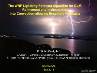
The WRF Lightning Forecast Algorithm for GLM: Refinement and Incorporation into Convection-allowing Ensemble Forecasts E. W. McCaul, Jr.1 J. Case2, T. Chronis3, S. Goodman4, S. Dembek1 , F. Kong5 1: USRA; 2: ENSCO, NASA SPoRT; 3: UAH; 4: NOAA NESDIS; 5: OU/CAPS Science Mtg Sep 2013 Photo, David Blankenship Guntersville, Alabama
Recent LFA Studies with NSSL,HRRR,SPoRT:Recent tasks have involved:1. Examination of LFA performance by season2. Study of LFA variability in CAPS ensembles3. Reexamination of LFA threat areal coverage in NSSL WRF4. Check of LFA calibration in HRRR with Thompson micro5. Inspection of HRRR LFA output for Hurcn Isaac 20126. Study of LFA variability in 8x3 matrix of WRF runs equipped with diverse micro (8) and PBL (3) schemes
2010-11 NALMA, LFA Scatterplots by regime: O = graupel flux threat; x = vertical ice integral threat Supercell cases are well-handled by LFA Unsheared storms less well-handled WRF may have problems predicting pulse storm strength.
Year-2 LFA studies, CAPS WRF, 2011:(examined to assess sensitivity to model physics packages) Preliminary findings for spring weather, AMJ20111. CAPS Spring Expt runs used; focus is on severe storms, i.e.,supercells; spring 2011 had good WRF config diversity 2. Spring 2011: several major supercell days, little wx diversity3. Examined LFA ranges, SDs in the CAPS WRF configurations as a function of ensemble mean peak hourly LFA output4. LFA range, SD increases slowly as LTG rates increase, with fractional errors bigger at low FRD5. Assessed average LFA performance for specific microphysics configurations: WSM6, WDM6, Thompson 2-moment6. WSM6, WDM6 yield LTG FRDs bigger than ensemble mean; Thompson scheme yields LTG FRDs smaller
CAPS 2011 Experiments Model IC (arw_cn+) BC micro LSM PBL S4cn +00zARPSa 00zNAMf Thompson Noah MYJ S4m4 +em-p1 pert 21zSREF em-p1 Morrison RUC YSU S4m5 +em-p2 pert 21zSREF em-p2 Thompson Noah QNSE S4m6 +nmm-p1 pert 21zSREF nmm-p1 WSM6 RUC QNSE S4m7 +nmm-p2 pert 21zSREF nmm-p2 WDM6 Noah MYNN S4m8 +rsm-n1 pert 21zSREF rsm-n1 Ferrier RUC YSU S4m9 +eKF-n1 pert 21zSREF eKF-n1 Ferrier Noah YSU S4m10 +eKF-p1 pert 21zSREF eKF-p1 WDM6 Noah QNSE S4m11 +eBMJ-n1 prt 21zSREF eBMJ-n1 WSM6 RUC MYNN S4m12 +eBMJ-p1 prt 21zSREF eBMJ-p1 Thompson RUC MYNN S4m13 +rsm-p1 pert 21zSREF rsm-p1 M-Y Noah MYJ S4m14 +em-n1 pert 21zSREF em-n1 Ferrier+ Noah YSU S4m15 +em-n2 pert 21zSREF em-n2 WSM6 Noah MYNN S4m16 +nmm-n1 pert 21zSREF nmm-n1 Ferrier+ Noah QNSE S4m17 +nmm-n2 pert 21zSREF nmm-n2 Thompson Noah ACM2 S4m18 +rsm-p2 pert 21zSREF rsm-p2 WSM6 Noah MYJ S4m19 +rsm-n1 pert 21zSREF rsm-n1 M-Y Noah MYJ S4m20 +rsm-n2 pert 21zSREF rsm-n2 M-Y RUC ACM2
CAPS 2011 results, HUN Mean, range, SD vs. LTG1, x = expt 18, WSM6 LTG1 = graupel flux LTG threat Mean relative to full ensemble = 1.07 (4 expts) CAPS 2011 had four WSM6 expts Vertical lines: range of LFA peak output, each hr Diagonal: sorted means of all LFA members Orange: LFA mean +/- 1.0 SD X: results from listed single experiment
CAPS 2011 results, HUN Mean, range, SD vs. LTG1, x = expt 7, WDM6 Mean relative to full ensemble = 1.57 (2 expts) CAPS 2011 had two WDM6 expts
CAPS 2011 results, HUN Mean, range, SD vs. LTG1, x = expt 17, Thompson Mean relative to full ensemble = 0.71 (4 expts) CAPS 2011 had four Thompson expts
CAPS 2011 HUN findings (preliminary):expt micro LSM PBL mean/ensemble 3 Thompson Noah MYJ 0.831 5 Thompson Noah QNSE 0.80812 Thompson RUC MYNN 0.59017 Thompson Noah ACM2 0.613 6 WSM6 RUC QNSE 1.25711 WSM6 RUC MYNN 0.92015 WSM6 Noah MYNN 0.99818 WSM6 Noah MYJ 1.089 7 WDM6 Noah MYNN 1.41310 WDM6 Noah QNSE 1.726
CAPS 2011 findings (preliminary):1. Variations in LFA flash rate estimates display sensitivity to choices of microphysics and other physics packages;2. CAPS 2011 offers desirable set of 1- and 2-moment micro choices, facilitating intercomparisons (2012 all 2-moment);3. WDM6 produces the most graupel, so that LFA peak values are 1.57 times bigger than grand ensemble average; WSM6 average is 1.07 times bigger; Thompson 2-moment scheme is only 0.71 times as large;4. For recalibration of Thompson to match WSM6, must boost Thompson results by an estimated factor (1.07/0.71) = 1.50; 5. 2011 CAPS runs offer few storm days, too little storm type diversity; full calibration may be problematic; examine HRRR data from a variety of cases, if possible
NSSL 2011-2012 LFA area coverage checks: + (0.0,0.02,0.04,…0.30) = LTG area threshold; view diagonal crossings; 0.08 looks optimal
HRRR 2012 LFA recalibration (preliminary): Mean LMA/LFA=2.43 for HRRR Thomp micro
HRRR 2012 LFA in tropical cyclones:1. HRRR LFA shows LTG threat in most of the hourly forecasts on 28-31 Aug 2012 in Isaac, with max of 7.23 fl/km2/(5 min); no LMA, but ENTLN obs show:
SPoRT WRF LFA 20120703 matrix:1. Study variations in LFA flash rate estimates to systematic variations in microphysics (8), PBL (3) packages: micro = {WSM6,LIN,GODD,WDM6,THOM,MORR,MIL,NSSL}; PBL = {MYJ,QNSE, MYNN}2. All 24 runs otherwise identical (more specificity than CAPS);3. Consider weakly-forced summer convection in MOB, HGX;4. LFA starts threat earliest in WSM6,GODD,MIL,NSSL micro; especially with QNSE PBL; fades soonest for NSSL-MYNN, and LIN,GODD,WDM6 with QNSE5. LTG threat is biggest for WDM6, small for THOM,MIL,NSSL6. LTG threat seems to depend more on midlevel graupel than on midlevel VVEL; WDM6 has largest graupel amounts and moderately large VVEL; LTG max is especially sensitive to PBL choice for THOM microphysics
SPoRT WRF LFA 20120703 findings: LFA LTG threat, 20 UTC
SPoRT WRF LFA 20120703 findings: Graupel at 500 hPa
SPoRT WRF LFA 20120703 findings: VVEL at 500 hPa
Future Work:1. Continue collaborations with NSSL, CAPS, HRRR, others to implement, validate revised LFA;2. Complete study of LMA cases from 2010-2012 NSSL and CAPS WRF runs, using full data (in progress);3. Continue study of revised LFA in SPoRT matrix of runs, CAPS ensembles to assess varying model configurations; 4. Assess LFA for dry summer LTG storms in w USA;5. Examine HWRF, HRRR runs to assess LFA in TCs;6. Study ways of adding CG forecasts to LFA threat field, without compromising simplicity, if possible.Acknowledgments: NOAA GOES-R R3, NASA SPoRT

