Download
1 / 12
120 likes | 250 Vues
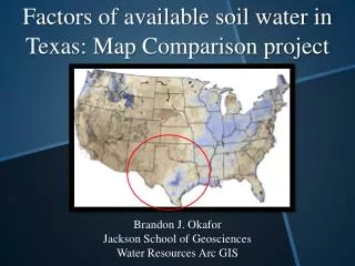
Factors of available soil water in Texas: Map Comparison project. Brandon J. Okafor Jackson School of Geosciences Water Resources Arc GIS. Edwards Aquifer two hydrogeological zones: Contributing and Recharge Zone

E N D
Factors of available soil water in Texas: Map Comparison project Brandon J. Okafor Jackson School of Geosciences Water Resources Arc GIS
Edwards Aquifer two hydrogeological zones: Contributing and Recharge Zone • Southeastern Dipping limestone formations in recharge zone = Greater amount of soil = more available soil water • But is that it? What about soil type, land cover, topographical relief, or actual geological units Exercise 2: Why the difference in available soil water in Texas?
Compared the available soil water map with soil type, land cover, geological units, and river locations. (And if I have time topographical relief) • Looked at Texas as a whole and my field site (river dominated system) What did I do?
Collision between North American Plate with Eurpoean-African –South American Plate building a mounting range River system that flowed westward creating a deltas on the coastline Plates separated and geological events switched he flowing rivers eastward. Sediment pile led to the subsidence of the coast, creation of Balcones Fault Zone (Edwards Aquifer) Sea level change creates the different Cenzoic sediment rocks Llano uplift exposing precambrian rocks at the surface Geological History of Texas
S = ∫(Cl,o,r,p,t); Climate, Organisms, Relief, parent rock, time 12 soil orders, but only 3 will be important to this project Soil Formations and Orders • Vertisols • Clay rich soils that shrinks and swells due to water content • Typically located in Texas
S = ∫(Cl,o,r,p,t); Climate, Organisms, Relief, parent rock, time 12 soil orders, but only 3 will be important to this project Soil Formations and Orders • Alfisols • Moderately leached soils formed under forests • Typically located in warm and humid/sub-humid regions
S = ∫(Cl,o,r,p,t); Climate, Organisms, Relief, parent rock, time 12 soil orders, but only 3 will be important to this project Soil Formations and Orders • Ultisols • Acidic soils with strong leaching of nutrient to plants ( Ca, Mg, K) • Typically located in humid, temperate, and tropical regions
Richland Creek Wildlife Management Area, Fairfield, TX • Floodplain of the Trinity river • Highly vegetated and mostly covered with Vertisols Where is the field site?
There are multiple factors that affect available soil water, making this property of soil very complex. • These factors are all connected and leads to the development of soils. • Rivers channels will not change the relationship between available soil water and the other factors, but will alter each factor individually. Conclusion