Download
1 / 4
80 likes | 831 Vues
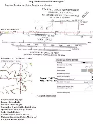
Location: Top right top. Series: Top right below location. Map Location/series/scale/index/legend. Scale: Bottom middle. Index contours: Dark brown contours with marked elevations. Legend: USGS Topo Map Symbols Sheet. Marginal Information. Location/series: Top right Legend: Bottom Right

E N D
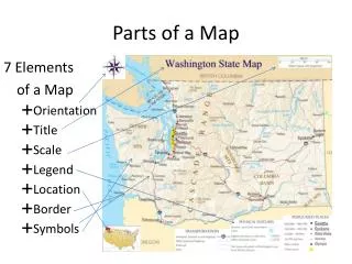
Location: Top right top. Series: Top right below location Map Location/series/scale/index/legend Scale: Bottom middle Index contours: Dark brown contours with marked elevations. Legend: USGS Topo Map Symbols Sheet Marginal Information Location/series: Top right Legend: Bottom Right Published: Bottom Right Surrounding Quads: Middle-Right Bottom Quad location: Middle-Right Bottom Scale: Middle Bottom Contour interval: Middle Bottom Magnetic Declination: Bottom Middle-Left Bar Scales: Bottom Middle
Contours Types: Dark, bold, brown = index contours. Thin, light brown = intermediate contours Contours used to enclose areas = closed contours. Enclose areas but include right angle tics pointing inward = depression contours. Map Features Magnetic Declination There is a diagram located at the center of the bottom margin of the quad. This diagram will have three (sometimes two) lines coming out of it. The one straight up is true north. One of the other two will say MN. This is magnetic north. The magnetic declination is the number of degrees between true north and magnetic north, and it is written right next to line MN. Map Colors- There are 6 major colors on a topographic map: black, blue, brown, green, red, and purple. Each means a different thing. black can denote features like roads and buildings, blue identifies water features, brown, contours, green, vegetation, red, important roads, and purple, revisions. Survey Control Marks (Control Stations and Spot Elevations) Survey Control Marks- These are specific points on a quad that give the exact elevation of a place that is not found on a contour line. You need to know control station marks, spot elevations, and benchmarks. The symbols for each of these can be found in the topographic map symbols booklet. Azimuths and Bearings Azimuth: ex. 197 degrees Bearing: ex. South 17 degrees West Stream Gradient (ft./1000 ft.) To find stream gradient, first measure the section of the stream you wish to use with a string. Then, figure out the change in elevation between the beginning and ending points of the portion of the stream. Input these amounts into the formula "change in elevation over distance x 1000" (C.I.E/Distance x 1000) to find the answer. You will need to use sting for this to accurately find the distance along the stream/river. Distance values between features (both English and metric units) See “Common map conversions sheet” word document. Geographic coordinate system features and symbols (degrees, minutes, seconds) ° = degrees ‘ = minutes “ = seconds 1° = 60’ = 3600” 1’ = 60”
Example: NE ¼ / NE ¼ / 21 / T1S-R4E Meaning: The Northeast quarter of the Northeast quarter of section 21 of township 1 south and range 4 east. Find the Township on the inside side of the right margins, in red type. Find the Range on the inside side of the bottom margins, in red type. Find the section number as a red letter on the map. The section quarter containing the number should be, for a northwest section, the northwest quarter. Public Land Survey System (PLSS) Slope (feet per 100 feet) Slope Gradient- Similar to stream gradient, use the formula "change in elevation over distance x 100" to find the answer. Sector Reference System and Graticule Tick Marks The SRS is a way of dividing a topo into 9 equal rectangular sections. There are 4 graticule tick marks on the map, which mark the corners of the sectors. 1 2 3 4 5 6 7 8 9 Topographic Profiles Take a piece of paper, place its edge on the line of interest, and make and label a tick mark for each contour line, labeling each one’s elevation. Now, put this paper on a piece of graph paper, and make a profile by connecting your dots.
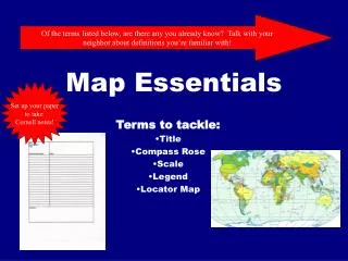
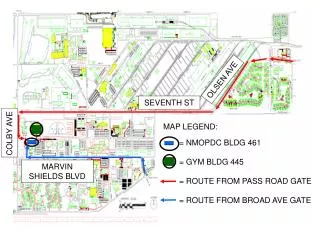
Highway: Map/Legend/Table/Index Legend: Top left Table: Bottom left Index: Top to Middle Right City/Regional inserts are located on the side opposite the main map.