Integrating NOAA's NDFD Data into GIS: Enhancements and Applications for Coastal Resource Management
This document outlines the integration of NOAA's National Digital Forecast Database (NDFD) with Geographic Information System (GIS) technologies. The Coastal Services Center (CSC) has partnered with the National Weather Service (NWS) to develop tools that convert NDFD data into GIS formats to support coastal resource management. Key outcomes include automated data downloads, GIS-compatible color tables, and comprehensive tutorials for users. These innovations aim to enhance the accessibility and display of meteorological forecasts for effective decision-making by federal, state, and local resource managers.

Integrating NOAA's NDFD Data into GIS: Enhancements and Applications for Coastal Resource Management
E N D
Presentation Transcript
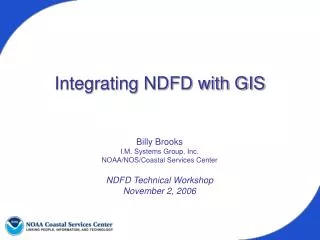
Integrating NDFD with GIS Billy BrooksI.M. Systems Group, Inc.NOAA/NOS/Coastal Services CenterNDFD Technical WorkshopNovember 2, 2006
CSC and NDFD • CSC’s mission - To support the environmental, social, and economic well being of the coast by linking people, information, and technology • Customers are Federal, State, and Local Coastal Resource Managers • CSC has worked and is working with the NWS to get products into GIS format or enhance GIS compatibility • CSC’s connection to NWS through Shared FTE – located at CSC (Doug Marcy) via agreement with OCWWS / HSD (2002) www.csc.noaa.gov
GIS and NDFD • Meteorological Development Laboratory’s Degrib: NDFD GRIB2 Decoder and Download Program • Provides access to all available forecast elements • Used to convert NDFD from GRIB2 to GIS format (.shp, .flt, .nc, .csv) - Shapefile - Floating Point Grid - NetCDF - Comma Delimited ASCII • Download and conversion can be automated via command line
GIS and NDFD CSC efforts have been to make NDFD data more GIS-friendly CSC worked with MDL to develop ArcView legend files (.avl) for proper display of converted data and tutorial on how to load NDFD color table legends in GIS Meets need for consistent, standard display of NDFD in GIS Included with Degrib version 1.42 on 1/23/04 Developed 2 tutorials: - Data Download and Image Generationwww.weather.gov/ndfd/gis/ndfd_tutorial.pdf - Using NDFD in a GIS Environmentwww.weather.gov/ndfd/gis/ndfd_GIS_tutorial.html
NDFD Color Tables to AVLs For GIS output to be consistent legends as viewed on the web there is a need create customized legends to match NDFD color tables 25 Color Tables for weather parameters and seasonal differences (max temp, min temp, snow, wspeed and dir, weather, pop12, temp/wind, QPF, waveheight, sky, dewpoint) Total of 50 AVLs (25 for points and 25 for polygons) Can be loaded into ArcView 3.x and imported into ArcGIS Documented process to make legends consistent - provided with Degrib tool documentation
NDFD GIS Tutorials Regular Degrib tutorial with screen grabs to make it more user friendly Using NDFD in GIS Case studies and examples Detailed tutorial on how to get NDFD data into GIS including loading legends
Storm Mapping Tutorial Starting in 2004, CSC provided maps of NOAA products to FEMA during hurricane season Maps included NDFD forecast data – Wind Speed, Wave Height, and QPF Led to development of Storm Mapping Tutorial – step-by-step tutorial for GIS users that contains chapters on how to download, convert, and display NDFD data www.csc.noaa.gov/storm_info
TC Wind Speed Probabilities CSC employee at National Hurricane Center worked with NWS to get Tropical Cyclone Wind Speed Probabilities product into NDFD Data provided as cumulative or incremental probability at 34 kts, 50 kts, and 64 kts Available through Degrib Will be included in the Storm Mapping Tutorial Hurricane Paul Get graphic from Ethan…need one here
NDFD via Web Service As part of the NOAA Coastal Storms Program, CSC is developing an Internet mapping tool that displays NDFD data with local hazards planning data Emergency managers wanted to view weather forecasts with local hazards planning data NOAA/NOS Coast Survey Development Lab nowCOAST team has automated download and conversion of select NDFD elements (http://nowcoast.noaa.gov) Data currently provided as ArcIMS Image Service CSC is combining service with local GIS data in Internet mapping tool
NDFD via Web Service CSC and others evaluating feasibility of providing data this way nowCOAST will explore other web service types – OGC Web Map Service nowCOAST service to include additional data – radar, GOES cloud imagery, warning polygons Web service allows for integration of data into various levels of GIS functionality: - Internet mapping tools – available from any Internet connection - Lightweight GIS – free desktop GIS (ArcExplorer) - Fully functional GIS – desktop GIS (ArcGIS)
Temperature forecast for 10/18/06 18Z for SW US States and interstate highways added from AWIPS shapefiles NDFD for Fire Weather Ira Graffman, GIS Focal Point – NWS Office of Science and Technology Los Angeles WFO and LA County Fire Department Automated GRIB2 & DeGRIB Decoder Data pushed to database Feature Server (IMS, WMS) using ArcIMS
Pacific Region Efforts Ken Waters, NWS Pacific Region Headquarters Scheduled download of CONUS and Hawaii grids every 12 hours • Experimental service to upload to Web • Degrib used to convert to shapefile (6 hour forecast for each element) • Additional conversion to NetCDF for local testing in ArcGIS 9.2 Beta • Future plans are to convert solely to NetCDF – multiple time steps and smaller file sizes
Further NDFD Investigation Continued investigation into web services and data formats Data access and visualization tools Questions? Doug.Marcy@noaa.gov William.Brooks@noaa.gov