Download
1 / 15
150 likes | 260 Vues
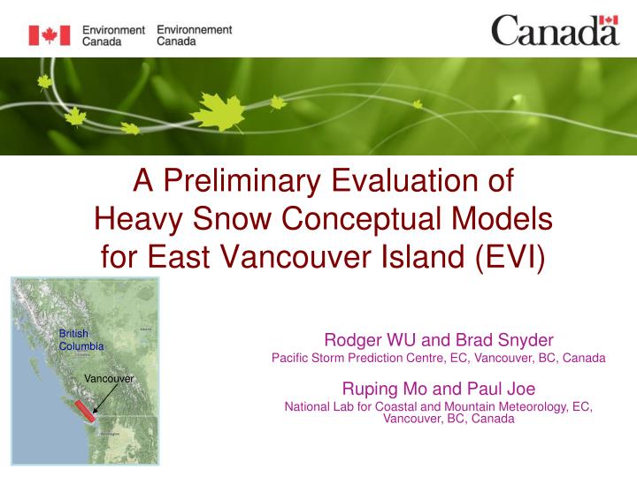
A Preliminary Evaluation of Heavy Snow Conceptual Models for East Vancouver Island (EVI). Rodger WU and Brad Snyder Pacific Storm Prediction Centre, EC, Vancouver, BC, Canada Ruping Mo and Paul Joe National Lab for Coastal and Mountain Meteorology, EC, Vancouver, BC, Canada. British Columbia.

E N D
A Preliminary Evaluation of Heavy Snow Conceptual Models for East Vancouver Island (EVI) Rodger WU and Brad Snyder Pacific Storm Prediction Centre, EC, Vancouver, BC, Canada Ruping Mo and Paul Joe National Lab for Coastal and Mountain Meteorology, EC, Vancouver, BC, Canada British Columbia Vancouver
Large N-S region • Most complex terrain • Subject to outflow • 4. Dense population Coast Mountains Strait of Georgia Vancouver X Fraser Valley East Vancouver Island (EVI) X Pacific Ocean
EVI is prone to heavy snowfalls (Jan 2000-Dec 2009) 33 81 snow events (>=5 cm/24 hrs) in the past 10 year 44 43 81 38 47 70 44 15 extreme snow events (>=30 cm/24 hrs) in the same period 29 22 35 Back ground picture was taken Dec 15, 2008 at Nanaimo where 38cm snow was reported (courtesy of randsco.com)
Forecast challenges Warning criteria
Four principal patterns indentified(total 81 events from Jan 2000-Dec 2009) • Surface low • Warm front • Trowal • Unstable airmass The Surface Low: Extreme snow producer & forecasting trouble maker
10 Key ingredients investigated and four conceptual models developed Sources of moisture Arctic front Surface low track Georgia Strait convergence zone Low-level flows Vertical wind profiles Stability Conveyor belts Banded structures Upper level features Combined with pattern analyses, four conceptual models were developed to help forecasters understand physical processes and make better warning decisions: The surface low The warm front The trowal The unstable airmass
Surface Low 500hpa trough Arctic front Enhanced vertical motion 250hpa jet Arctic air Moisture pick-up Heavy snow B A L Destabi-lization Unstable Open cells 1008 GST C. Z. Outflows 528 Moisture transfer 500hpa 700hpa Surface
A cross section along line AB Enhanced vertical motion Moist, unstable flows Dry, cold outflows Vancouver Island Ranges Strait of Georgia Fraser Valley Pacific
Preliminary evaluation of conceptual models using 10 snow events from winter 2010-11 For each event • Identify pattern and determine relevant conceptual model • Identify key ingredients depicted in the model • Determine if these ingredients play roles on heavy snow over EVI
Four key ingredients Key ingredient Conceptual Model Says 1. Arctic front Moderate 2. Low centre West of VI - intensity below 1000 hPa 3. GSTCZ* Srn Sxns - intensity 35-45 knot 4. Instability - Inversion top 4KM or higher Case 1 20-Nov-10 (29 cm) Moderate West of VI 998 hPa Srn Sxns 35 knots 7 km Case 2 9-Jan-11 (18 cm) Weak West of VI 1018 hPa Srn Sxns 20 knots 5 km Case 3 22-Nov-10 (10 cm) Weak West of VI 1007 hPa Srn Sxns 25 knots 2 km * Georgia strait convergence zone
20 Nov 2010 case: - the instability CB top 7 km Echo top 6 km KUIL X
20 Nov 2010 case: - GST convergence 29 cm 2 cm 5 cm Shawnigan Lake
Summary Complex terrain enhanced heavy snowfalls over EVI pose great forecasting challenges to meteorologists. Based on 81 snow events over EVI during the years of 2000 – 2009, four principal weather patterns were identified and 10 key ingredients were investigated. Four conceptual models were developed aiming at assisting meteorologists to do better warning decisions. A preliminary evaluation of these conceptual models was performed by using 10 snow events that occurred during the winter of 2010 – 2011. The results indicate that these conceptual models have the capacity to provide a reliable forecasting guidanceto the meteorologists.
Thank you! Questions?