GIS Map Projections and Coordinate Systems
210 likes | 365 Vues
Discover the importance of map projections in GIS, including distortion effects and coordinate systems like Mercator and Albers Equal Area. Learn about geographic and rectangular coordinates, State Plane Coordinates, and Universal Transverse Mercator (UTM) system.

GIS Map Projections and Coordinate Systems
E N D
Presentation Transcript
Outline • Map Projections • Coordinate Systems
Map Projections and Distortion • Mathematical transformation that behaves as if it were projecting features of the world onto one of three surfaces: a plane, cone, or cylinder
When Projection Is Important • Measurements used to make important decisions • Comparing shapes, areas, distances, or directions of map features • Feature and image themes are aligned New York New York Los Angeles Los Angeles Projection: MercatorDistance: 3,124.67 miles Projection: Albers Equal AreaDistance: 2,455.03 miles Actual distance: 2,451 miles
When Projection Is Not Important • Business applications • Not of critical importance • Concerned with the relative location of different features • On large scale maps - street maps • Distortion may be negligible • Map covers only a small part of the Earth's surface.
Projection vs. Coordinate System • Projection = the method used for flattening the paper on the spherical earth • Coordinate System = • the method for referencing specific locations • - on a sphere (Geographic Coordinates) - on that flattened paper (Rectangular Coord)
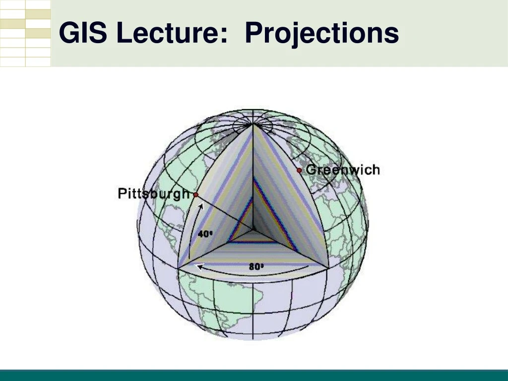
Geographic Coordinates • Geographic Coordinate System (GCS) • Spherical coordinates • “Un-Projected” • Angles of rotation of a radius anchored at earth’s center • Latitude and Longitude
Latitude and Longitude • Longitude (Meridians) • Latitude (Parallels)
Latitude and Longitude • Longitude (prime meridian) 0 • Latitude (equator) 0
Latitude and Longitude • Coordinates Pittsburgh, PA USA 40°26’2”N latitude -80°0’58”W longitude 40 -80
Rectangular Coordinates • Used for locating an intersection on a flat sheet of paper • Cartesian Coordinates (X,Y) Y X<0 Y>0 X>0 Y>0 (0,0) X X<0 Y<0 X>0 Y<0
State Plane Coordinates • Used by local US Governments • All positive coordinates in feet
State Plane Coordinates • Zones • 125 zones, following state and county boundaries • At least one for each state
Universal Transverse Mercator (UTM) • Coordinate system used by U.S. Military • Covers entire world • Metric coordinates
Summary • Map Projections • Coordinate Systems


