Download
1 / 6
60 likes | 179 Vues
Discover the cultural and ecological significance of Te Waihora/Lake Ellesmere through an immersive heritage walkway. This project integrates historical narratives with nature, inviting visitors to explore the reciprocal relationships of natural processes and human intervention. Engage with the rich history of Maori and European settlement, while experiencing the evolving landscape shaped by time and heritage. Embrace an imaginative sense of place as you walk through the wetlands, connecting with the past and present of this iconic site.

E N D
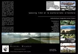
“by viewing wetlands as a culture replete with history as well as biology, we see an expanded definition of ecological design. rather than assume an ecological aesthetic that disdains signs of human intervention or attempts to get back to nature, the design promotes exploration of the reciprocating relationships of natural processes and constructed acts. the project encourages our symbiosis and our friction with nature to resonate in one place (kathy poole, 2005). as part of a programme to increase public awareness and recreational use of te waihora/lake ellesmere, the little river railway embankment between motukarara and birdlings flat has been selected by the department of conservation as a site to develop a walkway/cycleway as one of a collection of sites encouraging appreciation of heritage significance in the area. separated from the sea by kaitorete spit, te waihora is one of new zealand’s most important wetland systems and over time, has been through many dramatic changes due to the cultural and natural influences of various activities. historic maori occupation and subsequent maori and european settlement and their use of natural resources has placed te waihora as an important part of canterbury’s heritage. the extensive wetlands of the lake, hard against banks peninsula were a barrier to early land transport and much of the peninsula was felled for timber while the lake was artificially opened at kaitorete spit to drain the rich wetland for farming. the little river railway embankment now dissects these wetlands, a reminder of the changes that land reclamation and railway construction brought to the area. - te waihora joint management plan 2004 - joanna braithwaite banks peninsula diana adams te waihora/lake ellesmere taumutu ‘p a s s i n g t i m e’ a t t e w a i h o r a / l a k e e l l e s m e r e ________________________________restructuring an imaginative sense of place “The landscape can strengthen our sense of the passage and organization of time. The cycles of the sun and of human activity can be celebrated, and our orientation to the past can be maintained.” KEVIN LYNCH, 1971 I N T R O D U C T I O N wendy hoddinott major design 2005 claire reilly
theoretically, the design strategy is based on the horizontal movement of travel and the vertical threads of whakapapa, developing an experiential journey along the margins of the lake and connections to reserves in the wider landscape. the intention is to engage visitors with the passing of time which continues to shape this landscape. heritage interpretation has often been treated in a prosaic and instructive way, seeking to ‘educate’ the visitor. such approaches can switch off people’s association with landscape, as their attention is focused only on captions, signs and displays. this design explores instead some of the more poetic ways in which heritage can be experienced in the landscape, evoking those values that are unique to this area. how design intervention might attract the attention of the visitor to encourage contemplation and awakening of memory. heritage interpretation in this instance is not just about viewing, but evoking the multi-sensed imagination to engage, enlighten and alter people’s perception – to sense the passing of time in the landscape. heritage interpretation is focused where the proposed walkway passes through the mouth of kaituna river and kaituna lagoon. the proposal provides access to the lake, traditionally a difficult place to get close to, while circulation patterns and layout allow people to experience the geological, ecological and cultural significance of te waihora. Reading the landscape is like a collage, interweaving the patterns of ecology and the fragments of history with footprints of the personal journey. The journey in time as well as space, plays no small part. GEOFF PARK, 1995 motukarara reduction in average lake level at te waihora since first artificial lake opening at kaitorete spit halswell river maori access through kaituna valley volcanic spurs kaituna railway station kaituna (focus area) poplar trees changing sea & lake levels railway embankment heritage layers at kaituna valley waikakahi pa site birdlings flat simon kaan railway embankment from motukarara to birdlings flat spatial & experiential qualities by developing the area as a mahinga kai cultural park, ecological restoration of the area assists in making visible ngai tahu’s history. the park contains narratives of ngai tahu’s past, as well as emphasising its direction for the future. also underpinning the design are references to geological, ecological and european heritage, made accessible as the passing of time is evoked. T H E O R E T I C A L C O N T E X T
design intent by ‘ordering’ time in the landscape, a hierarchy of geological, ecological, cultural and scenic ‘layers’ have been established and responded to through spatial character and circulation patterns in the kaituna lagoon section of the walkway. background the meeting of the kaituna river mouth and te waihora was a ‘gateway’ to horomaka/banks peninsula for early maori who gained access to the lake through kaituna valley. this enabled the many hapu of ngai tahu to share the resources of the bay which once teemed with fish and bird life. circulation circulation patterns provide access into the wider landscape - to the trig point on an adjacent spur (1), the quarry site, and the lake edge itself, currently a difficult place to get close to. the juxtaposition of natural elements (kahikatea in linear grids - 5) and organic forms (new lake edge) with the strong lineal man-made line of the railway embankment represents identity, journeys, learning and enjoyment. bridges, earth-mounds, a jetty and site specific artworks provide the setting for individual contemplation, self-exploration and connection with the site. existing parking currently at bends either side of the embayment is relocated to a safer location within the new park at an entrance point (4) allowing visitors time to decide to stop. large scale earthworks removal of a 250m section of the railway embankment and excavation of intermittently waterlogged farmland creates a dendritic ‘finger’ of water of sufficient depth to restore a portion of habitat to the lake. this allows lake water to flow back to it’s previous location, before the dramatic reduction in lake levels and loss of the diminishing wetland and habitat that has come with the lake opening. in relation to the entire lake, this action restores one of the lake’s important embayments, providing a natural lake edge and functioning ecosystem while reinventing the industrial era of the railway through construction of a steel bridge (7). the mapping that focuses on re-establishing a connection to the lake’s fluctuating water levels demonstrates how water naturally gathers a landscape around it. water previously held against the railway embankment is seen no longer as a line, but a ‘condition’. the opportunity then exists for the visitor’s engagement with water as a body that commands space which changes over time. 1 1 4 4 4 site of kaituna railway station 5 7 7 contemporary steel bridge spans newly created lake edge kaituna quarry european influence of poplar trees along christchurch-akaroa highway M A S T E R P L A N
1 BOARDWALK a timber boardwalk takes the visitor alongside a reconstructed wetland, under the new elevated bridge to the kaituna quarry site and lake edge. the bridge and boardwalk meet at the intersection of the removed railway embankment, railway siding and an old farm fenceline. • 2 ELEVATED BRIDGE a steel bridge, replaces the railway embankment, effectively reinventing the colonial influences of the former railway line, while taking visitors on an elevated journey across the reconstructed wetland. • 3 KAHIKATEA once a significant part of this wetland ecosystem, kahikatea are re-introduced to the area. they bisect a visual line where the colonial influence of existing poplars along the christchurch - akaroa highway and the old kaituna station site align. kahikatea require us to look at the landscape with a sense of time, as ancient survivors of the cretaceous period, the land they prefer to live on has an ephemeral quality with the periodic covering of water. their beautiful scarlet and black fruit so highly prized by maori, provide a food source for kereru, also a traditional mahinga kai species in the waihora region. • KO following the line of kahikatea, a series of steel poles extend from the park entrance, through the trees, intersect at the bridge and into the lake towards taumutu. their orientation references the digging sticks (ko) used by early maori to open the lake. these vertical elements also strengthen the concept of whakapapa, the understanding that everything is connected – birds, fish, animals, trees, soil, rocks, mountains and people. • WAVE FIELD wave like landforms are created to evoke the energy of the sea, as it once carved the adjacent sea stacks and produced the weathered sea cliffs on the volcanic spurs. the stature of the landforms also mimic the quarry spoils remaining from the sea stack, and continue the wave-like motion towards the spurs. • SEA OF FLAX ‘fingers’ of flax draw visitors through the wave field to the quarry site and lake edge. plants provide nesting and habitat for birds and as a traditional mahinga kai species, resources for traditional weaving. • 7 FISH HOOK/WAKA JETTY the construction of a jetty and canopy at the lake edge assists visitors to sense the passing of time in the landscape. as lake levels rise and fall and the sun’s angle changes, these elements draw on the imagination and perception of the visitor in interpreting the constant change they are part of at te waihora. at high lake levels, the fish hook boardwalk becomes obvious as the gabion baskets are covered. when the lake is opened at taumutu and the lake level drops, a waka of gabion baskets is revealed. 3 cross section of kahikatea & steel ko through wetland view from boardwalk towards sea stack 1 4 cross section through wave field 2 cross section of bridge, boardwalk & ko directed towards lake opening at taumutu wave field (maya lin) 5 quarry spoils 6 7 railway embankment wave field 6 I N T E R M E D I A T E P L A N sea stack
TIMBER BOARDWALK - at high lake levels, the gabion baskets are covered with water referring to the abundance of fish found in the lake in previous times. level changes are indicated by changing materials as visitors step down - timber deck to basalt and then greywacke stone gabions, which reflect the geological underpinnings of the area. • BASALT GABIONS are constructed from basalt removed from the existing railway embankment (where the new elevated bridge is to be located) and used to fill gabion basket steps which during lower lake levels, form the shape of a waka. the forms evoke the passing of time, using local materials, and re-establishing the presence and occupation of many hapu in kaituna. the rock originates from the adjacent seastack and over time has been worn by the sea as well as by the modifications of human intervention. • GREYWACKE STONES fill the lower level of gabion baskets, an abstraction of the underlying lake bed, which was created from the outwash fans of the waimakariri river. shadows cast by the canopy sculpture on the timber deck & gabions, change with the time of day and season according to the angle of the sun. • 4 CANOPYSCULPTURE appears as a lightly traced boat form, and seems to hover in the sky, its scale in keeping with the vast horizontal expanse of the lake and nearby seastack. recalling the recurring motif throughout the walkway of ngai tahu waka, it has an internal quality allowing people to experience the passing of time as the shadow of the eel like sculptures move with the sun and the rotation of the earth. shadows fall on the people themselves, the timber boardwalk or the gabion baskets below. sculptured steel tubing is representative of flax weaving, hinaki baskets, and refers to eel (tuna) which is one of the most important parts of the biodiversity of te waihora. the story of the creation of tuna provides an ‘oral map’ and an explanation of the biodiversity of the area. • 5 SEATING is orientated towards the southern alps, te waka o aoraki (the canoe of aoraki) offering the opportunity for contemplation of the ancestors connection to waihora and kaituna lagoon. two ko frame the view of aoraki from this position. • 6 STEEL POSTS vertically represent the concept of whakapapa and refer to the digging stick of both the ancestor rakaihautu and ko that were used by early maori at the lake opening at taumutu. the contemporary material of steel makes clear the human modifications to the lake, while leaving a mark of today, a trace of today’s activity. 6 3 2 5 4 shadows cast on the canopy sculpture to the deck and gabions below, change according to the time of day and season. 1 D E T A I L E D D E S I G N
“A landscape of 3 dimensions thus becomes the representation of another in 4 dimensions, which the imagination of the inhabitants and the walkers can develop, populate or invest with personal images and feelings” MAROT, 2002 poles painted black at 4m above mean sea level to indicate level at which lake breached kaitorete spit before human intervention 1.2m amsl (current level of lake opening) C R O S S – S E C T I O N & I M A G E S view across lake from banks peninsula spurs