Leech Lake Brownfields Program
Learn about Leech Lake's Brownfields Response Program (BRP) initiated in 2003, conducting cleanup actions on hazardous sites. Explore past and current sites like Inger Store and DRM. Discover how the program follows CERCLA Section 128(a) requirements and collaborates with agencies like EPA and USGS.

Leech Lake Brownfields Program
E N D
Presentation Transcript
Leech Lake Brownfields Program • Diane Thompson Hazardous Waste Manager • Mario Reyes Hazardous Waste Technician
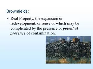
What is a Brownfield? • Brownfields are real property, the expansion, redevelopment, or reuse of which may be complicated by the presence or potential presence of a hazardous substance, pollutant, or contaminant.
Funding for Tribes in United States • In 2002, Congress passed the Small Business Liability Relief and Brownfields Revitalization Act • the Brownfields Revitalization Act authorizes $50 million in annual grants between 2002 and 2006 to Tribes and States to develop BRPs • Environmental Protection Agency (“EPA”) awards grants to Tribes and States
Leech Lake Brownfields Response Program (B.R.P.) • Initiated in 2003, the BRP is an ongoing multi-year effort by the Band’s Division of Resource Management (“DRM”) to develop a dynamic response program. • Expand the Department’s environmental enforcement capabilities. • Assert the Band’s sovereignty and civil regulatory authority. • Protect the health of the Reservation Population and the quality of the Reservation Environment.
B.R.P. Requirements under CERCLA Section 128(a) • Timely survey and inventory of brownfields sites on Tribal lands • Oversight and enforcement authorities • Effective means to approve, verify, and certify cleanup actions • Meaningful opportunities for public participation • Maintenance of public records.
Steps in Conducting a Brownfields Response Program • Site discovery • Initial investigation • Site hazard assessment • Site hazard ranking • Remedial investigation/feasibility study • Selection of a cleanup action • Site cleanup
Past and Current Sites • Facility Center –Cass Lake Underground Storage Tanks • Enbridge Pumping Station – Cass Lake • Inger Store • Division of Resource Management (DRM) • Waboose Bay Methamphetamine Lab Site
Facility Center U.S.T.’s • Two 10,000 gallon fuel oil tanks on northwest corner of Facility Center • These were removed in 2006 • Picture of tanks outside of Facility Center on next slide
South Cass Lake Station Release • Identified in May 2001 during voluntary monitoring well construction program • Source was from an underground weeping flange. Dug up and fixed, accessible impacted soil removed. • Investigation completed in phases in May 2001, September 2001, August 2002 and October 2003 • Ongoing ground water monitoring 4 times/year
U.S.G.S. Survey September 2007 • DRM, Ennbridge and United States Geological Survey (USGS) are in collaboration in dealing with the South Cass Lake Pumping Station Spill • USGS finished push-probes work on Sept. 21, 2007 • Found the dissolved plume of benzene to be 100 meters (328 ft.) further to the east-southeast than the original survey • Map of past and current plume on next page
U.S.G.S. Future Surveys • Data from September survey will be reviewed to see if any more push-probe data are needed • Decisions will also be made on where to put observation wells • A few links to look at regarding this site: http://www.lldrmenvironmental.com/Brownfields/Page06-Cleanup.htm http://enbridgecasslake.com/go/site/986/
Inger Store • The site was used as a Grocery Store/Gas Station. • Leech Lake Band of Ojibwe is the legal owner of this property. • Phase I Environmental survey completed on 7-22-91 • 3 tanks were removed from this site – all of which were in poor condition. • Two suction pumps remain at the site. • Suspected source of the release to the unsaturated soil and groundwater system was attributed to tank overfill. *** This site is ready for use as of 2006***
Leech Lake DRM Site • Planning to have botanical seed garden put on DRM site • Past owners were Wheeler Lumber/Supply Company • Minnesota Chippewa Tribe construction company • Now owned by Leech Lake Band of Ojibwe
DRM Phase I and Phase II work • Phase I – consisted of interviews of past owners and people familiar with the site • It also included searching of databases, and old documents regarding the site. • Possibly some contamination from the RCRA vault to the east and St. Regis superfund site just to the north of the DRM property
DRM – Phase II • Phase II soil sampling completed on DRM site on June 20th, 2007 • Data still being processed • Next step if needed will be the cleanup phase for the site • Photo of soil sample locations on the site on next page
Waboose Bay Site • A clandestine drug laboratory was seized on June 13, 2003 • The production of methamphetamine potentially provides immediate and long term health and safety concerns • This allotment has been and is currently occupied illegally (trespassing) by unknown individuals. • Phase I completed and report sent to EPA in November 2006 • It was approved by EPA for Phase II testing
Phase II • Soil Sampling of property completed on October 30th, 2007 • Samples were sent to STL Labs and we are waiting for the results • Photos included on next few pages of location of Waboose bay and aerial of property
Horse Stable Scattered Solid Waste Pit #3 P o r j k t a g e C 2 Small Trailers BLDG 1 r e e k BLDG 3 Scattered Solid Waste ! j k ? ! k j Pit #2 Dock Pit #1 Active Burn Pits BLDG 2 Well BLDG 4 Outhouse
Brownfields 2008 • If needed we plan on starting cleanup process of DRM and Waboose Bay Site. • Working with foresty on the cleanup of more open (illegal) dumps around the reservation –currently over 70 dumps located around the reservation. • Cleanup of S. Lake open dump site and testing for asbestos and lead at the Onigum church site. • Working with the community to locate any other sites that would fall under the brownfields program, as well as any other open dump sites that are not already logged in.
Onigum Church • Approved Site Eligible on November 19th, 2007 by E.P.A. • Will be doing testing for Lead and Asbestos • Three photos of the onigum church on next three slides
S. Lake illegal Dump Site • Received e-mail from Jane Neumann in Chicago stated that this site is eligible for the brownfields Grant 128(a) to do an assessment • Site was located by Keith Karnes and DRM Forestry Department • Will do Phase I assessment Spring 2008 • Picture and Map location on next two pages