Download
1 / 19
190 likes | 315 Vues
This presentation proposes a low-cost Synthetic Vision System (SVS) designed to assist pilots in landing aircraft under zero-zero conditions—where visibility is extremely low. Leveraging advanced GPS technology and tablet integration, the SVS provides a virtual reality display of the runway environment to enhance safety for general aviation pilots facing unpredicted poor weather conditions. The presentation details the system's requirements, testing methodology, and expected outcomes, advocating for an affordable solution to improve emergency landings in critical situations.

E N D
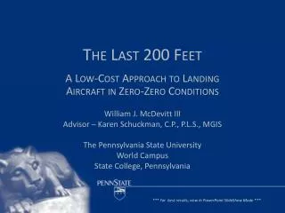
The Last 200 Feet A Low-Cost Approach to Landing Aircraft in Zero-Zero Conditions William J. McDevitt III Advisor – Karen Schuckman, C.P., P.L.S., MGIS The Pennsylvania State University World Campus State College, Pennsylvania *** For best results, view in PowerPoint SlideShow Mode ***
Outline • Problem • Proposed Solution • Issues • System Requirements • Database Creation and Data Flow • Test Methodology and Test Points • Expected Outcome • Acknowledments • Questions
Problem • Current FAA Category I Instrument Landing System approach minima are: • 200’ AGL Decision Height • 2,400’ Runway Visual Range • Pilot may not begin an approach to landing if reported conditions are below minimums and may only continue the approach below decision height if the runway environment is in sight
But that is not really a problem… • These standards have been around for many years • There are ILS approaches (Category IIIc) with no decision height and no RVR requirement (zero-zero) • Not available at most small airfields or to general aviation pilots • The problem is when a pilot unexpectedly encounters weather below minimums at his destination with not enough fuel to reach a suitable alternate airfield… • Then what…?
Proposed Solution • Synthetic Vision System (SVS) • A virtual presentation of the world as the pilot would see it from the cockpit • Displayed on a Windows™-based tablet computer • Location driven by Wide Area Augmentation System (WAAS) augmented GPS • Provides highly accurate own-ship location – typically 1 meter horizontal and 1.3 meters vertical • Well within the footprint of even the smallest aircraft
Synthetic Vision System Issues • Government agencies, universities, and aerospace corporations already at work on systems of this type • Will initially be designed for commercial, military, or business-class aircraft • Very expensive – 10’s to 100’s of thousands of $$ • Unaffordable for general aviation pilots • This system is designed to support their needs
System Requirements • Synthetic Vision System • Tablet computer • Attitude Heading Reference System (AHRS) • Terrain Database • Rendering Engine
System Requirements • Terrain Database • Imagery • Elevation Data • Vector Drawings • Precise survey
Terrain Database Creation • Multi-step process • GPS Survey • Process raw GPS data with GeoOffice • OPUS post-process survey for precision • Georeference imagery • Vector drawings • Texture drawings • Create precise TIN • Create tiles for VRSG • ‘Curve’ drawings to elevation TIN • Display with VRSG
Real Time Data Flow • GPS • Latitude, longitude, altitude • AHRS • Roll, pitch, heading • Surface™ • Decodes data • Transfers as ASCII to serial • Picked up by HyperTerminal • HUD.dll – drives eyepoint • VRSG displays results
Test Methodology • Test aircraft – Piper PA-28 Archer • Test airfield – General William J. Fox Field, Lancaster, CA • All testing will occur in VFR conditions • Video recordings • Cockpit and outside world • SVS • Data logging
Test Points • Flight 1 (Day) • SVS recording only • All visual flying • 1 GPS LPV approach • 5 touch and go landings • Record SVS for latency determination • Assess feasibility of: • SVS approach • SVS takeoff and landings • Flight 2 (Day) • 1 GPS LPV approach using SVS to DH • Continue visual landing to full stop • Takeoff using SVS as primary reference • 1 GPS LPV approach using SVS to touchdown • 5 additional landings using SVS to touchdown
Test Points • Flight 3 (Night) • SVS recorded only • 3 touch and go landings at night with data and video recording using normal flight displays and instruments • Assess feasibility of: • Night SVS approach • Night SVS landings • Flight 4 (Night) • 1 night GPS LPV approach and landing using SVS
Expected Outcome • SVS will allow a pilot to continue an approach from a 200’ AGL decision height on a standard 3° glideslope and be assured of touching down in the center of the runway. • SVS will ensure the pilot can ‘see’ the runway and use it to make ‘visual’ corrections. • SVS will allow the pilot to make an emergency safe landing in weather conditions that would otherwise preclude it.
Timeline • May 2013 – Complete software connectivity, GPS Survey of Fox Field • May 20 – Acceptance letters from conference • June - July – Flight Testing • July - August – Data analysis, paper wrap-up • August 31 – Deadline for paper submission • October 6-10 – Present at 32nd Digital Avionics Systems Conference, Syracuse, NY
Bottom Line • This system, as presented, will allow an aircraft to land safely when no other options are available, providing a possibly lifesaving tool for general aviation pilots in a life or death situation.
Acknowledgements • Advisor – Karen Schuckman • GIS Data – Los Angeles County GIS Portal • HUD.dll code – MetaVR, Inc • Programmer – RuthAnn Abruzzi, Applied Research Associates, Albuquerque, NM • Pilot – John Howell, Lockheed-Martin Corporation, Palmdale, CA