Download
1 / 12
120 likes | 216 Vues
Explore a comprehensive EDM baseline field test conducted in Santa Ana River in February 2006 using RTK technology. The project aimed to measure distances between stable monuments, compare RTK measurements with record measurements, and assess equipment performance. Detailed procedures, equipment used, and relative test results are highlighted.

E N D
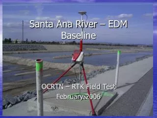
Santa Ana River – EDM Baseline OCRTN – RTK Field Test February 2006
Objective: • To measure the horizontal distance and vertical difference between 4 stable monuments • To position monuments from 4 different Base Stations with different baseline lengths • Compare RTK measurements to record measurements
RTK Procedures • 2 Independent occupations on each station • Each independent occupation consists of two 50 epoch measurements (about 1 minute) • Independent occupations occur on different days and different times of the day (+/- 3 hours)
Equipment Used: • One Voodoo Stick • Leica SR530 receiver • Leica AT502 antenna • CDMA Airlink modem • Fixed 2 meter pole w/ 8’ bubble
# of Independent Occupations • Compare coordinates computed for each station and from each base station to the RTK average coordinate: Station OEOC(8.2 mi) WHYT(16.6 mi) SCMS(28.7 mi) CAT2(44.7 mi) A 2 2 2 2 B 2 2 1* 1* C 2 2 1* 1^ D 2 2 1* 2 Wait at least 3 minutes to achieve fix *= could not achieve fix on day 1 ^ = could not achieve fix on day 2
Relative - Test Results: • Compare Historic (record) horizontal distance and vertical difference to RTK coordinate differences for stations: Pt to Pt Record Horiz Dist (ft) Record Vert Diff (ft) A to B 371.967’ +0.977 B to C 2702.579’ +8.324 C to D 2769.172’ +10.895