Download
1 / 16
160 likes | 347 Vues
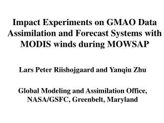
Impact Experiments on GMAO Data Assimilation and Forecast Systems with MODIS Winds During MOWSAP. Lars Peter Riishojgaard Yan-Qiu Zhu Global Modeling and Assimilation Office NASA Goddard Space Flight Center. Presented by Ron Gelaro, NASA/GMAO. MODIS winds.

E N D
Impact Experiments on GMAO Data Assimilation and Forecast Systems with MODIS Winds During MOWSAP Lars Peter Riishojgaard Yan-Qiu Zhu Global Modeling and Assimilation Office NASA Goddard Space Flight Center Presented by Ron Gelaro, NASA/GMAO
MODIS winds • Polar orbiting platform (NASA Terra, Aqua), primarily intended for aerosol/clouds/land surface measurements • Wind vectors calculated using geostationary feature tracking algorithms on high-latitude imagery from two MODIS channels • 6.7µ water vapor channel for clear-sky moisture field • 11µ window channel for clouds • Coverage in high latitudes (beyond 65o) where successive overpasses cover the same region • Useful complement to geostationary satellite winds that drop off sharply beyond 58o latitudes • Image repeat frequency tied to orbital period of ~100 min. • Need for image triplets implies long acquisition time
Unlike geostationary satellites at lower latitudes, it is not be possible to obtain complete polar coverage at a snapshot in time with one or two polar-orbiters. Instead, winds must be derived for areas that are covered by two or three successive orbits, an example of which is shown here. The whitish area is the overlap between three orbits. (slide provided by Key et al., CIMSS)
Example 6-hour data coverage; MODIS winds (left panel); all other satellite and conventional surface and upper air winds (right panel)
MODIS winds vertical distribution Water Vapor Observations Infra-Red Observations
GMAO MODIS winds experiments • MOWSAP (MODIS Winds Special Acquisition Period): November 8, 2003-January 31, 2004 • Winds generated by CIMSS and by NESDIS (pre-operational mode) • Same algorithm, different code bases • Different backgrounds for QC and height assignment • Winds generated from MODIS Aqua and MODIS Terra imagery • Assimilation experiments by GMAO, ECMWF, Met Office, CMC • Experimental setup: 5-day forecast every other day; 42 members in the ensemble • GMAO GEOS4: fvGCM+PSAS analysis (1o x 55 levels)
Innovation statistics for raobs: Arctic RMS (obs – 6hr fcst) control+MODIS control height (m) u-wind (m/s)
Innovation statistics for raobs: Antarctic RMS (obs – 6hr fcst) control+MODIS MODIS control control height (m) u-wind (m/s)
Forecast skill - ACC 500 hPa height at 120 hrs Northern High-Latitudes: 60-90N
Forecast skill - ACC 500 hPa height at 120 hrs Southern High-Latitudes: 60-90S
Forecast skill - ACC 500 hPa height at 120 hrs Southern Mid-Latitudes: 60-90N
Forecast error evolution Jan 21, 2004; Control (left), MODIS (right)
Summary • MODIS winds complement other observations in the high latitudes; more so in the SH than in the NH due to the current data sparsity • Consistency of data delivery is acceptable • Based on independent verification statistics, the quality of the information is acceptable • Positive overall contribution to forecast skill • Substantial impact in the SH • Impact extends to entire hemisphere • Improvements in average forecast skill results primarily from improving the skill of the worst forecasts • Timeliness remains an important issue; current delay is 4-6 hours; some improvement possible via use of Direct Broadcast capability
Outlook • MODIS winds experiments with new GMAO assimilation system based on grid space analysis (GSI developed at NCEP) • Case study diagnostics; busts? • Data density/QC studies • WV vs. IR winds • Two-satellite winds End of Talk…Thank You.