Download
1 / 22
220 likes | 337 Vues
Advisory Committee on Water Information. Status report: Subcommittee on Spatial Water Data. Herndon, VA September 15, 2004. Integration of key Spatial Water Datasets. “surface water geospatial framework”. National Elevation Dataset. National Hydrography Dataset. COMPLETE 30meter.

E N D
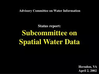
Advisory Committee on Water Information Status report: Subcommittee on Spatial Water Data Herndon, VA September 15, 2004
Integration of key Spatial Water Datasets “surface water geospatial framework” National Elevation Dataset National Hydrography Dataset COMPLETE 30meter COMPLETE 1:100K IN PROGRESS 1:24K IN PROGRESS 10meter NED-Hydrology Watershed Boundary Dataset IN PROGRESS 1:24K COMPLETE 30meter
Interagency Development of a Reference Set of Watersheds for the United StatesWBD
2-digit=1st level=22 regions 4-digit=2nd level=222 subregions 6-digit=3rd level=789 basins 8-digit=4th level=2223 subbasins Hydrologic Unit Codes
WBD .
WBD STATUS as of September ‘04
Challenges • Agency support is highly variable • Delineation methods vary state to state • Addressing cooperators needs to preserve existing watershed boundaries • Inconsistent funding • Edge-matching
Technical WBD Coordination - SSWD • Ensure communication between Federal, State, local • Assess progress in each state • Offer guidance on delineation method for states • Ensure compliance with the National Guidelines • Facilitate edge matching between states • Provide supplemental datasets that expedite delineations • Organize and attend workshops and training sessions
Request the Subcommittee members: • Increase awareness in your organizations • Help make completion of the WBD a priority • Help identify potential funding sources • Assist the Subcommittee with a supported business plan (how to get WBD completed)
geodata.gov The Government Portal For Geospatial Access • Metadata Publishing • Documentation and Organization • Discovery and Access …the directory for NSDI
Ken Lanfear, SSWD “channel steward”
Geospatial One-Stop:The Inland Water Channel Spatial Water Data Subcommittee September 15, 2004 Kenneth J. Lanfear, USGS
geodata.gov • Metadata search • 17 “channels” of data, following ISO categories • Channels can feature the key datasets • Inland Water Resources • The Drainage Network • Major Water Databases
Inland Water Resources • Current features: • National Hydrography Dataset • HUC Image Service • National Wetlands Inventory
The Drainage Network • Current features: • National Hydrography Dataset • National Elevation Dataset – Shaded Relief
Major Water Databases • Current features: • Enviromapper • NWIS • STORET
Link to Metadata • Owner must register metadata with GOS • XML format • GOS displays • Summary (right) • Full metadata
“How do I get my dataset or application featured in the Inland Water Channel?” • Role of channel steward still is developing • Absolute monarch (at least now) • Contact our fearless leader: • Ken Lanfear, Channel Steward • lanfear@usgs.gov • Be nice to me! ☺ • Need broader base… In my castle in Scotland ☺
Role of the Spatial Water Data Subcommittee • “Board of Directors” for the GOS Inland Water Channel • General guidance on content selection • Help resolve conflicts • Recommend datasets for featuring
Resolution Spatial Water Data Subcommittee • ACWI encourages the Spatial Water Data Subcommittee to provide guidance and direction to the Geospatial One-Stop Inland Water Channel.