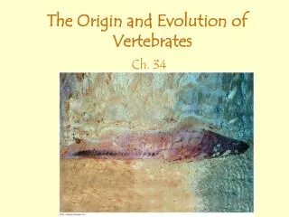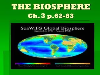
Ch. 34 The Biosphere
520 likes | 694 Vues
Ch. 34 The Biosphere. 34.1 The biosphere is the global ecosystem. I. The Study of Ecology. ecology: scientific study of the interactions among organisms and between organisms and their environment

Ch. 34 The Biosphere
E N D
Presentation Transcript
I. The Study of Ecology • ecology: scientific study of the interactions among organisms and between organisms and their environment • biotic factor- any living part of an environment, ex: prokaryotes, protists, animals, fungi, and plants. abiotic factor: nonliving physical or chemical condition in an environment. • Ecologists study the relationships among biotic and abiotic factors at five increasingly broad levels: organisms, populations, communities, ecosystems, and the biosphere.
The Study of Ecology D. individual organism: the smallest unit of ecological study, Ex: blue sweetlip fish in a coral reef environment. E. population: a group of individual organisms of the same species living in a particular area, Ex: A group of sweetlip fish in the reef environment F. community: all the organisms living in an area, Ex: All living things in a coral reef including fish, coral animals, microscopic algae, and all other organisms living in and around the reef.
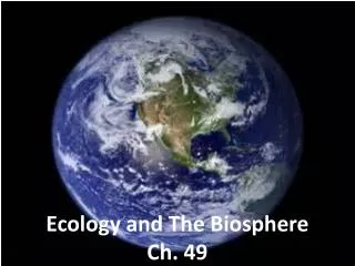
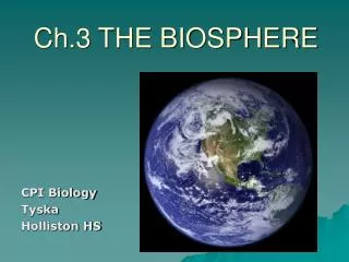
The Study of Ecology G. ecosystem: community of living things plus the nonliving features of the environment that support them, Ex: Coral reef’s living and nonliving inhabitants H. biosphere: all the parts of the planet that are inhabited by living things; sum of all Earth's ecosystems, broadest category, 1. Closed system where nothing enters or leaves except light and heat.
II. Patchiness of the Biosphere A. The biosphere is not spread out uniformly around the planet. B. All these environmental variations are due mainly to differences in abiotic factors such as temperature, soil type, and the availability of water and light. C. habitat: an organism's specific environment, with characteristic abiotic and biotic factors
III. Key Abiotic Factors A. Sunlight - the sun provides light and warmth, and is the energy source for almost all ecosystems on Earth. The sunlight powers photosynthesis in land and in the water (only on top layer). B. Water – All organisms contain water (human contain 70%), water can dissolve gases and solutes such as salt, terrestrial (land) organisms have adaptation to control water (pine tree needles), water organisms must control osmosis (movement of water) C. Temperature – most life between 00C – 500C, too low and metabolisms slow, too high and enzymes denature (lose shape), except for some prokaryotes (deep-sea vents)
Key Abiotic Factors D. Soil – product of abiotic forces such as ice, rain, wind. Allows only certain adapted plants to grow E. Wind – effects distribution and activity of organisms, Ex: stirs up lakes, pollinates plants F. Severe Disturbances – fire, hurricane, drought, floods, volcanoes, etc. allow some organisms to adapt Ex: brush growing after a fire
I. Uneven Heating of the Earth’s Surface A. Because of Earth's spherical shape, different locations on Earth's surface receive different amounts of solar energy 1.Close to equator – low latitudes, high angle sun rays, absorb more heat, higher temperatures 2. Farther from equator – high latitudes, low angle sun rays, reflect more heat, lower temperatures
Uneven Heating of the Earth’s Surface B. tropics: regions between 23.5ー N latitude and 23.5ー S latitude; warmest temperature zones on Earth C. polar zones: the regions north of the Arctic Circle (66.5ー N) and south of the Antarctic Circle (66.5ー S), that receive the smallest amount of direct sunlight year-round D. temperate zones: latitudes between the tropics and polar regions in each hemisphere (most of the US), moderate
II. Wind, Precipitation, and Ocean Currents A. Uneven heating causes wind and precipitation. Near the equator more heat means more moisture and rising air, lots of rainfall After losing moisture over the equator, dry air spreads from the equator and B. descends at about 300N and 300S latitudes where most deserts are located. C. Rising, falling air masses and Earth’s Rotation cause predictable wind patterns which combine with the uneven heating of the Earth and the shapes of the continents create currents - riverlike flow pattern within a body of water, circulates water back and forth from poles to equator
Local & Microclimate III. Local Climate A. Large bodies of water can hold heat and cause stable tempertures. Rock and soil absorb/lose heat quickly. Ex: Great Britain has mild temperatures B. Mountains causes the temperature to drop as elevation increases (60C every 1000m), also block moisture from the air as it moves across (causes some deserts) IV. Microclimate A. microclimate: climate in a specific area that varies from the surrounding climate region, Ex: organisms thriving under a fallen log
I. What is a Biome A. biome : major type of terrestrial ecosystem that covers a large region of Earth (abiotic and biotic), related to latitude
II. Tropical Forest A. tropical rain forest: type of forest near the equator that receives as much as 250 cm of rainfall yearly, tall broad-leaved trees create a canopy where little light reaches the ground B. Plants adapt to shade, many mosses and vines grow on trees C. animals are tree-dwellers as well, including monkeys, birds, snakes, and bats. D. Contains 50% of all species, most diverse, Ex: Madagascar, Amazon E. Clearing forests is a conservation problem (mining, lumber, farms)
III. Savanna A. savanna: grassland with scattered trees; found in tropical regions of Africa, Australia, and South America B. animals, such as zebras, wildebeest, antelope, and, in Australia, kangaroos, as well as numerous insects, also burrowing animals, and predators (lions, cheetahs, etc.) C. Warm climate with alternating wet and dry seasons, droughts are common, animals often migrate
IV. Desert A. desert: land area that receives less than 30 centimeters of rain per year, temperatures vary greatly, often have less plant life, Ex: Sahara, Gobi B. Cactus adapt by storing water, kangaroo rat has a burrow for shade
V. Chaparral A. chaparral: temperate coastal biome dominated by dense evergreen shrubs, mild, rainy winters, hot, dry summers, brush fire common to climate Ex: Mediterranean, California coast B. Animals of the chaparral include deer, birds, and rodents that feed on the shrubs and their seeds, as well as lizards and snakes.
VI. Temperate Grassland • temperate grassland: biome characterized by deep, nutrient-rich soil that supports many grass species, colder winter than savannah, seasonal droughts, height of vegetation depends on yearly rainfall B. North American grasslands (also known as prairies, Midwest) include grazing mammals such as bison and pronghorns, as well as coyotes, snakes, lizards, worms, arthropods, rodents, and insects.
VII. Temperate Deciduous Forest A. temperate deciduous forest: forest in a temperate region, characterized by trees that drop their leaves annually, large trees, winters cold, summers hot (parts of Ohio, eastern forests of US) B. deciduous trees such as maples, oaks, beeches, and hickory shed their leaves in autumn, which helps reduce evaporation during the winter C. microorganisms, fungi, and arthropods live in the soil, Mammals found in the temperate deciduous forests of eastern North America include deer, squirrels, chipmunks, foxes, and bears. During the cold winter, many of these animals conserve energy by greatly reducing their activity levels
VIII. Coniferous Forest A. coniferous forest: forest populated by cone-bearing evergreen trees; mostly found in northern latitudes, northern regions are called taiga, long cold winters, heavy snowfall, Ex: Canada lower latitudes B. conical shape of tree needle (leaf) limits snow from piling on trees, and limits evaporation during dry periods C. Typical taiga animals include hares, moose, elk, wolves, and bears.
IX. Tundra A. tundra: biome in the Arctic Circle or on high mountaintops, characterized by bitterly cold temperatures and high winds, Ex: Northern Canada, Alaska, Siberia, Arctic B. permafrost: permanently frozen subsoil, shallow topsoil, mosses, lichens, grasses thrive, no large plants C. Lemmings, caribou, and reindeer eat the tundra ground cover, some animals like the snow owl change color
I. Ponds and Lakes • Freshwater bodies of water with little dissolved salts, Ex: Great lakes • photic zone: regions of a body of water where light penetrates, enabling photosynthesis, lakes are divided into zones by depth C. phytoplankton: microscopic algae and cyanobacteria that carry out photosynthesis in photic zone
Ponds and Lakes D. aphotic zone: deep areas, no photosynthesis E. benthic zone: bottom of an aquatic ecosystem; consists of sand and sediment and supports its own community of organisms
II. Streams and Rivers A. Flowing freshwater, usually empties to lake or ocean B. near source low in nutrients, cold, major producer is algae, downstream is warmer and larger, supports more life including phytoplankton C. trout, frogs, worms, insects, etc.
III. Estuaries A. estuary: area where fresh water from streams and rivers merges with salty ocean water; productive ecosystem, Ex: Chesapeake Bay, parts of Florida B. have changes in salt concentration and temperature, very productive, lots of nutrients, many fish and birds, crabs, oysters, clams. Etc.
IV. Ocean Zones A. Oceans are divided 4 zones based on depth and distance from shore B. pelagic zone: open water above the ocean floor C. intertidal zone: area of shore between the high-tide and low-tide lines D. neritic zone: area of ocean that extends from the low-tide line out to the edge of the continental shelf E. oceanic zone: vast open ocean from the edge of the continental shelf outward, includes zooplankton: microscopic animals that swim or drift near the surface of aquatic environments
V. Coral Reefs A. very diverse, like the rainforest of ocean, coral is an animal that builds upon hard, dead external skeletons, can be poisonous, Ex: Great Barrier Reef B. including sponges, sea anemones, worms, sea stars, and mollusks, sea turtles, and fishes
VI. Deep-sea Vents A. hydrothermal vent: opening in the ocean floor where hot gases and minerals escape from Earth's interior, producers (prokaryotes) use chemical energy (eat sulfur) because of no light, Ex: Mid-Atlantic Ridge