Download
1 / 62
810 likes | 1.19k Vues
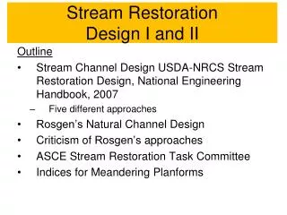
Stream Restoration Design I and II. Outline Stream Channel Design USDA-NRCS Stream Restoration Design, National Engineering Handbook, 2007 Five different approaches Rosgen’s Natural Channel Design Criticism of Rosgen’s approaches ASCE Stream Restoration Task Committee

E N D
Stream RestorationDesign I and II Outline • Stream Channel Design USDA-NRCS Stream Restoration Design, National Engineering Handbook, 2007 • Five different approaches • Rosgen’s Natural Channel Design • Criticism of Rosgen’s approaches • ASCE Stream Restoration Task Committee • Indices for Meandering Planforms
Approaches to Stream Channel Design (1) • Analogy Method: Channel dimensions from a reference reach can be transferred to another location • Regime Method: Dependent channel dimensions can be determined from regression relationships with independent variables • Hydraulic Geometry Method: Dependent channel dimensions can be determined from regression relationships with independent variables • Extremal Hypotheses: Alluvial channels will adjust channel dimensions so that some parameter is optimized • Analytical Method: Depth and sediment transport can be calculated from physically-based equations
Analogy Method (1) • Estimates for stable channel design width, depth, and slope in an alluvial channel can be made using channel dimensions from a similar stable channel (reference reach) • The concept is that alluvial streams will evolve to the same stable channel dimensions, given the same independent driving hydraulic variables; bed and bank materials, sediment inflow, slope, valley type, and annual discharge hydrograph should be close to the same in both the design and reference reaches • A reference reach is a site that is able to transport sediments and detritus from its contributing watershed drainage area, while maintaining a consistent profile, dimension, and plan view, over time • Several reference reaches with relatively similar channel-forming discharges may be used to develop a range of solutions for a single dependent design variable, typically, width
Analogy Method (2) Limitations: • Very difficult to find a stable alluvial reference reach with characteristics physiographically similar to the reach to be restored • The independent driving variables of sediment inflow, bed and bank material, and channel-forming discharge must be similar • The dependent design variables of slope, depth, and width must be taken together as a set
Regime Method (1) • Introduced by British engineers in the late 19th C. to design and operate extensive irrigation systems in India, excavated into fine sand-bed material and carried their design discharge within the channel • The objective of channel design was to set the channel dimensions so that the inflowing sediment load would be passed without significant scour or deposition • Regime formulations include relationships to calculate channel width, depth, and slope as functions of channel-forming (or dominant) discharge and bed-material
Regime Method (2) • Stable channel dimensions may be calculated using the Blench (1957) regime equations; data came from Indian canals with sand beds and slightly cohesive to cohesive banks • Three channel dimensions—width, depth, and slope—are calculated as a function of bed-material grain size, channel-forming discharge, bed-material sediment concentration, and bank composition.
Regime Method (3) Limitations: • Equations often contain empirical coefficients that must be estimated primarily using judgment and experience • Regime equations are typically regression equations; should not be used in cases where the discharge, sediment transport, bed gradations, and channel characteristics of the project channel are significantly different from those used in the development of the regime relationships
Hydraulic Geometry Method (1) • Based on the concept that a river system tends to develop in a predictable way, producing an approximate equilibrium between the channel and the inflowing water and sediment • Typically relates a dependent variable, such as width, to an independent or driving variable, such as discharge or drainage area • May be useful for preliminary or trial selection of the stable channel width • Hydraulic geometry depends on: watershed characteristics, geology, vegetation, land use, sediment load and gradation, runoff characteristics, woody debris, and composition of the bank
Hydraulic Geometry Method (2) • From gaging stations with long-term records, calculate an annual peak frequency curve and a flow-duration curve • Survey stable alluvial channel reaches in association with gaging stations; determine average channel top width and depth at bankfull flow, estimate channel hydraulic roughness; determine average channel bed slope and bankfull discharge • Note channel characteristics such as bank material composition, bed-material gradation, and bank vegetation • Determine the channel-forming discharge (2-year peak discharge from the annual peak frequency curve; flow-duration curve and sediment transport curve; bankfull discharge from field measurements) • Plot the measured channel top width versus the channel-forming discharge, and develop a power regression curve through data (implicit: determine similar relations for depth, velocity, and slope)
wBF = aQBFb a=5.19 (T1) a=3.31 (T2) b=0.5 Hydraulic geometry relation for width based on 32 sand-bed rivers with less or more than 50% tree cover on banks
Hydraulic Geometry Method (3) Limitations: • Relations are for the channel-forming discharge only • Difficult to determine water surface elevation at channel-forming discharge • Equations must be developed from physiographically similar streams • Assumption that channel dimensions are related only to one or two independent variables is simplistic • Relationships are assumed to be power functions • Relationships should not be extended beyond the range of the data used to develop them
Extremal Hypotheses (1) • River channel design can be optimized to maximize or minimize a critical parameter • Such hypotheses include: • Minimum stream power (Chang, 1979) • Minimum unit stream power (Yang, 1976) • Maximum sediment transport efficiency (Kirkby, 1977) or capacity (White et al., 1982) • Maximum friction factor (Davies and Sutherland, 1983) • N.B. Under appropriately defined circumstances, some of these conditions turn out to be equivalent • Solve the resistance, sediment transport, and extremal equations simultaneously and obtained a unique solution for the dependent variables of width, depth, and slope
Extremal Hypotheses (2) Given equations for flow continuity, flow resistance, sediment transport capacity and bank strength, and independent variables Q, Sv, Qb, D and φ′, one can predict S, w, d, and t (Eaton et al., 2004) Solution curves subject to the constraints Q = 100 m3/s, S = 0.003. For constant φ′ (50°), bedload concentration predicted using the Meyer-Peter and Muller (1948) equation for constant variable D50 (22 mm, 32 mm, 45 mm) plotted against bed width and aspect ratio
Extremal Hypotheses (3) Limitations: • Channels can be stable with widths, depths, and slopes different from those found at the extremal conditions • Sensitivity of energy minima or sediment transport maxima to changes in driving variables may be low, so that the channel dimensions corresponding to the extremal value are poorly defined • Project constraints (anthropogenic or geologic) may limit the theoretical variability in channel geometry
Analytical Method (1) • Calculate stable channel dimensions that will pass a prescribed sediment load without deposition or erosion • Stable channel analytical method in the COE SAM program (Copeland, 1994; Thomas et al., 2003) that simultaneously solves resistance and sediment transport equations (also available in HEC–RAS) • Determines dependent design variables of width, slope, and depth from the independent variables of discharge, sediment inflow, and bed-material composition; it solves flow resistance and sediment transport equations simultaneously, leaving one dependent variable optional (e.g., extremal hypothesis) • Family of solutions from which the unique solution for depth and slope can be determined using width from geomorphic principles or project constraints
Analytical Approach (2) For subcritical, sand-bedded channel (abridged SAM)
Analytical Approach (3) For subcritical, sand-bedded channel (abridged SAM)
Analytical Method (4) • Determine the channel-forming discharge—bankfull discharge, effective discharge, or a specific peak frequency • Determine sediment inflow for reach—calculate a sediment transport rating curve for the upstream supply reach (typical upstream cross section using a normal depth equation and a sediment transport equation) • Develop a stability curve—Calculate a family of slope-width-depth solutions that satisfy resistance and sediment transport equations for the channel-forming discharge (stable design channel) • Determine channel width—A channel top width for the channel-forming discharge is selected from the stability curve using geomorphic principles or project constraints; depth and slope for selected width are determined from the stability curve
Analytical Approach (5) • Conduct an analytical sediment budget analysis—Using the design channel dimensions, calculate a sediment-transport rating curve in the project reach • Determine channel planform—Sinuosity determined; also need meander wavelength, channel length, and trace of the channel • Natural variability in cross-sectional shape—Variability in channel width and depth can either be allowed to develop naturally or can be part of the project design (e.g., riffles and pools) • Instream structures—Successful stream restoration often includes the use of bank protection, grade control, and habitat features
Implications of USDA-NRCS Stream Restoration Design • Stream Restoration Handbook: First time such methods were presented as a technical handbook • There are advantages and disadvantages with each method • Primary limitations • No assessment of success • One-dimensional • Ambiguity of design dimensions • Choice of equations
Rosgen’s Natural Channel Design (1) • Restoring the dimension, pattern, and profile of a disturbed river system by emulating the natural, stable river • A channel design technique based on the morphological and morphometric qualities of the Rosgen classification system • Based on measured morphological relations associated with bankfull flow, geomorphic valley type, and geomorphic stream type • Est. 14,000 “students” spent $28 to $40M USDA-NRCS, Part 654 Stream Restoration Design National Engineering Handbook, Chapter 11, Rosgen Geomorphic Channel Design, 2007.
Rosgen’s Natural Channel Design (2) The methodology is divided into eight phases: • Define specific restoration objectives associated with physical, biological, and/or chemical process • Develop regional and localized information on geomorphic characterization, hydrology, and hydraulics • Conduct a watershed/river assessment to determine river potential, current state, and the nature, magnitude, direction, duration, and consequences of change • Initially consider passive restoration recommendations based on land use change in lieu of mechanical restoration
Rosgen’s Natural Channel Design (3) • Initiate natural channel design with subsequent analytical testing of hydraulic and sediment transport relations (competence and capacity). • Select and design stabilization/enhancement/vegetative establishment measures and materials to maintain dimension, pattern, and profile to meet stated objectives. • Implement the proposed design. • Design a plan for effectiveness, validation, monitoring, and maintenance to ensure stated objectives are met, prediction methods are appropriate, and the construction is implemented as designed.
River restoration using Rosgen geomorphic channel design approach (Rosgen, 2007)
1. Restoration Objectives • Clear and concise statements of restoration objectives to appropriately design the solution(s) • Common objectives are: flood level reduction, streambank stability, reduce sediment supply, land loss, and attached nutrients, improve visual values, improve fish habitat and biological diversity, create a natural stable river, withstand floods, be self-maintaining, be cost-effective, improve water quality, improve wetlands (Rosgen, 2007)
2a. Local and Regional Relations • Developing local and regional relations in geomorphic characterization, hydrology, and hydraulics • Geomorphic characterization: valley types and stream types (see table and figures) • Often advantageous to have an undisturbed and/or stable river reach immediately upstream of the restoration reach • Specific design variables use reference reach data for extrapolation purposes, assuming the same valley and stream type as represented (Rosgen, 2007)
Valley types used in geomorphic characterization (Rosgen, 2007)
Broad-level stream classification delineation showing longitudinal, cross-sectional, and plan views of major stream types (Rosgen, 2007)
Classification key for natural rivers (Rosgen, 2007)
2b. Local and Regional Relations • Hydrology often determined from regional curves constructed from long-term stream gage records • Bankfull discharge and dimensions are plotted as a function of drainage area for extrapolation to ungaged sites in similar hydro-physiographic provinces • Regional curves of bankfull discharge versus drainage area and at-a-station hydraulic geometry relations are developed • Hydraulic relations are validated using resistance equations for velocity prediction at ungaged sites (such as Manning’s n) (Rosgen, 2007)
Regional curves from stream gaging stations showing bankfull discharge (ft3/s) vs. drainage area (mi2) (Rosgen, 2007)
Regional curves from stream gaging stations showing bankfull discharge (ft3/s) vs. drainage area (mi2) (Rosgen, 2007)
Prediction of Manning’s n roughness coefficient (Rosgen, 2007)
3a. Watershed and River Assessment • A stream channel stability analysis is conducted along with riparian vegetation inventory, flow and sediment regime changes, limiting factor analysis compared to biological potential, sources/causes of instability, and adverse consequences to physical and biological function • Streamflow alteration (magnitude, duration, and timing) must be determined • Sediment competence and capacity—Potential aggradation, degradation, and channel enlargement are predicted for the disturbed reach (based on shear stress, maximum grain size, and regional sediment transport relations) • Streambank erosion—Streambank erosion rate is predicted as part of the river stability assessment (Rosgen, 2007)
3b. Watershed and River Assessment • A stream channel stability analysis (continued) • Successional stages of channel evolution—identify the present stage of the stream and predict the direction and consequence of change • Base-level change—degree of channel incision determined by the lowest bank height divided by maximum bankfull depth • Direct disturbance and riparian vegetation—disturbance of stream channels must be offset by correcting dimension, pattern, profile, and often channel materials. Riparian vegetation reestablishment should contain the correct species • Biological assessments—Fish species, food chains, diversity with broad categories of ecoregions, and stream types (habitat units) are collected for identifying biological potential (Rosgen, 2007)
Various stream type succession scenarios (Rosgen, 2007)
4. Passive recommendationsfor restoration • A change in management strategies can be very effective in securing stability and function • The alternative of self-stabilization is always a key consideration in any stability assessment • If natural recovery potential is poor and/or does not meet specific objectives, phase 5 would be appropriate (Rosgen, 2007)
5. Natural Channel Design • Mixture of analogue, empirical, and analytical methods in the design procedure • Determine existing valley type and potential stream type of the stable form • The proposed channel type must be converted to a dimension, pattern, and profile to initially test whether the hydraulic and sediment relations associated with the watershed are compatible prior to advancing through all of the procedural steps • Watershed and river assessment given in the following steps (Rosgen, 2007)
Generalized flowchart representing Rosgen geomorphic channel design utilizing analogue, analytical, and empirical methodologies (Rosgen, 2007)
6. Stabilization and EnhancementStructures • River stabilization and enhancement structures used in the Rosgen geomorphic channel design methodology • Utilize native materials such as natural boulders, logs, rootwads, and vegetative transplants • Grade control—cross vane (+/- logs and rootwads) and W-weir • Streambank stabilization—J–hook vane, and others (Rosgen, 2007)
Cross section, profile, and plan view of a cross vane (Rosgen, 2007)
Cross section, profile, and plan view of a W-weir (Rosgen, 2007)
(Rosgen, 2007) Log vane/J-hook combo with rootwad structure
Longitudinal profile of proposed C4 stream type showing bed features in relation to structure location (Rosgen, 2007)