Virtual Survey System for Wide Field Imaging in Astronomy
190 likes | 216 Vues
This system facilitates image data handling, calibration, quality control, and dissemination for astronomy research. Utilizing Python as a glue, it integrates databases, dynamic processing, and parallel computing for efficient surveying operations.

Virtual Survey System for Wide Field Imaging in Astronomy
E N D
Presentation Transcript
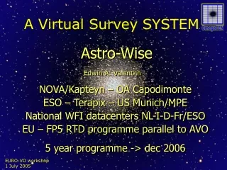
A Virtual Survey SYSTEM Astro-Wise NOVA/Kapteyn – OA Capodimonte ESO – Terapix – US Munich/MPE National WFI datacenters NL-I-D-Fr/ESO EU – FP5 RTD programme parallel to AVO 5 year programme -> dec 2006 Edwin A. Valentijn
Basic objectivesWide Field imaging EU Facilitate: handling, calibration, quality control, pipelining, user tuned research, archiving, disseminating results 100’s Tbyte of image data and 10’s Tbyte of catalogue data With production spread over EU What-ever –> object model / scalability Where-ever -> federations, GRIDS Who-ever -> Python as glue (+GUIs) }(O)MegaCAM
status • VO conference 2002 - design • Build information system - working • Implemented, qualified WFI@2.2m, WFC@INT, MDM, OmegaCAM@ILT • >>Qualify with OmegaCAM@VST-2006 • >>tune to run Public Surveys • >>quality control • >>Optimize federation/replication
new paradigmtarget processing to: -hunting /full linking -data pulling -target processing -raw data -archive -all in archive -request driven from: -waterfall/ multi-tier -data pushing -raw data processing -raw data delete -result ->archive -”releases” • raw pixel data pipelines/cal files catalogues • all integrated in one information system • distributed services Virtual Survey Telescope • processing GRID • Storage GRID • Methods/services GRID
Astro-Wise VO Properties Benefits integrated dynamic db • on-the fly re-processing • 5LS: 5 Lines Script • All bits are traced • Administration for parallel processing compute GRID SETI@home • Global solutions –astrometry/photometry • Build–in workflow • Fully user tunable – own provided script • Context: projects/surveys, instruments, mydb • Publish directly in EURO-VO
components • Procedures + Cal plan at telescope • Data model -> object model ++ ->++db • Central db ; server/clients • All I/O except images • Meta data • Source lists = catalogues + associate lists • Links = references = joints • Fileserver – distributed- via db • Python clients • CVS distributed code base - opipe
Bias pipeline Source pipeline Flatfield pipeline Photometric pipeline Image pipeline Astro-Wise Pipelines
Target processing:++ the make metaphor awe> targethot=HotPixelMap.get(date='2003-02-14', chip='A5382') The processing chain is ReadNoise <-- Bias <-- HotPixels • > class HotPixelMap(ProcesTarget): • > > def self.make() • > class ProcessTarget(): • > > def get(date, chip) # if not exist/up-to-date then make() • > > def exist() # does the target exist? • > > def uptodate() # is each dependency up to date? Fully recursive
Intra-operability peer to peer • code base + docs : CVS • Db: “Advanced Replication” evolving to streaming WRITE WRITE • READ-ONLY • READ-ONLY • REPLICATION • REPLICATION • REPLICATION • REPLICATION • READ-ONLY • READ-ONLY
Contents of federation • Raw data • Observed images • Ancillary information • Calibration results • Calibration files time stamped • Reduced images • Single observation • Co added images • Software • Methods (pipelines) for processing calibration • Configuration files • Source lists – catalogues • Extracted source information • Associated among different data objects
Example 5LS #Find ScienceFrames for a ccd named ccd53 and filter Awe> q = (ReducedScienceFrame.chip.name == 'ccd‘) and (ReducedScienceFrame.filter == ‘841’) # From the query result, get the rms of the sky in image Awe> x = [k.imstat.stdev for k in q] # get the rms of the used Masterflat Awe> y = [k.flat.imstat.stdev for k in q] # Make a plot Awe> pylab.scatter(x,y)
Lofar IBM- Blue Gene/L
Thanks! Welcome at next Astro-Wise tutorial! October 2005 Netherlands www.astro-wise.org