Download
1 / 21
290 likes | 735 Vues
VFR CROSS COUNTRY FLIGHT. PLANNING EXECUTION. PHASES. Pre-plan and prep Plane Pilot Portable comm, data, Nav Provisional Flight Plan Weather Final Flight Plan(s) Flight Briefing, pre-flight, fly. Preparations. Plane Registration Annual Inspection Oil change Repairs Pilot

E N D
VFR CROSS COUNTRY FLIGHT PLANNING EXECUTION by: Mark Phillips, ATP CFII MEI
PHASES • Pre-plan and prep • Plane • Pilot • Portable comm, data, Nav • Provisional Flight Plan • Weather • Final Flight Plan(s) • Flight • Briefing, pre-flight, fly by: Mark Phillips, ATP CFII MEI
Preparations • Plane • Registration • Annual Inspection • Oil change • Repairs • Pilot • Medical • Current • Flight Review • Practice • Portable Comm & Data • Hardware and Apps by: Mark Phillips, ATP CFII MEI
Portable Comm & DataHardware and AppsTips • Apple products work good • Acquire iPad and iPhone • Install apps on iPad & iPhone • Load databases on iPad & iPhone • Allow at least 2 months for proficiency by: Mark Phillips, ATP CFII MEI
Portable Comm & DataHardware • iPad • Get the model having cellular capability • Provides on board GPS • Do NOT need to enable the cellular (phone line not needed) • 64 Gbs min memory • iPhone • 16 Gbs is not enough. Recommend 64 • Mobile chargers • Cigarette lighter plug type • Rechargeable portable battery pack • Wall chargers by: Mark Phillips, ATP CFII MEI
Planning, Charting, & Nav Apps • DUATwww.duat.com Std Briefing & Planning • DUATS www.duats.com Std Briefing & Planning • WingXPro7www.hiltonsoftware.com Charts, Nav • FlyQ Pocket app (works great with 3G. DUAT Std Briefing, file flight plans, weather graphics) • FltPlan app (back up charts) • GPS RAIM Prediction www.raimprediction.net • E6B Sporty’s, app • Simple calculator std utility app • (Underlined items are most frequently used) by: Mark Phillips, ATP CFII MEI
Weather Apps • Weather Streetwww.weatherstreet.com 7 day • US Airnetwww.usairnet.com 3 day aviation • AWCwww.aviationweather.gov 3 day, like FSS • MyRadar app national radar, location forecast • AccuWeather app current and forecast • DUAT (listed previously) • DUATS (listed previously) • FlyQ Pocket (listed previously) • WingXPro7 (listed previously) store wx, TFRs • (Underlined items are most frequently used) by: Mark Phillips, ATP CFII MEI
Trip Example • Destination Myrtle Beach, SC • PA28-180 • 110 kt cruise TAS • 10 gph fuel burn rate • Depart LAF • Wt and Bal allows 38 gal fuel • Nav by GPS, Direct • VFR • No night flying by: Mark Phillips, ATP CFII MEI
Provisional Flight PlanMax Leg Distance • Wt and Bal • Max fuel (gals) for the planned load • Endurance (hours) • Max Endur = Max fuel (gals)/ gph • Safe Endur = Max Endur - 1 hour (for reserve) • Plan Endur = Safe Endur (or less for people endur) • Ground Speed = cruise TAS • 20kts less if westbound • Max Leg Distance (Nm) = Plan Endur * Gnd Spd by: Mark Phillips, ATP CFII MEI
Max Leg Distanceexample • Max fuel for the load = 38 gal (depends on W &B) • 10 gph fuel burn rate, 110 kt TAS cruise • Max Endur = 38 gal / 10 gph • Max Endur = 3.8 hrs • Safe Endur is 1 hour less for reserve • Safe Endur = 2.8 hrs • Plan Endur = 2.8 hrs (assume passengers OK) • Ground Speed = TAS (assume not westbound) • Max Leg Dist = Plan Endur * GS • 2.8 hrs * 110 kts = 308 Nm by: Mark Phillips, ATP CFII MEI
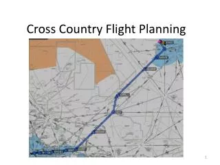
Provisional Flight PlanCreate Route • Chart program (WingX7Pro) • Start to finish, straight line • Route around obstacles, airspace • Total distance • Number of legs • legs = total distance / max leg distance • Identify and insert fuel stop airports • at no greater than max leg distances • Review entire route, adjust as needed • Identify alternates by: Mark Phillips, ATP CFII MEI
Final week before Trip • Check weather each day • Weather street www.weatherstreet.com • Accuweather • TV by: Mark Phillips, ATP CFII MEI
3 Days before Trip • Check weather each day • All previous sources • Winds and temps aloft • Aviation weather center (AWC) www.aviationweather.gov • US Air Net www.usairnet.com by: Mark Phillips, ATP CFII MEI
2 Days before Trip • Check weather • All previous sources • 48 hour progs, AWC www.aviationweather.gov • Update all databases • Mobile equipment • Installed in plane • Confirm planned stops are feasible and OK • Facilities and prices, hours, food • Make reservations • Charge all mobile equipment batteries by: Mark Phillips, ATP CFII MEI
1 Day before Trip • Plane • Preflight • Fuel • Start and warm up engine • Preheat on • Brief passengers • No coffee tomorrow morning by: Mark Phillips, ATP CFII MEI
Night before Departure • Confirm databases updated • Download weather to ipad/iphone chart apps • Outlook briefing (DUAT) www.duat.com • Check leg times and fuel with DUAT or equiv. • Optimum cruise altitude • Adjust stops as required • Modify flight plans if necessary • Modify reservations if necessary by: Mark Phillips, ATP CFII MEI
Night before Departure (page 2) • Enter flight plan legs into apps. • Chart program (WingX7Pro) • DUAT • FlyQ Pocket • RAIM Forecast www.raimprediction.gov • Pack flight bag • Paper charts • Plug in ipad and iphone chargers by: Mark Phillips, ATP CFII MEI
Before leaving home for Airport • Check weather • AWC and others as needed • Standard Briefing for first leg • DUAT • Call FSS with any questions • Download weather data to ipad and iphone chart app • Radar • Pack ipad and iphone and chargers!!! by: Mark Phillips, ATP CFII MEI
Before boarding Plane • Check Radar • MyRadar (or FlyQ Pocket) by: Mark Phillips, ATP CFII MEI
During Flight • Note time of Departure • Establish VFR Flight Following (with ATC) • ETE • After establishing cruise • (from chart app or GPS) • Compare fuel remaining to ETE • Recheck each half hour • Consider alternates • Call EFAS (Flight Watch) weather updates 122.0 • Alternative: ADS-B by: Mark Phillips, ATP CFII MEI
At Each Stop • Fuel up and check oil • Check weather • AWC • FlyQ • Standard Briefing for next Leg • DUAT (FlyQ) or FSS • Radar by: Mark Phillips, ATP CFII MEI