Download
1 / 38
380 likes | 519 Vues
Streambed Mapping Project For Western North Carolina Counties. Presentation Topics. Background Task Descriptions Progress To Date Path Forward. Background. Background. PROJECT TEAM Sponsor: North Carolina Center for Geographic Information and Analysis

E N D
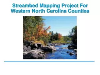
Streambed Mapping Project For Western North Carolina Counties
Presentation Topics • Background • Task Descriptions • Progress To Date • Path Forward
Background • PROJECT TEAM • Sponsor: North Carolina Center for Geographic Information and Analysis • Advisory Committee: USGS, EPA, NC DWQ, NC DOT, NC EEP, City of Charlotte, Buncombe County • Contractors: Watershed Concepts, EarthData, ESP Associates, Data Enhancement Services
Background • North Carolina Senate Bill 1152 • Mandated that a plan be created to improve the mapping of streams in the State of North Carolina • Creation of new dataset to map surface waters in North Carolina including streams, lakes, ponds, and other water bodies
Background • Stream Mapping Working Group • Four meetings in late 2004 • Requirements Survey / User Requirements Summary • Stream Mapping Implementation Plan • Submitted to the NC Legislature in January 2005 • Endorsed by the GICC and presented to the General Assembly’s Environmental Review Commission in January of 2005 • Statewide implementation in a 5 year period Website for Document Download: http://cgia.cgia.state.nc.us/streammap
Background • A benefit / cost analysis was performed to show the value of the Streambed Mapping Project to agencies as well as the general public. Note: This estimate yields an initial B/C ratio of 16:1, a value that does not reflect long term benefits.
Background • Senate Bill 7 Hurricane Recovery Act • Allocated mapping funds for the 19 counties in Western North Carolina that were declared disaster areas after Hurricanes Frances and Ivan.
Task Descriptions • The Streambed Mapping Project is comprised of many tasks including: • Project Management • Horizontal Accuracy Study • Schema and Geodatabase Design • Software Tool Creation • Drawing of Streamlines and Water Bodies to 6-Acre Upstream Drainage Limit • NHD Conflation and Attribution of Streamlines and Water Bodies
Project Management • Project Management Plan • Project Organization, Communications, QA/ QC, Change Management, Risk Management, File Management, Project Schedule and Deliverables • Coordination Activities • Advisory Committee formed to assist with project decisions
Horizontal Accuracy Study • Purpose was to perform a pilot study to determine the horizontal accuracy of the streamlines in various situations. • Study was based on: • 250 Survey Points, 100 miles of stream • Varying degrees of terrain density, differing imagery resolutions, and varying drainage areas • Varying land characteristics (open, brush, forest, and urban)
Horizontal Accuracy Study • Two GIS specialists digitized the streamlines • Two types of imagery (DOQQs and Local) • TIN surfaces generated from bare earth LIDAR returns, hillshades, DEMs, and contours • Each analysts work performed independently of one another • Simultaneously, surveyors collected 250 GPS points and stream widths using survey grade GPS and OPUS post-processing methods • ArcHydro, LIDAR Tool, 1:24K NHD streams, NCFMP Breaklines, Independently-Derived Streamlines, and Streamlines Derived to the 6-Acre Drainage Area Limit were also analyzed against the survey points and the analysts linework
Horizontal Accuracy Study Average Distance from Stream Bank for 100% of the Data Note: Analyst 1, Analyst 2, and Independently-Derived Streamlines are over twice the accuracy of the existing NHD streamlines
Horizontal Accuracy Study • Cumulative Probability Distribution for Selected Manual Methods (Including Analysts 1 and 2, NC Independently Derived Streamlines and 1:24K NHD) for All Streams
Horizontal Accuracy Study Observed Accuracy by Land Cover Setting
Horizontal Accuracy Study Findings: • Six different methods tested • In general, manual processes more accurate than automated processes • Manual methods 2 and 3 times more accurate than existing 1:24K NHD • NHD for all points -- 70% were within 15 ft of stream banks, 85% are within 25 ft of stream banks, and 90% were within 35 ft of stream banks • Manual process for all points -- 70% within 3 ft of stream banks, 85% within 10 ft of stream banks, and 90% within 15 ft of stream banks • Of open, brush, forest, and urban, the urban environment posed the biggest challenge in terms of horizontal placement
Geodatabase Schema and Design • Schema • Various models reviewed • NHD data model appended with additional attributes previously identified in the Implementation Plan • Design • Conceptual – feature classes, object classes, entity relationships, cardinality, topologies, and domains defined • Logical – finalizes the conceptual design • Physical – utilizes SQL Server 2000 with SDE
Geodatabase Schema and Design • Additional Features Include State Custom Tables • Change Table: Tracks history of edits • Submetadata Table: Provides information on source data used to create or edit stream data • Significant Coordination Effort • Data Dictionary Created
Software Tool Development • Suite of Software Tools • Suite of software tools created to assist with horizontal alignment, attribution and conflation of the 1:24K NHD attributes to the dataset • Optimize both production and quality of the Streambed Mapping Dataset • Tools incorporated into the “Streambed Mapping Analyst Toolset” as an extension in ArcGIS, and will be made available to the public • Design • User requirements collection • Prototype Screenshots • Coding • Testing • Software Requirements Document • User Guide and Online Help
Software Tool Development • Project Configuration Options Tool • Multiple Dataframe Modeler • Create Feature Types Toolset • Source File Comparison Tool • Streambed Mapping Analyst Toolset – Horizontal Alignment Tools • Horizontal Placement QC Tool • Flow Checker Tool • Tree Builder Tool • NHD Breakpoint Extraction Tool • Move Breakpoint Tool
Software Tool Development • Assign Streambed Mapping Attributes Tool • Drainage Area Transfer and QC Tool • NHD Batch Attribute Transfer Tool • NHD Manual Attribute Transfer Toolset • QC Streambed Mapping Attributes Tool • Populate Submetadata Table Tool • NHD Cross Reference and Change Table Population Tool • Stream Leveling and Flow Table Population Tools • Streambed Mapping Analyst Toolset – Attribution / Conflation Tools
Streamline and Waterbody Identification and Attribution • Horizontal Alignment • Streamlines terminate at the 6-acre drainage area upstream limit – creates a consistent dataset • Same base data used for alignment as the sources used for the Horizontal Accuracy Study • Increasing both the quality and quantity of streams in existing stream files
Streamline and Waterbody Identification and Attribution • Attribution • All attributes found in the 1:24K NHD are conflated to the Streambed Mapping Dataset (point, line, polygon) • Additional attributes placed in an appended table to the NHD model • Reach codes conflated from 1:24K NHD data, and generated for new streams that do not exist in the NHD • All changes from existing 1:24K NHD attributes are recorded in the Reach Cross Reference Table and the Change Table created for the project • Attribution performed with the assistance of automated tools
Progress To Date • Project Management Plan created • Multiple stakeholder briefings and updates • Accuracy Study completed – final report of findings submitted • Geodatabase finalized and physical Geodatabase installed • Prototypes created for all tools; tools finalized & implemented • User guide and online help completed for all tools • Software Requirements Specification Document finalized
Progress To Date • First Delivery Area Submitted as Final to State (Pigeon) • Two Additional Delivery Areas (Upper New and Upper Yadkin, Seneca) have been finalized as of beginning of year
Path Forward • Entire project is a 2 year effort with a completion date of Summer 2007 for all 19 counties • A long term maintenance plan for the Streambed Mapping Dataset will be developed that documents the business and technical requirements of project stakeholders • North Carolina will develop an NHD Stewardship Agreement with USGS for long term maintenance of NC Stream Mapping dataset