Download
1 / 26
260 likes | 415 Vues
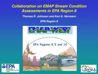
Collaboration on EMAP Stream Condition Assessments in EPA Region 8 Thomas R. Johnson and Karl A. Hermann EPA Region 8. What is EMAP-West?. A demonstration of indicators and designs for assessing the ecological condition of streams. partnerships between EPA / States / Tribes

E N D
Collaboration on EMAP Stream Condition Assessments in EPA Region 8 Thomas R. Johnson and Karl A. Hermann EPA Region 8
What is EMAP-West? A demonstration of indicators and designs for assessing the ecological condition of streams • partnerships between EPA / States / Tribes • estimates of ecological condition of streams and rivers • comparative ranking of stressors • tools for bioassessment • supporting framework for 305b/303d process
EMAP-West Indicators • Fish Community Structure • Macroinvertebrate Community Structure • Periphyton Community Structure • Physical Habitat (in-stream and near-stream) • Ambient Chemistry (nutrients, major ions) • Fish Tissue (mercury, some organic contaminants) • Watershed Characteristics
EMAP-West Sampling and Analysis • EMAP sampling occurred from 2000 – 2004 • Most Laboratory Analyses are complete • Some remaining 2004-sampled macroinvertebrate data • Periphyton data are being completed
Region 8 EMAP Status and Plans • Region 8 Assessment • Chapters (reporting / assessment units) • Chapter Content • Ecoregional / State Workshops • Reference Designation Refinement • Ecological Indicator (Multi-Metric and Predictive Models) Development • Threshold Setting • Landscape Models
Region 8 Assessment Chapters are reporting units with a desired 50+ probability sites
Region 8 Assessment Chapters:Reporting Units and Monitoring Data • Upper Missouri Basin • 210 Probability Sites Complete; 196 Usable • Middle Rockies (Region 8 only) • 70 Probability Sites Complete; 66 Usable • Middle / Northern / Canadian Rockies (Region 8 only) • 82 Probability Sites Complete; 79 Usable • Northwestern Great Plains • 101 Probability Sites Complete; 90 Usable • All Rangeland Northern Plains • 121 Probability Sites Complete; 108 Usable • All Cultivated Northern Plains • 64 Probability Sites Complete; 59 Usable
Region 8 Assessment Chapters:Reporting Units and Monitoring Data • Region 8 • 429 Probability Sites Complete; 404 Usable • Colorado • 71 Probability Sites Complete; 67 Usable • Montana • 82 Probability Sites Complete; 69 Usable • North Dakota • 65 Probability Sites Complete; 63 Usable • South Dakota • 81 Probability Sites Complete; 76 Usable • Utah • 55 Probability Sites Complete; 55 Usable • Wyoming • 75 Probability Sites Complete; 74 Usable
Region 8EMAP Assessment Proposed Chapter Content • Resource Characterization (Extent Estimates) • Ecological Condition of Streams • Biological Condition (Population Estimates) • Fish Assemblages • Macroinvertebrate Assemblages • Periphyton Assemblages • Habitat Condition (Population Estimates) • In-Stream Habitat • Riparian Habitat • Chemical Condition (Population Estimates) • Stressors (Chemical, Physical, Biological, Anthropogenic) • Extent • Stressor / Condition Association (Relative Risk) • Nutrient and Excess Sediment Landscape Models
Assessment Area Population Estimates • Using Ecoregional Multi-Metric Indicators / Stressor Indicators: - Ecoregion Population Estimates -Done for Each Ecoregion in a State -Sum Ecoregional Results for State Total • Using Predictive model values (O/E): - Sum weights directly for assessment area
Region 8 Ecoregion Indicators Workshops • May 3 – 5, 2005 - Northwestern Great Plains • Rapid City, SD • May 10 – 12, 2005 – Periphyton Workshop • Nederland, CO • June 7 – 9, 2005 – Middle Rockies • Sheridan, WY • July 26 - 27, 2005 – Southern Rockies • Denver, CO • August, 2 – 3, 2005 - Wasatch and Unitah Mountains • Salt Lake City, UT • Spring and Summer 2006 • Virtual Ecoregion Workshops • Web Broadcasts and Conference Calls • April 3 – 6, 2006 – Region 8 Bioassessment Workshop • Logan, UT • April/May 2006 – Colorado Fish MMIs • Denver, CO
Reference (and Stressed) Condition • Identification of Reference (and Stressed) is Critical for: • Indicator Development • MMI and O/E Approaches • Final Assessment (Thresholds)
Reference Designation Refinement • Workshop Efforts (ORD reference starting point) • Plains (Rapid City) • Middle Rockies (Sheridan) • Southern Rockies • Colorado – Mountains, Plains, Xeric (Denver) • Wasatch Front • Utah - Mountains, Plains, Xeric(Salt Lake City) • State Follow Ups • MT DEQ, WY DEQ, NDDH, SD GF&P, SD DENR
Sources of Macroinvertebrate MMIs to be Used in Assessment EPA/USGS/State MMIs - Developed at (or result of) workshops using EMAP-West data. State MMIs - MMIs developed for State Use (State or TetraTech). ORD MMIs - Developed for use in EMAP West-wide Assessment (Mountains, Plains, Xeric).
Predictive Models (O/E) Complete for Colorado, Montana, and Wyoming. Utah and South Dakota – Fall 2006. EMAP west-wide models with full Region 8 coverage. O/E values will be used in R8 assessment along with multi-metric Indicators.
Fish Indicator Status Colorado MMI Workshops April/May, 2006 – CDOW, CDPHE, EPA Aquatic Gap ‘Predictive Model’ – CDOW Montana Plains Fish MMI - MT Eastern Plains REMAP Study ORD-Corvallis West-wide MMI Efforts (Plains, Mountains, Xeric) Region 8 Examine Corvallis metrics for targeted Ecoregions Develop Ecoregional Fish MMIs Where Possible
Threshold Setting for Stream Condition To categorize the ecological indicators into ‘Least Disturbed’, ‘Moderate’, and ‘Most Disturbed’ Classes • Determine condition of streams in study based on biological measures, chemistry, physical habitat, and landscape indicators • Determine condition for the same indicators for least disturbed sites • Set Thresholds for population based on least disturbed condition
Macroinvertebrate MMI “Reference” vs “Stressed”
Region 8 EMAP Landscape Indicators • Potential Grazing Impact Model • Region 8 version of Montana complete • ORD version for Utah complete • Need to decide on model version and apply • Nutrient Models (N and P) • Excess Clean Sediment Models