Understanding Rasters: Tessellations and Data Types in GIS
This course dives into the concept of rasters in Geographic Information Systems (GIS), focusing on tessellations. Learn the distinction between regular and irregular tessellations, the types of raster data (continuous and discrete), and key datasets like the National Elevation Dataset (NED) and National Land Cover Dataset (NLCD). Explore the resolution and scale of raster cells, and how these elements are crucial for terrain modeling and land classification. Gain insights into the evolution and applications of raster datasets in scientific research.


Understanding Rasters: Tessellations and Data Types in GIS
E N D
Presentation Transcript
GIS in the Sciences ERTH 4750 (38031) Rasters Steve Signell, Instructor (signes@rpi.edu) Robert Poirier, TA (poirir@rpi.edu) School of Science Rensselaer Polytechnic Institute Monday, February 2, 2014
Rasters • Rasters are tesselations • A tessellation is a partition of space into mutually exclusive cells that together make up the complete study area • There are two groups of tessellations: • Regular tessellations, the cells are the same shape and size • Irregular tessellations, the cells vary in shape and size
Regular tessellations • All regular tessellations have in common that the cells are of the same shape and size, and the field attribute value assigned to a cell is associated with the entire area occupied by the cell Reality Regular tessellation
Irregular tesselations • Triangulated Irregular Networks (TIN) • Each plane fitted through three anchor points has a fixed gradient (Slope)
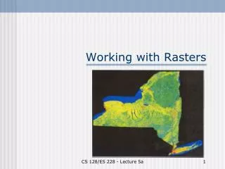
Raster types Two major types of raster data: • Continuous • Discrete, or ‘thematic’ National Land Cover Dataset (NLCD National Elevation Dataset (NED)
Resolution & Scale • The size of the area that a single raster cell represents is called the raster’s resolution • Independent of scale
Zones & Regions • Zone: Any two or more cells with the same value belong to the same zone • Region: Each group of connected cells in a zone is considered a region
Continuous Rasters • Digital Elevation Model (DEM) • National Elevation Dataset (NED)
National Elevation Dataset • primary elevation data product of the USGS • Seamless for US and territories • Compiled from contour maps, remote sensing: SRTM, LiDAR, and more
National Elevation Dataset • USGS contour maps • Resolution: 10-30m • Not emperical • Quality varies by surveyor/map
National Elevation Dataset • Shuttle Radar Terrain Model (SRTM) • Resolution: 30m • Holes
National Elevation Dataset • LiDAR (Lilight, DARradar) • High Resolution (sub cm) • Multiple returns
National Elevation Dataset • Updated regularly to reflect better data, changes in the landscape
National Elevation Dataset Terrain Modeling
National Land Cover Dataset Land Classification
National Land Cover Dataset • NLCD derived from Landsat, a series of multi-spectral remote sensing satellites.
National Land Cover Dataset • Landsat 8 & 7 • Multispectral ( Infrared- UV) • New data every 8 days • http://landsat.usgs.gov/gallery.php
National Land Cover Dataset • Every ~ 5-10 years • http://www.mrlc.gov/ • http://landcover-modeling.cr.usgs.gov/index.php
Questions? 5 min break
Part II Demos & details