Download
1 / 29
290 likes | 449 Vues
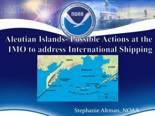
Aleutian Islands- Possible Actions at the IMO to address International Shipping. Stephanie Altman, NOAA. AIRA Phase A Summary Report. Recommendation 4.6 2 “US Government petition the IMO MEPC to designate the Aleutian Island region, or a portion therein, as a PSSA.”

E N D
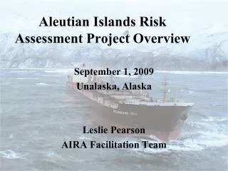
Aleutian Islands- Possible Actions at the IMO to address International Shipping Stephanie Altman, NOAA
AIRA Phase A Summary Report • Recommendation 4.62 • “US Government petition the IMO MEPC to designate the Aleutian Island region, or a portion therein, as a PSSA.” • Consider associated protective measures
IMO TOOLBOX • Protective Measures • PSSA w/ associated protective measures OR • Routing Measures (Alone)
Overview • What type of protection are you looking for? • From what ships? • Where? • IMO: The Toolbox • SOLAS ship routing/reporting • MARPOL • Particularly Sensitive Sea Areas (PSSAs)
The Toolbox: Ship Routing & Reporting • Traffic separation scheme • Separation zone or line • Traffic lane • Roundabout • Inshore traffic zone • Archipelagic sealanes • Two-way route • Recommended route • Recommended track • Precautionary area • Area to be avoided • No anchoring area • Established direction of traffic flow • Recommended direction of traffic flow
Choice of routing measure will depend on hazardous circumstances that it is intended to alleviate. • A few examples: • Separation of opposing streams of traffic to reduce incidence of head on collisions • Guidance of traffic away from ecologically important areas • Organization of traffic flow in or around areas where navigation by all or certain classes of ship is dangerous or undesirable • Reduction of risk of grounding by providing special guidance to vessels in areas where water depths are uncertain
Area to Be Avoided (ATBA) An area within defined limits in which either navigation is particularly hazardous or it is exceptionally important to avoid casualties and which should be avoided by all ships, or certain classes of ships. GPSR, 2.1.12
Traffic separation scheme (TSS): • A routing system aimed at the separation of opposing streams of traffic by appropriate means and by the establishment of traffic lanes. GPSR, 2.1.2 • COLREGs Rule 10 applies for traffic within the TSS
Precautionary Area An area within defined limits where ships must navigate with particular caution and within which the direction of traffic flow may be recommended. GPSR, 2.1.11
Two-Way Route • A route within defined limits inside which two way traffic is established, aimed at providing safe passage of ships through waters where navigation is difficult or dangerous. GPSR, 2.1.7.
What is a PSSA? • “A PSSA is an area that needs special protection through action by IMO because of its significance for recognized ecological, socio-economic, or scientific attributeswhere such attributes may be vulnerable to damage by international shipping activities. ”
Particularly Sensitive Sea Areas (PSSAs) • Can be anywhere at sea- TS, EEZ, and beyond • To be designated as a PSSA, an area must: • Have certain characteristics (ecological, socio-economic, scientific) • Be vulnerable to damage by international maritime traffic, and • Have protective measures adopted by IMO to address the identified vulnerability
Element 2: VULNERABILITY OF THE AREA TO DAMAGE FROM INTERNATIONAL MARITIME ACTIVITIES • Vessel Traffic • Characteristics • Vessel types • Cargoes Past Incidents • Natural Factors • Hydrography • Meteorological • Oceanographic
Identification of Associated Protective Measures • Element Three: Tailor measures to address the threat: linkage issue, incident history • Impact on traffic • Ships to which measure applies • Hours/Routes • Number of ships, types of ships, traffic patterns, aids to navigation
PSSA must be accompanied by APM There is no legal significance to PSSA designation. The legal significance is derived from the associated protective measure because it is the measure that results in a change to ship operations.
IMO-Designated PSSAs • Great Barrier Reef and Torres Strait (AUS/PNG 1990 and 2005) • Sabana-Camaguey Archipelago (Cuba 1997) • Marine Area Around the Florida Keys (US 2002) • Malpelo Island (Colombia 2002) • Wadden Sea (Denmark, Germany, the Netherlands 2002) • Paracas National Reserve (Peru 2003) Western European Waters (Belgium, France, Ireland, Portugal, Spain, UK 2004), Baltic Sea Area (Denmark, Estonia, Finland, Germany, Latvia, Lithuania, Poland, Sweden 2005), Canary Islands (Spain 2005) Galapagos Archipelago (Ecuador 2005) Papahānaumokuākea Marine National Monument (US 2008) Strait of Bonifacio (2011) Saba Bank (2012)
Marine Area Around the Florida Keys • Identification of the Issue • Anchor damage to ecological reserve • Significant risk of collisions in one of four existing ATBAs • Sewage • Significant amount of traffic in the area Identification of Possible IMO Measures • Routing Measures (ATBA, NAA) • Special Area Designation • PSSA designation
Marine Area Around the Florida Keys Why PSSA designation? • Ecological, Socio-economic, scientific characteristics: • The site fulfills almost every one of the factors • Vulnerability: • Various types of damage, including potential collisions, ships grounding on coral, and damage caused by anchoring, as well as concerns regarding discharges
Marine Area Around the Florida Keys • Why was PSSA Designation Pursued: • Model proposal, amount of vessel traffic in this area (40% of world’s ship traffic), its vulnerability and economic importance, history of incidents, comparison to other potential U.S. sites
Monterey Bay National Marine Sanctuary Identification of Issues • Ships operating w/n 1-2 miles of shore • Concern collisions including with high number of recreational craft, groundings, inability to get to disabled ship before it ran into coast • Mystery spills
Monterey Bay National Marine Sanctuary Identification of Possible IMO Measures • multiple measures and combinations of measures were considered • Routing (e.g., ATBA, recommended tracks, realignment of TSSs) • Mandatory Ship Reporting • PSSA designation
Monterey Bay National Marine Sanctuary Why not PSSA designation? • Ecological, Socio-economic, scientific characteristics: • Uniqueness, critical habitat, diversity, spawning or breeding grounds, economic • Vulnerability: • Ships operating very close to shore, potential for collisions between fast moving commercial ships and recreational activities, mystery oil spills • IMO tools available to address vulnerability • So why not: Timing and chart cycle, desire to proceed as expeditiously as possible
Factors to Consider 1. Ability to fulfill criteria (e.g., routing, reporting, PSSA) 2. Tailoring of measures to address risk 3. Political considerations 5. Availability of data 7. Preparation of documents 8. Timing issues 9. Strategy to proceed
Potential Benefits • Reduce risk of damage from international shipping to area by adoption of measures tailored to address the risk • Notice to int’l maritime community of risk and adoption of IMO measures to address risk • Educate shipping community about significance of area as well as safety concerns
Potential Benefits • Increased awareness about area’s sensitivity to shipping activities • Potential for higher standard of care in vessel operations, including safe and sound navigation. • Increased compliance w/ IMO measures as well as domestically adopted regulations