Download
1 / 11
110 likes | 137 Vues
Meet GIS professionals in Indiana who excel in using spatial technology for environmental protection, sanitation, and problem-solving. Learn how they harness the power of GIS to streamline operations and serve the public effectively.

E N D
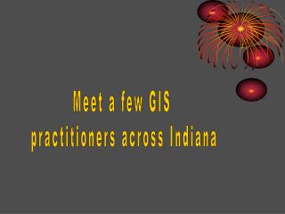
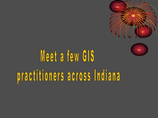
Meet a few GIS practitioners across Indiana
Doug Marvel with Spatial Marvels, an Indianapolis-based GIS consultant. Doug’s college focus resulted in a degree in Engineering Technology. Doug provides consulting expertise in setting up, researching, maintaining, and enhancing a Geographic InformationSystem (GIS) for many types of indivduals And organizations/business entities. From small start-up companies to local, city, township, and state governmental agencies and to large corporations, Doug enables an entity to better utilize its human and financial resources through streamlining GIS accessibility. The most enjoyable aspect of Doug’s job is watching a business/entity work their way from no GIS, to the beginnings of a GIS (training, hardware, software, nervous- ness), through to a fully robust and established GIS. The final phase - where everything is proceeding smoothly and everyone is comfortable using the software and grasps the possibilities that GIS offers, in terms of problem-solving, makes Doug feel like a proud parent. Everyone then Is better able to serve the public. During high school, Doug had a special interest in then emerging technologies – before personal computers. Course work that helped in accomplishing his goals include drafting and lots of math. Drafting provided the foundation for visualizing a GIS, thus, implementing the software. College courses that have been invaluable to Doug’s professional career have been math, engineering and design, and relational database management systems. Doug encourages students to become aware of the concept of a GIS as most data available today is utilized to solve problems in some type of a GIS.
Becky McKinley with the Hammond Sanitary District. Becky’s leadership and tutelage have brought the northwestern corner of Indiana into the light in terms of geo-spatial technology use, applications, problem- solving, and outreach. She thoroughly enjoys collaborating with colleagues, learning from others, and sharing possibilities – all revolving around GIS, including aerial photography. Becky is the GIS Manager for the Hammond Sanitary District. Her job encompasses all data, hardware and software work revolving around the use of geographic Information systems addressing the Hammond, Indiana area sanitation issues. Becky is quite active in providing connections with geo-spatial technology colleagues around the state, with K+ educators in the area, and with business and political leaders throughout the state. Spending time educating those not familiar with GIS is a task that Becky takes on graciously. She also spends time assisting GIS professionals in the northwestern portion of the state enabling data sharing, problem- solving, and cost sharing. Connecting Indiana’s students (future geo-spatial technology professionals) with GIS, GPS, and aerial photography makes Becky feel positive about the direction that GIS will take in Indiana’s future. Bruce Nielsen, USDA-NRCS Indianapolis Office, Jill, Saligoe- Simmel, IGIC President, Jack Dangermond (ESRI Founder, CEO and owner) and Becky McKinley. Photograph was taken in San Diego in 2002 when the Indiana Geographic Information Council won an ESRI Special Achievement in GIS Award. Course work that Becky finds useful from high school would be math, drafting and computer design. Communications and writing were also vital course work from both high school and college training. Much GIS work revolves around the manipulation of data and the production of visuals, but in order to explain the visuals, a good written report must accompany the project. Becky will visit with schools in the area. She can be reached at bmckinley@hammondsd.com .
Kelly Johnstonwith the Indiana Department of Environmental Management. Kelly is an Environmental Manager with IDEM. He has a Masters of Science in Geographic Information Science. Kelly creates custom maps, trains users on GIS software, provides support for GIS users, maintains/ updates/enhances GIS data, and works with aerial photographs. The aspects of his job that he likes include using GIS technology to protect the environment, working with lots of maps, learning about cutting-edge technologies, and working with individuals from diverse fields (chemists, geologists, and others). Kelly feels that he learns something every day from the people he encounters. Kelly feels that through GIS and geo-spatial technologies, the environment will be made a better place by mitigating the human impact and maximizing the relationship between humans and the environment. Some of the college courses that have proven valuable to his job: Geographic Information Systems (GIS), remote sensing, cartography, spatial statistics, and research methodologies. Some of the high school courses that have proven valuable to his job: algebra, trigonometry, and drafting. Kelly would be willing to visit your school in central Indiana to discuss GIS or to talk about environmental issues and the use of GIS to develop solutions; e-mail at kjohnsto@idem.in.gov
Charles Hickman with the United States Geological Survey Charles is a Geographer with the USGS. He has a Masters of Arts in Geography from Ohio State University. Charles is a Mapping Liaison between the United States Geological Survey and the state of Ohio. In this capacity he helps to coordinate mapping and geographic data activities among Federal, State and local governments and programs and projects. Some aspects of Charles’ job that he really enjoys are meeting a variety of people and sharing his love of data. Charles believes that spatial data is fun! Most people like maps, and Charles benefits from this commonality as people share their enthusiasm for GIS and for maps. Some of the college courses Charles took that help him in his job were physical geography, cartography, communications, and Geographic Information Systems (GIS). Some of the high school courses that Charles took that have helped in his career are algebra, geometry, trigonometry, calculus, and art. If you would like further information on the USGS “Community Map” program, contact Charles at chickman@usgs.gov.
Jennifer Wayman with Pinnacle Mapping, Inc., is a Photogrammetry Technician. Jennifer received her Associates Degree in Photogrammetry and has been mapping in three-dimensions ever since! Her job entails planimetric and topographic mapping in a 3-D environment. This means that she wears stereoscopic lenses (see them in the photo at left – they look like black glasses) that add the three-dimensionality to an aerial photograph. From the three-dimensional aerial photograph, she can capture ground features by “tracing” them. – or the x/y coordinates on the ground can be matched to the same coordinates on the aerial photograph. This refined data can then be used in a GIS to solve problems. By doing this highly specialized job, contours and depth are added to the computer visual images that are accessed by users of the GIS software and data. In this type of work, experience and training are invaluable. Reliance upon the human eye is key in determining planimetric applications. There are still many facets that the human eye can detect that a computer cannot. The course work that Jennifer found most valuable to her current career would include all math and drafting at the high school level. And at the college level math, technology, and photogrammetry courses were the reason that she determined this type of career. Jennifer enjoys exploring new and remote places from a different perspective, yet, the feeling is as though you are really there.
Bill Holder is the GIS Director for the Kosciusko County Government. He manages the acquisition, use, distribution, and management of the various pieces/layers of GIS data available in the county in order to solve problems, to enhance commerce, and to outreach to the public. Bill works with many individuals at all levels of government and within business and at-home citizens. Bill received a Bachelor’s Degree in Geography from the University of South Alabama and a Master of Arts Degree in Geography from Appalachian State University. He loves geography and the possibilities that it brings to better understand humans and the world in which they live. A few items that Bill especially enjoys about his job are making maps that help people, finding ways to improve the quality and functionality of the county mapping website, using GIS data to resolve problems, working with aerial photo- graphy, and knowing that every day will be differ- ent, challenging, and exciting. The best part about his job is working with so many different types of people with so many various needs. Looking back, Bill finds that the most helpful courses taken in high school that help in his employment today were English composition (because he has to write many reports and proposals), Architectural Drawing, and Speech. Courses in college that enable Bill to better accomplish his professional goals were any type of GIS or Computer Mapping/Cartography, Map and Aerial Photo- graphy Interpretation, Plane Table Survey, Hydrology, Digital Image Processing, and Writing. Bill would be willing to visit classrooms in the Kosciusko County area (and surrounding counties). His e-mail is bholder@kcgov.com. Telephone is 574.372.2485.
Dawn Torok Dawn’s title is the GIS Coordinator with the City of Lawrence, Dawn works a lot with local school groups familiarizing the educators and students with a GIS and other geo-spatial technology possi- bilities. One of the best ways to outreach about GIS is through the use of aerial photography. Everyone loves to see places from above: home, school, lakes, rivers, interstates and other structures, and natural places. She enjoys introducing young people to possibilities that will be a part of their everyday personal and professional lives as they get older. Dawn has worked with the Indiana Technology Educators Association in providing guidance and classroom ideas and resource possibilities to many high school technology educators. She has also worked with the Geography Educators’ Network of Indiana in facilitating outreach. And Dawn has assisted local Scouting groups to work toward their GPS/GIS badges. The parts of her job that she enjoys the most is working with great colleagues, helping local citizens better understand property issues, and teaching others about the beauty of geo-spatial technologies. She also enjoys knowing that people can actually use her work to solve problems. High School courses that Dawn believes were valuable to her career today: math, geography, history, business, and language arts. College courses that were valuable to Dawn’s career were everything related to location, location, location! English, Business, Geography, Math, Science, History, Planning. Dawn would be willing to visit your classroom to teach about geo-spatial technologies. dtorok@cityoflawrence.org
Phil Worrell Phil is the GIS Director with Pinnacle Mapping, Inc. Currently, Phil oversees all GIS-related activities undertaken by Pinnacle. Whether training (internal and external), consulting, problem-solving, or resource management, Phil ensures that Pinnacle maintains a professional image, a quality product, and a task-oriented staff for timely completion. Phil received an Associates of Science in Computer Technology and a Bachelor of Science in Business Information Systems. The aspects about Phil’s job that he enjoys The most are working with local and state governments: maximizing their resources (human, capital, hardware) to obtain reliable, high-quality results with the promise of future shared data to enable quicker problem-solving in the coming years. “Hind-sight is 20/20 they say”. And Phil looks back to his high school and college days remembering the academics that enable him to better facilitate his job today. In high school, Phil took all of the math available and the drafting courses that were available. The mechanics of math enable the mind to better utilize and understand data management and GIS software. Any computer-related course available in college was helpful as they each teach and familiarize you with something valuable. High school may seem not too important, but in the long run of your life, it can be the little things that you learn that become the most valuable in your future life.
Layne Young with the Department of Natural Resources, GIS Division. Layne enjoys working with educators and Students throughout the Indianapolis metropolitan area in his capacity as an employee of the DNR and in his capacity as an avid geo-spatial technology specialist. Layne’s imagination in terms of classroom curriculum and applying geography and geo- spatial technologies is immeasurable. He creates ideas and methodology on a weekly basis. The trick is to type up the ideas! The Indiana Orthophotography Map Puzzle (http://www.iupui.edu/~gst/ortho.html) and the M&M Community Map Activity (http://www.iupui.edu/~gst/gps.html) are examples of Layne’s education-oriented mind. In high school,Layne believes that math, science, and geography enhanced his ability in the workplace. As well, Layne believes that college courses such as creative writing, science, geography, and planning provided a solid foundation for his success in the workplace. Layne may not have time to visit your classroom, but you can e-mail him questions at Layne.Young@indy.gov
Invite your county GIS specialist to visit the school/classroom and to introduce your students to local spatial data, local problems being solved spatially, and local solutions. Look for your county GIS webpage, too. Visit the IGIC (Indiana Geographic Information Council) website for access to IndianaMap --- a free, on-line resource that provides data for all 92 counties in the state and that can create various maps with the data – including orthophotography (aerial photography). Students can learn a lot about their state and county. http://www.indianamap.org Visit the IndianaViewProject via Purdue University. The site offers various spatial data materials that students can utilize to solve problems and plan for the future. View images, learn about GIS (through a free software package called MultiSpec), and link to AmericaView to learn about other states. http://www.indianaview.org Visit the Indiana Spatial Data Portal for more Indiana spatial data. View maps, aerial photographs, and learn about where data comes from (meta- data). http://gis.iu.edu