Download
1 / 36
360 likes | 457 Vues
This project from 2009 delves into the climate, vegetation, pollution, groundwater, and geology of North Tallinn, focusing on the landscapes and formations of the region. It discusses sediment beddings, limestone formations, sea-level changes, and the characteristics of the local ground cover. The study also touches upon the landform changes due to sea-level fluctuations over thousands of years and provides insights into the geological and geographical features of the area. Additionally, it explores the impact of climate on vegetation, wind patterns, air, and soil pollution in the region.

E N D
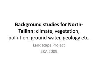
BackgroundstudiesforNorth-Tallinn: climate, vegetation, pollution, groundwater, geologyetc. Landscape Project EKA 2009
Alt üles: Vendi, Kambriumi, Ordoviitsiumi, Siluri ja Devoni ladestu settekivimitest ning pinnakattest, mille moodustavad Kvaternaari ladestu purdsetted.
Beddings of Tallinn sandstone limestone clay Skeem 4. Tallinna aluspõhja geoloogilis-litoloogiline skeem (R. Männili, A. Verte ja V. Karise järgi). 1 – liivakivi, kohati savikate vahekihtidega (gdoovi ja kotlini kihistu); 2 – savi (lontova kihistu); 3 – liivakivid (pirita ja tiskre kihistu ning pakeroidi lademe liivakivid); 4 – diktüoneemakilt; 5 – lubjakivid (volhovi, kunda, aseri ja lasnamäe lade); 6 – merglilised lubjakivid (uhaku lade); 7 – lubjakivi põlevkivikihikestega (kukruse lade); 8 – merglilised lubjakivid (idavere ja jõhvi lade); 9 –paekallas.
Change of the sea-level 10200–9300 years ago Sea level: +35 m 9300–7600 years ago. Sea level: +23 m 7600–4200 years ago. Sea level: +12 m
Inflitration of ground water and its run-off to rivers Annual rainfall: 600-800mm Run-off on ground: 39% Infiltration: 10% Intensive infiltration takes place during spring season, autumn rains, and winter thaw [sula]
North-Estonianlower seaside area (Põhja-Eesti rannikumadalik) • Narrowstripoflandbetween sea and limestonebank. Area = ca 765 km² • 65% coveredwithforest • High number ofspecies. Dominating: Tilia, Fraxinus, Sorbus, Picea • Highlimestonebankborderinglowerareainthesouthprotectsfromcoldcontinentalwindsduringwinter • Lowsalt-levelintheGulfofFinlandcomparedtothe rest ofthe Baltic Sea = solidicecoverduringcolderwinters;
North-Estonian lower seaside area (Põhja-Eesti rannikumadalik) NW-SE orientation of peninsulas and islands due to the underground formation of land masses
Climate: generalinformation • Estonian climateisintransitionzonefrompelagian (/ sea) tocontinental • Winterdayisupto 3x shorter (6h) than summer day (18h). • Weatherinfluencedbycyclones and anti-cyclones. Cyclones are mostactivefromNov-Jan (= stormyweather) • Vegetationperiodis170-180 days (average temp. of dayis +5°C) • Activeplantgrowingtakesplacewhenaverage temp. of dayis+10°C.
Climate: Temperature differences Summer day, clear and quiet
Climate: Temperature differences Summer night, clear and quiet
Climate: Temperature differences Winter day, clear and quiet wind
Wind directions 3 AM 9 AM 9 PM 3 PM
Speed and repetition (%) ofthewind January and July 1 – 0–1 m/s; 2 – 2–5 m/s; 3 – 6–9 m/s; 4 – 10–13 m/s; 5 – 14–17 m/s; repetition < 1%: 6 – 10–13 m/s; 7 – 14–17 m/s; 8 – 18–20 m/s; 9 – 21–24 m/s.
Climate: Differences in relative humidity Summer day, clear and quiet wind
Plants: biomass Big, average, small
Plants: number of species in built up areas Big, average, small
Existing “green structure” • Total area of green structure: 40,06 km² • 100m² of green structure per city-dweller • 27,23% of city area covered with green structure
Existing green structures: North-Tallinn Süsta park Kalamaja kalmistupark Kase park Kopli kalmistupark Ädala-Kolde-Sõle Stroomi beach
September 14, 2009 Fieldwork