Download
1 / 24
240 likes | 474 Vues
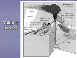
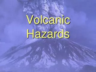
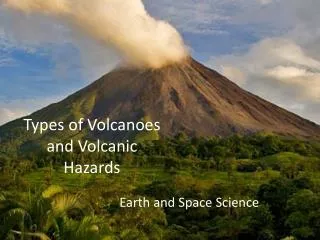
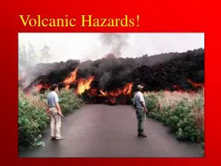
Volcanic Hazards and Cities. Global Urban Population at Risk?. Volcanic Eruption Phenomena and Hazards. “Understanding Volcanic Hazards”—Video produced by the International Association of Volcanology and Chemistry of the Earth’s Interior. Ash fall Pyroclastic (ash) flows Lava Flows

E N D
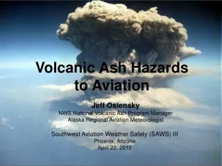
Volcanic Eruption Phenomena and Hazards “Understanding Volcanic Hazards”—Video produced by the International Association of Volcanology and Chemistry of the Earth’s Interior • Ash fall • Pyroclastic (ash) flows • Lava Flows • Lahars (volcanic mudflows) • Earthquakes • Tsunamis • Volcanic Gases
Manila, Philippines • Population, metro area—10 million • Two caldera complexes, many smaller volcanoes • Last large-scale eruption—Taal, 5380 years ago • Last smaller eruption—Taal, 1977 AD PhiVolcs
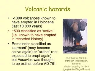
Potential risks from: Ash fall Pyroclastic (ash) flows Gases Lava flows (low probability) Response and Planning Mapping of deposits from past eruptions Geophysical monitoring Emergency response plans (near Taal, but not Manila) Education (near Taal), including the public and students Manila, Philippines
Auckland, New Zealand Kermode, 1992 • Population— ~1 million • Located in a 360 km2 volcanic field; scoria cones and tuff rings • 49 volcanoes erupted during the last 140,000 years • Last eruption about 1000 years ago
Auckland, New Zealand Potential risks from: • Ash fall; ballistic ejecta • Pyroclastic surges • Gases • Lava flows • Potential hazards of pyroclastic flows from distant calderas Response and Planning • Mapping of deposits from past eruptions • Geophysical monitoring • Emergency response plans; evacuation and infrastructure protection • Education including the public and students
Quito, Ecuador • Population—1.1 million • Located below Guagua Pichincha, a large composite cone (stratovolcano) • 12 eruption periods since 1533 AD. • Erupting now (since October, 1999) M. Hall El Comercio
Quito, Ecuador Response and Planning • Mapping of deposits from past eruptions • Geophysical monitoring • Emergency response plans; evacuation, cleanup • Education including the public and students • Especially good reporting on eruptions in the newspapers Potential risks from: • Ash fall; ballistic ejecta • Pyroclastic flows • Mudflows (lahars) • Gases
Seattle/Tacoma, Washington, USA • Population, metro Seattle and Tacoma—3.4 million • Mount Rainier, large composite cone (strato-volcano) east of the cities • Over the last several thousand years, lahars (mudflows) have reached the lowlands every 500-1000 years • Minimal risk from Mt. Baker and Glacier Peak volcanoes (northeast of Seattle) USGS, 1997
Seattle/Tacoma, Washington, USA Response and Planning • Mapping and dating of deposits from past eruptions • Geophysical monitoring, especially seismic detection of collapse and flow monitors along valleys • Emergency response plans for communities along valleys; warning systems • Education—students and public Potential risks from: • Lahars (mudflows) along valleys radiating from Mt. Rainier • Minimal risk from ash fall; fallout usually to the east
Napoli, Italy US Army, 1944 Orsi et al., 1998
Napoli, Italy • Population, metro area— ~3 million • Vesuvius; frequent historic eruptions; last eruption 1944 AD • Phlegrean Fields; two calderas (last large eruption 12,000 years ago); multiple smaller scoria cones and tuff rings (last eruption-1538 AD); restless calderas Il Mattino, 1906
Napoli, Italy Response and Planning • Mapping and dating of deposits from past eruptions; tectonic framework • Geophysical monitoring— Seismic, GPS, Gases, Tilt, Temperature variation, etc. • Emergency response plans with Civil Defense, City, Province • Education—students and public; museums; publications; public lectures and TV presentations Potential risks from: • Earthquakes, uplift and subsidence • Ash fall and pumice fall • Pyroclastic surges and flows • Lava Flows • Gases • Panic
IDNDR—IAVCEI Decade VolcanoProjects-"Reducing Volcanic Disasters”Leader—Chris Newhall Decade Volcanoes Near Cities: • Colima, Mexico (Colima) • Merapi, Indonesia (Yogyakarta) • Mount Rainier, USA (Seattle-Tacoma) • Santa Maria, Guatemala (Quezaltenango) • Taal, Philippines (Manila, Batangas) • Sakurajima, Japan (Kagoshima City) • Vesuvius, Italy (Napoli) • Galeras, Colombia (Pasto) • Teide, Spain (Santa Cruz de Tenerife) • Avachinsky-Koriaksky, Russia (Petropavlovsk-Kamchatsky
Volcanology Geographic Information Systems Public Health Remote Sensing Risk Analysis Civil Engineering Hydrology Sociology & Psychology Civil Defense City Management City Planning Education The Media (Science Reporters) City Officials Insurance Industry Infrastructure management Disciplines Represented at “Cities on Volcanoes” Workshops “Cities on Volcanoes-Roma/Napoli, Auckland, and Hilo
What should be done to reduce urban volcanic risk in the next century? • Follow the examples for integrated programs of observation, planning and education established in several of the world’s “volcano cities.” Use the potential for Geographic-Information System-based integrated analysis, with heavy use of visualization to present results. • Continue to raise the level of awareness of volcanic risk. Use all available modern educational tools, including the internet. Integrate disaster awareness into the culture (e.g., a “national disaster day”). Annual training of civil defense officials with “virtual reality” scenarios that require real-time responses.
What should be done to reduce urban volcanic risk in the next century? (continued) • Earth scientists working for the cities, with integrated teams, which include environmental scientists, engineers, planners, and social scientists to prepare science- and culture-based emergency response plans. Frequent workshops and meetings like “Cities on Volcanoes.” • Provide the scientific basis for cost-benefit analyses of the value of mitigation and disaster education to decision-makers. Get the politicians and business people involved.
Who pays for urban disaster mitigation in the “volcano cities?” • Traditional support • The Nation • The State • National and international disaster relief organizations and NGO’s (always comes after an eruption; very little goes toward mitigation) • The insurance industry (again, after the eruption) • Non-traditional support • The insurance industry (great interest in mitigation and threat reduction) • The utilities (infrastructure)—mitigation, hardening facilities
Volcanoes, integrated science, and cities in the 21st century—Suggestions for Professional Geoscience Associations • “GeoRisk” program for the International Unions of Geodesy and Geophysics and Geological Sciences • 2000-2010—the proposed “Decade of Geosciences in the Cities” with each nation picking a “decade city” for integrated scientific study • Urban geoscience curricula need to be encouraged at universities • Communicate the importance of geosciences to mayors, city planners and engineers • We (geoscientists) need to “come out of the woods” and into the cities