Download
1 / 20
200 likes | 308 Vues
This project aims to map natural communities and vertebrate species habitats to identify gaps in biodiversity conservation across Nevada, Utah, New Mexico, Colorado, and Arizona. It involves digital mapping and analyses to support land management decisions.

E N D
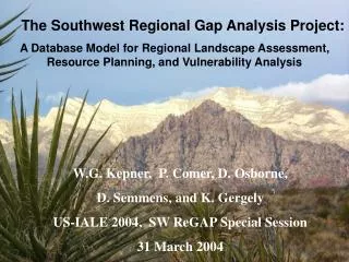
Regional Gap Analysis Program for Nevada, Utah, New Mexico, Colorado, and Arizona W.G. Kepner and D.F. Bradford 29 April 2004
What Is GAP? A “gap” is the lack of representation or under-representation of an element of biodiversity (plant community or animal species) in an area intended for its long term maintenance. Gap analysis is a process to keep common species common by plugging the gaps in our network of lands managed for biodiversity.
Project area: 530, 415 sq mi, 339,465,600 ac - 93% of the size of Alaska • BLM lands: 31% of area • USFS lands: 14% of area • State lands: 7% of area • Tribal lands: 9% of area
Gap Objectives • Map the distributions of natural communities using NVCS. • Map predicted habitat of native vertebrate species. • Map the degree of management for biodiversity maintenance focusing on intent. • Analyze the representation of biotic elements in the conservation network to identify “gaps” in long-term security. • Provide this information to the public and those entities charged with land use research, policy, planning, and management.
Southwest ReGap Product Development Digital Land Cover Map (5 states/NVCS) Digital Land Status Map (5 states) Digital Potential Habitat Maps (~833 Vertebrate species/5 states) Analyses for “Gaps” In Biodiversity Protection
Who is SWReGAP? State Project Principle Investigators and NatureServe Cooperator: AZ: Kathryn Thomas, USGS Colorado Plateau Field Station, Northern Arizona University, Flagstaff. CO: Don Schrupp, Colorado Division of Wildlife; Lee O’Brien, NREL, Colorado State University; Dianne Osborne, BLM-NSTC. NV: William Kepner and David Bradford, EPA – National Exposure Research Lab, Las Vegas. NM: Ken Boykin, USGS Cooperative Fish and Wildlife Research Unit, New Mexico State University, Las Cruces. UT: Doug Ramsey and John Lowry, Utah State University; Collin Homer, USGS EROS Data Center. NatureServe: Regional plant ecology coordination – Pat Comer and Keith Schulz
Products of GAP Digital products on CD-ROM and the Internet: • Land Cover GIS Coverage • Animal Habitat GIS Coverages • Stewardship/Ownership GIS Coverages • Analyses of “gaps” and general representation • Areas of species richness • Ancillary data used in modeling • A report of methods and results
Project Timeline 1998 First organizational workshops held. 1999 Planning workshop held and initial GAP funds distributed. Regional and State coordinators hired. 2000-1 Primary landsat imagery acquired along with field data. Regional animal habitat modeling methods established. Land cover mapping and animal habitat modeling work ongoing. 2002-3 Land cover mapping and animal modeling continues. Stewardship mapping begins in 2003. 2004 Land cover mapping and stewardship mapping will be complete in September 2004. 2005 Animal modeling will be complete in March 2005. Analysis completed, report written, and data published by fall 2005.
Model habitat of vertebrate species that reside, breed, or use habitat in the five-state region for a substantial portion of their life history. Vertebrate HabitatModeling and Mapping
Produce Regionally Consistent Maps Predicted distribution of mule deer habitat (Odocoileus hemionus) in the five SWReGAP States.
Animal Distribution Modeling Characteristics: • Map all terrestrial vertebrates (birds, mammals, reptiles, and amphibians) that breed or use habitat in the state for an important part of their life history. • Modeling utilizes, but is not constrained by known occurrence, also includes probable and possible occurrence to define range limits. • Requires active participation of vertebrate experts in determining geographic range, habitat relation models, and draft map review. • Does not include habitat quality or viability at this time.
Land Ownership Characteristics: • Maps categories of public land ownership and voluntarily provided private conservation lands. • Emphasizes managing entity over ownership. • Categorizes all land according to four levels of commitment to biodiversity maintenance. • Categorization based on expressed long-term intent rather than short-term actual practices. • Allows sublevels for states to include greater detail.
Stewardship GAP Management Categories: Status 1: Highest level of management intent for biodiversity, e.g., Research Natural Areas. Status 2: High level of intent but allows some use, e.g., Wilderness Areas that allow grazing. Status 3: Intent to preserve special features or endangered species in context of human use, i.e., public multiple use lands. Status 4: No known intent to maintain biodiversity.
Analyses: Animals Who are the land stewards and how well is the animal species protected? USFS: 53.0% BLM: 0.85% Protected: 7.3%
Conservation Lands Sage Grouse Distribution Sage Grouse Centrocercus urophasianus • Prefers large canopy sagebrush plants, open areas for leks, • Protection is currently <6% of its western range.
William Kepner kepner.william@epa.gov David Bradford bradford.david@epa.gov Todd Sajwaj tsajwaj@lmepo.com http://leopold.nmsu.edu/ fwscoop/swregap/default.htm