Restless Earth
580 likes | 906 Vues
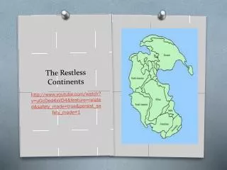
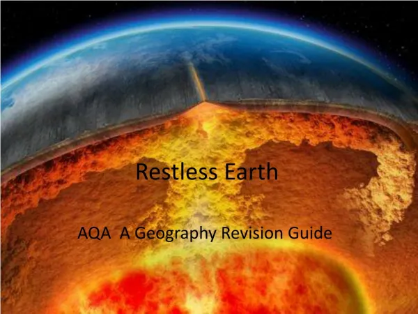
Restless Earth. AQA A Geography Revision Guide. The Structure of the Earth. Key Words: Crust Plates Plate Margins Mantle Convection currents. Major Plates forming the earth’s crust. Continental and Oceanic Plates. Plate Margins – what happens? Why does it happen? How does it happen?.

Restless Earth
E N D
Presentation Transcript
Restless Earth AQA A Geography Revision Guide
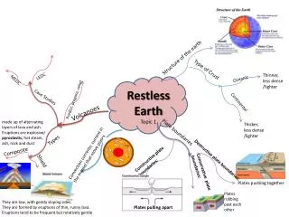
The Structure of the Earth • Key Words: • Crust • Plates • Plate Margins • Mantle • Convection currents
Plate Margins – what happens? Why does it happen? How does it happen? Destructive Plate Margin – Crust is destroyed! Constructive Plate Margin – Crust is made! Conservative Plate Margin – Crust is not destroyed or made – sliding!
Plate Margins • Key Words: • Collision • Subduction • Friction • Melting • Magma • Lava • Fault line Make sure that you can draw and label and explain the diagram below:
Fold Mountains – when plates move together... • CASE STUDY: THE ANDES MOUNTAINS Steep relief, poor soils! Definition: “Large mountain ranges where rock layers have been crumpled as they have been forced together”.
Andes Mountains – Facts you need to know... • Longest mountain range in world: 7000km in South America • Average height 4000m! • Caused by NAZCA and SOUTH AMERICAN PLATE colliding. How are they used? Farming, tourism, mining, energy from hydroelectric power.
How can we make use of fold mountains? • Farming – In Bolivia, many SUBSISTENCE farmers grow crops on steep slopes e.g. potatoes. They create flat land by digging in TERRACES into the side of the mountains. Terraces: Collect rainwater, stop soil erosion of thin soils. Rainfall runs off steep mountainside very quickly! Some cash crops are grown such as soybeans, rice and cotton. Idea: Make best use of the land! If the terraces were not there, soil would be washed down the mountain and so farmers would not be able to grow crops.
Andes Mountains – Facts you need to know... Mining • Excellent area for mining tin especially Peru. • Famous mine: Yanacocha gold mine. This is jointly owned by a US company and a company based in Peru. • POSITIVE: Mine brings jobs to Cajamarca (population has gone from 30,000 when the mine began to 240,000 in 2005). • NEGATIVE: Pressure on services e.g. shops, hospitals and causes higher crime rates. • NEGATIVE: Water sources contaminated by mining – water quality has gone down.
Andes Mountains – Facts you need to know... • Hydroelectric power – rivers dammed, water passed through turbines to create electricity. • Steep and narrow valleys can be easily dammed. • Melting snow in spring provides excellent water supply BUT there is high variation of water supply through then year – LOW in summer. • Famous Hydroelectric projects: Yuncan and El Platinal.
Andes Mountains – Facts you need to know... • Tourism! The Inca Trail and Machu Pichu. • Machu Pichu is a very famous UNESCO world heritage site. • Inca Trail South America’s best known trek! 45km trek at 4200m altitude! You can see Inca ruins, lush forest, mountain scenery. • Other attractions: mountain peaks, volcanoes, glaciers, lakes.
Ocean Trenches – when plates move together... Definition: “Deep sections of the ocean, usually where an oceanic plate is sinking below a continental plate”. Some of the deepest parts of the ocean!
Composite and Shield Volcanoes • COMPOSITE volcanoes occur at DESTRUCTIVE MARGINS. • SHIELD volcanoes occur at CONSTRUCTIVE MARGINS. Both types have craters, magma chambers. Can you label the crater, vent, magma chamber?
Volcanoes • An example of a natural hazard: an occurrence over which people have little control, which poses a threat to people’s lives and possessions. A natural event is different as a volcano could erupt in unpopulated areas without being a hazard! • The are found close to plate margins. The area around the Pacific Ocean known as the PACIFIC RING OF FIRE is especially prone to volcanic eruptions.
Shield Volcano Case Study • Name: Nyiragongo volcano, Congo • Cause: Movement of plates in East African Rift valley • Primary Effects – 60kph lava flow, lava flowed over runway closing Goma airport, lava split town of Goma in 2. Many homes destroyed, water pipes burst, fuel stores exploded, 45 people killed. • Secondary Effects – 500,000 people fled to Rwanda to escape the lava spending night on streets. No shelter, no clean water, no electricity. Disease such as cholera was a real risk due to the shear number of people. • One week of aid arrived. Residents returned to Goma only to find many houses had been looted (burgled) whilst they were away! • Responses: Water supplied by tankers, Aid agencies helped e.g. Christian Aid and Oxfam. Food, shelter, water distributed.
Composite Volcano Case Study • Name: Mount St. Helens, USA Dormant for many years. Steam filled with ash exploded into air and residents told to leave in March 1980. 8 km exclusion zone was introduced around the crater. ‘This is like standing next to dynamite, and the fuse it lit but you just cannot see how long the fuse is...’!
Mount St Helens • 8.32am 18th May, 1980. • Earthquake of 5.1 on the Richter Scale triggered a landslide on the NE side of the volcano! • The earthquake triggered the volcano to erupt. The rock, ash, glacier ice blasted out sideways killing all living things 27km north of the crater! • 57 people died. Spirit Lake fish and wildlife was destroyed!
Responses to Mount St Helens, 1980 • Immediate Responses: Helicopters used for search and rescue. Emergency treatment in nearby towns. Tourists rescued from mudflows. Attempts to unblock roads covered in metre deep ash (completed 3 days after the eruption). Millions of breathing masks sent to the area. • Long-term Responses: Farm land used as ash had made it more fertile. Buildings and bridges rebuilt. Forests re-planted. Roads rebuilt. Insects, birds, wildlife slowly returned to area 10 years later. • Now: very famous for tourists. Area designated as a national monument gaining $1.4 million investment. 3 million visitors allowed to access Mount St Helens each year. Johnston Ridge Observatory opened for tourists to view Mount St Helens. The trees felled by the eruption still cover a quarter of Spirit Lake but many are beginning to sink now!
Primary and Secondary Effects • Primary effects: the immediate effects of the eruption, caused directly by it. • Secondary effects: the after-effects that occur as an indirect effect of the eruption on a longer scale. Aid – money, food, training and technology given by richer countries to poorer ones, either to help with an emergency or to encourage long-term development.
Monitoring and Predicting Volcanoes • Frequency and strength can be recorded and historical records kept. • Volcanologists can monitor the records and look for patterns. • Tiltmeters can measure changes in slope angles • Surface temperatures can be monitored • Digital cameras can record if left in crater • Gases emitted can be measured • Robots called ‘spiders’ can monitor lava flows, ash movements
Supervolcanoes • Key words: supervolcano, caldera, fissure, geothermal, geyser, hot spot. • One example is Yellowstone National Park, USA • They release over 1000km cubed of material. • Do not look like volcanoes. • They are large depressions called CALDERAS. They often have rims of higher land.
Yellowstone – a worrying future!! • An eruption would destroy 10,000km squared of land, kill 87,000 people, 15 cm of ash would cover buildings within 1000km. Ash would affect transport, electricity, water and farming. • Magma beneath Yellowstone is shifting. The caldera is bulging beneath Lake Yellowstone! The ground has risen by up to 70cm! The magma chamber is believed to be 80km long and 40km wide and 8km deep! • Watch out! There have been eruptions 2 million years ago, 1.3 million years ago and 630,000 years ago! • Tourists love to visit Yellowstone National Park. They go a see Old Faithful – this is a Geyser. Google it! Check it out. Old Faithful releases pressure deep underground.
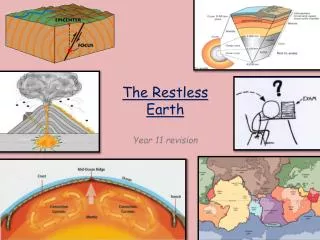
Earthquakes • Key words: earthquake, focus, epicentre, shock waves, aftershocks, Richter scale, Mercalli scale. Make sure you learn their meanings!
Measuring Earthquakes • We can measure earthquakes using the: • Richter scale (measurements created by seismographs)or 2) Mercalli scale (description of damage)
Earthquakes in LEDC’s and MEDC’s • What are the causes, effects and responses to earthquakes? How are they different in LEDC’s/MEDC’s? • The next slides give you 2 case studies for this!
Responses to Earthquakes: • KOBE: Emergency services searched through rubble. Hospitals did what they could, treating and operating in corridors!! Shops provided water and essentials free of charge. Railways were 80% operational within a month. After a year, the port was 80% operational. Buildings built to a 1981 code survived, buildings built in 1960’s collapsed. New buildings were built further apart so that they didn’t collapse onto each other in future. Rubber blocks were fitted under bridges to absorb shock. • SICHUAN: Some areas not reached within 30 hours of the quake. 20 helicopters were used for search and rescue. Troops parachuted in to help. Others hiked on foot. Army deployed – thousands of troops. Immediate needs were water, food, shelter. 3.3 million tents needed. China requested international help. Teams from Russia and Japan arrived. Cash donations were welcomed. Red Cross raised £100 million in the 2 weeks after the quake. 1,000,000 small homes were built. Medicine, shelter, food, water distributed. $10 million rebuilding fund set up. Banks wrote off debts owed by survivors who did not have insurance.
The 3 P’s These provide the key to REDUCING THE IMPACT of earthquakes. Prediction – forecast when and where tremors will happen based on current knowledge – this is VERY difficult to do. Protection – building using appropriate standards and designs so that they are safe to be in. Preparation – ensure that hospitals, emergency services and residents practise having disasters. Organising activities and drills.
Earthquake proof buildings... • Steel frames can sway during movement • Specialised flexible glass • Deep foundations • Rubber shock absorbers • Roads to allow quick evacuation • Fire-resistant materials • Open areas to evacuate to.
Tsunamis • Triggered by earthquakes • Primary effect – shifting of plates • Secondary effect – displacement of ocean water • 200km from crest to crest whereas normal waves are as follows:
Tsunamis • “A special type of wave where the entire depth of the sea or ocean is set in motion by an event, often an earthquake, which displaces water above it and creates a huge wave”. • Move at speeds of up to 800km per hour.
Japan Earthquake 2011 Facts to learn: • Date 9th March, 2011 • Earthquake was magnitude 8.9 on the Richter scale – largest on record! • Earthquake struck about 250 miles (400km) from the capital Tokyo and at a depth of 20 miles. • Plates – Pacific plate subducting underneath Eurasian plate near Honshu • The earthquake caused major damage in Tokyo but triggered a tsunami which devastated the Sendai region. • A 30 foot wall of water hit the coast in places. • Over 2400 killed with the number still rising. • Thousands of homes and business destroyed. • The city of Sendai is a scene of widespread devastation.
Japan Earthquake, 2011 Locating it! Plate Tectonics! It struck about 250 miles (400km) from the capital at a depth of 20 miles. There have been powerful aftershocks. The PACIFIC PLATE COLLIDED WITH THE EURASIAN PLATE.
Effects – Short Term Kyodo news agency said a 10-metre wave (33ft) struck the port of Sendai in Miyagi Japanese television showed cars, ships and even buildings being swept away by a vast wall of water after the 8.9-magnitude earthquake. The quake has sparked fires in several areas including Tokyo, with at least 15 people reported dead.
Effects – Short Term In central Tokyo, Jeffrey Balanag said he was stuck in his office in the Shiodome Sumitomo building because the elevators had stopped working.
Effects – Short Term Kyodo said at least 15 people had been killed in the earthquake and tsunami. It was believed the death toll could rise significantly.
Effects – Short Term Emergency response headquarters have been set up.
Effects – Short Term The earthquake also triggered a number of fires, including one at an oil refinery in Ichihara city in Chiba prefecture near Tokyo, engulfing storage tanks.
Effects – Short Term 20 people injured in Tokyo after the roof of a hall collapsed
Effects – Short Term Residents and workers in Tokyo rushed out of apartment buildings and office blocks and gathered in parks and open spaces as aftershocks continued to hit.
Effects – Short Term Bullet train services to northern Japan were halted, rapid transit in Tokyo was suspended
This man was found floating on the roof of his house 10 miles out to sea. He had been there for 2 days.