Emily Mitchell Ayers, Ph.D.
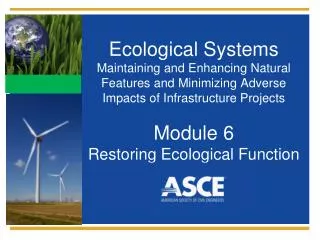
Ecological Systems Maintaining and Enhancing Natural Features and Minimizing Adverse Impacts of Infrastructure Projects Module 4 Protecting Habitat. Emily Mitchell Ayers, Ph.D. The Low Impact Development Center, Inc. emayers@lowimpactdevelopment.org. Learning Outcomes.

Emily Mitchell Ayers, Ph.D.
E N D
Presentation Transcript
Ecological SystemsMaintaining and Enhancing Natural Features and Minimizing Adverse Impacts of Infrastructure ProjectsModule 4Protecting Habitat
Emily Mitchell Ayers, Ph.D. The Low Impact Development Center, Inc. emayers@lowimpactdevelopment.org
Learning Outcomes • Understand the importance of ecological site assessment • Learn to prioritize areas for conservation • Learn techniques for incorporating conservation into infrastructure projects
The Envision™ Rating System • New system to rate infrastructure sustainability • Requires designers to consider environmental impacts of full project life cycle and work to reduce footprints • Encourages incorporating conservation and restoration into infrastructure projects
Levels of Achievement • Improved: Limited improvement in sustainable performance • Enhanced: Moderate improvement in sustainable performance • Superior: Sustainable performance that is noteworthy, but falls slightly short of sustainable. • Conserving: Performance that has achieved essentially zero negative impact. • Restorative: Performance that restores natural or social systems.
Envision™ credits • NW1.1 Preserve Prime Habitat • NW2.2 Reduce Pesticides and Fertilizer Impacts • NW3.1 Preserve Species Biodiversity • NW3.2 Control Invasive Species • NW3.3 Restore Disturbed Soils • NW3.4 Maintain Wetland and Surface Water Functions • CR2.5 Manage Heat Island Effects
Ecologically-sensitive design process • Know where you are • Avoid sensitive areas • Minimize infrastructure impacts • Mitigate unavoidable losses • Improve ecological function where possible
Site assessment • Conducting a site assessment is the first step in creating an ecologically-sensitive site design • A site assessment will tell you • How the site fits into larger local and regional ecosystems • Locations of ecologically-important areas (wetlands, floodplains, corridors, habitat for rare or endangered species, habitat areas in excellent condition, old growth forest)
Site assessment • Start by analyzing GIS maps • Identify existing habitats • Site features • Soils • Known locations of threatened and endangered species • Existing and historic land use (this will give clues as to likely conditions – soil compaction, potential contamination)
Site assessment • Consult with local experts to identify: • Locally important habitat, communities, and species • Historic vegetation patterns • Conduct field sampling • Survey targeted species • Estimate population size • Map habitat • Assess existing habitat quality (intact, degraded)
Field sampling • Document habitat features • Survey targeted species • Estimate population size • Map habitat • Assess existing habitat quality (intact, degraded)
Ecologically-sensitive design process • Know where you are • Avoid sensitive areas • Minimize infrastructure impacts • Mitigate unavoidable losses • Improve ecological function where possible
How to prioritize areas for conservation • Focus on the population and community levels • Viable, intact communities • Vulnerable, rare, or sensitive communities • Endemic communities (locally unique) • Communities occurring in association with unusual land features (e.g. serpentine soils)
Species types to target for conservation • Keystone • Vulnerable • Rare • Endemic • Specialist (dependent on particular plant or habitat resources) • Migratory
Identifying keystone species • Keystone species play central roles in critical ecological processes. Elimination can cause cascading effects, including the loss of other species • Examples: • Beavers • Large trees Wikimedia commons
Important habitat resourcesShelter • Tree snags • Rock outcrops • Caves Walter Siegmund
Important habitat resourcesEcotones – transition zones • Provides benefits of both ecosystems • Animals can feed in one habitat and shelter in another • Tend to have very abundant wildlife NPS
NW1.1 Preserve Prime Habitat • 9 points: avoid developing prime habitat • 14 points: establish a 300 ft buffer zone around prime habitat • 18 points: restore prime habitat and improve connectivity
NW1.1 Preserve Prime Habitat (cont’d) • Prime habitat should be designated by a third party (Sustainable Forestry Initiative, Forest Stewardship Council, Canadian Standards Association) • Examples: old growth forest, land that is home to species of high value, wetlands(separate credit), wildlife corridors
NW1.1 Preserve Prime Habitat (cont’d) • Requires consideration of prime habitat locations as part of the site selection process • Projects may need to be relocated to avoid prime habitat areas • In addition, wildlife movement must be considered and incorporated into site designs
NW3.1 Preserve Species Biodiversity • 2 points: Identify and protect habitat • 13 points: Improve habitat • 16 points: Restore and create habitat
NW3.1 Preserve Species Biodiversity (cont’d) • Identify four focal species • Representing a range of animal classes (mammals, birds, reptiles, etc.) • In decline, threatened, or endangered • Susceptible to threats associated with development • Sufficiently well-studied to evaluate habitat preferences and susceptibility to disturbances • Representative, with habitat preferences similar to other species
NW3.1 Preserve Species Biodiversity (cont’d) • Work with state and local agencies to identify existing and historical habitats for selected focal species in and near the project site • Improve connectivity between habitats • Reinstate appropriate vegetation
NW3.1 Preserve Species Biodiversity (cont’d) • Requires incorporating locations of existing and historical habitats into the site selection process • Consider wildlife movement in placement and design of roads, culverts, etc. • Work with local experts to incorporate habitat improvement and/or restoration into site design.
Previously disturbed land • abandoned agricultural fields • vacant lots • brownfields Google Earth
Previously fragmented, isolated areas Google Earth
Communities that have been highly infiltrated by exotic species FWS
Areas away from wetlands and floodplains Google Earth
On the edges of large, intact communities Google Earth
Populations • Focus on maintaining at least the minimum viable population of a targeted species – consult with an expert to determine a specific number • Preserve corridors to permit dispersal and migration
How large does a conservation area need to be? • Size depends on the target species and the ecosystem under consideration • In general, the larger the species, the larger the area needed
Maintaining connectivity • Connectivity is needed for • Animals with large home ranges (e.g. mountain lions) • Migration • Dispersal • Protect existing corridors, such as riparian areas
Barriers to movement • Roads • Changes in vegetation • Fences • Dams • Culverts • Noise • Light
Wildlife Crossings • Roads are some of the greatest barriers to wildlife movements • Wildlife crossings are usually tailored to the needs and habits of a particular target species • Usually underpasses, though some are overpasses
Design considerations • Siting where animals cross road • Keep underpasses high and wide, so that animals can see to the other side • Use fencing along road to funnel wildlife to crossing
Discussion Questions What are the tradeoffs between developing in a pristine area and filling in the last vestiges of nature in an urban area?
Review • Ecologically-sensitive design begins with a thorough site assessment • Identify and conserve the most important habitat areas • Focus development on previously disturbed land wherever possible • Maintain and improve connectivity to promote wildlife movement
Recommended Resources • NCHRP. Wildlife and Roads: A Resource to Help Mitigate Roads for Wildlife. http://www.wildlifeandroads.org/ • Peck, S., 1998. Planning for Biodiversity: Issues and Examples. Island Press, Washington DC.