Download
1 / 26
260 likes | 410 Vues
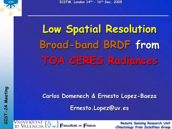
Low Spatial Resolution Broad-band BRDF from TOA CERES Radiances Carlos Domenech & Ernesto Lopez-Baeza Ernesto.Lopez@uv.es. Contents. Motivation Objectives Methodology Results Conclusions Forthcoming Work.

E N D
Low Spatial Resolution Broad-band BRDFfromTOA CERES Radiances Carlos Domenech & Ernesto Lopez-Baeza Ernesto.Lopez@uv.es
Contents Motivation Objectives Methodology Results Conclusions Forthcoming Work
This study is carried out in the context of the ESA-ESTEC Project on Improvement of Angular Dependence Modelsin the framework of the EarthCARE (Earth Clouds, Aerosol and Radiation Explorer)Mission. The objective of the Project is to optimize the radiance-to-flux inversion processes for the EarthCARE BBR (Broad-band Radiometer) by means of the construction of suitable ADMs developed from the 3 specific along-track BBR views (-55º, 0º, +55º). The study was defined in an ambitious way considering cloud 3D effects, surface BRDF influence, etc Motivation
Motivation • Project components: • ADM Scene definition • Database generationof real satellite TOA radiances • CERES • GERB • MISR • Database generation of simulated BBR TOA radiances • EarthCARE Simulator • SHDOM • 1-D • 3-D • Construction of the ADMfor each scene
Construction of a data base of representative TOA radiances EarthCARE End-to-End Simulator Code in continuous revision and improvement One of the points to be improved is the treatment ofanisotropic surfaces Motivation Need for simulations from a reliable 3D radiative transfer code Insufficient experimental satellite data
Implement a new BRDF in the EarthCARE Simulator, for the SARB/IGBP defined surface types, from broad-band radiances (short wave) and low spatial resolution, Proceeding from an instrument of similar characteristics to those of the forthcoming BBR. Objectives →RPV model parameters
X X X 19 – Fresh snow Objectives SARB/IGBP scene classification
Analysis of available satellite data Downloading and filtering of data Data base construction Algorithm for (quasi)-random selection of surfaces →obtaining a BRDF with no regional constraints Coupled algorithm for atmospheric correction – RPV model inversion → correction of model parameters Obtaining a general BRDF for each surface type by using statistical methods Methodology. Work Structure
Spatial and spectral resolution comparable to the future BBR pixels wide extent of angular conditions → obtaining the BRDF Simultaneous atmosphere/surface/radiance information → atmospheric correction Methodology. Requirements for data selection
Methodology. Data selection • Data selection • CERES SSF Terra-FM2-MODIS ed. 2A data for 2003 • Broad-band and large footprint • CERES RAPS scanning mode • provides optimum wide extent of angular conditions • MODIS information on the atmospheric conditions • SARB information on the surface conditions • FM2 operated in RAPS mode over all 2003 http://asd-www.larc.nasa.gov/Inversion/
Selective downloading of hourly HDF4 data from the Langley Atmospheric Sciences Data Center (ASDC) Selected parameters: Unfiltered CERES SW (CERES FM2) radiances Date and location (CERES FM2) Angular geometry (CERES FM2) Atmospheric information (MODIS) Aerosol type and concentration (MODIS) Surface maps (CERES/SARB surface map ) Methodology. Data downloading
SSF CERES database construction Filters applied: Cloud mask → Clear-sky scenes Water & ice mask → Land surfaces Non-homogeneous scene mask → Homogeneous scenes Night mask → Diurnal data High VZA mask → Off-limb radiance observations Wrong flag mask → Data with a valid quality control control Aerosol mask → Physically possible aerosols Monthly grouping of the SARB classified surfaces Methodology. SSF CERES database construction
Obtaining a BRDF independent, as much as possible, from regional conditions. Only a function of the SARB/IGBP surface type classification Look for radiances from the database to be inverted: Random selection of regions for each surface type and for each month Search criteria according to number of radiances and distance between coordinates Methodology. Quasi-random selection of zones Algorithm for quasi-random selection of zones
Methodology. IGBP types Surface Type 02 / January
Method that couples atmospheric correction and inversion of the surface reflective properties Methodology. Coupled algorithm atmospheric correction-RPV model inversion Coupled algorithmatmospheric correction-RPV model inversion Corrected surface reflectance Estimate atmosphere effect Anisotropic characteristics of the reflecting surface Radiative transfer code Atmosphere and surface are coupled
CERES TOA Radiances Lambertian correction RPV model inversion for Lambertian reflectances Directional correction RPV model inversion for corrected reflectances Convergence of RPV model parameters with previous iteration? RPV parameters atmospherically corrected Methodology. Atmospheric correction 6S RTC in atmospheric correction mode • Surface reflectances 6S RTC in direct mode • Atmospheric reflectance parameters • Atmospheric transmittance parameters (scattering) • Atmospheric transmittance parameters (absorption) • Coupling terms No Yes
Methodology. RPV model inversion The Rahman Pinty Verstraete (RPV) model is a semi-empirical BRF (bidirectional reflectance factor) model, with multiplying terms and non linear in its parameters Minnaert term Henyey-Greenstein function Hotspot term
Methodology. Inversion methods • Inversion methods to obtain the free parameters (k, Θ, ρ0,ρc) • Levenberg-marquardt Method • Powel hybrid Method • Depending on the initial conditions. The principle of energy conservation does not hold • Method that finds the grouping of possible solutions with minimizing conditions Results There exists more than a possible solution
Methodology. Inversion methods • Method from ‘A new inversion scheme for the RPV model’ (Nadine Gobron and Dulce Lajas, Can. J. Remote Sensing, Vol. 28, No. 2, pp. 156-167, 2002) • The RPV model parameters may be estimated if • where,
Results Output of the coupling algorithm: corrected independent RPV model parameters IGBP/SARB surface type 01
Results PRINCIPAL PLANE Month 02 / Surface type 07 / Region 1
Results DIRECTIONAL ANALYSIS in the Principal Plane
Conclusions PROBLEM: The results obtained so far show a large scattering for regions of the same surface type (SARB/IGBP classification) CAUSE: This may be due, largely, to the surface classification used. The SARB/IGBP definition does not provide sufficient information to solve the problem SOLUTION: Sub-classification according to NDVI within each biotype defined by SARB/IGBP
Forthcoming Work • Classification by hemispheres • Classification by NDVI • Radiance filtering (for high illumination zenith angles • Sensitivity study of BRDF according to the SARB/IGBP surface types • Comparison with POLDER resultados • Obtaining BRDFs SARB/IGBP biotypes and NDVI intervals