High School Outreach
160 likes | 289 Vues
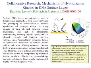
This document outlines the initiatives by San Diego State University to integrate Web-based Geographic Information Systems (GIS) into high school education through collaboration with three major high schools in San Diego. The focus is on the implementation of GIS courses at Helix Charter High School, High Tech High, and Hoover High School, emphasizing the adoption of web-based learning modules and their effectiveness in educating students in human geography. The goal is to evaluate the impact of this technology on learning outcomes and provide resources for teachers.

High School Outreach
E N D
Presentation Transcript
San Diego State University National Visiting Committee Meeting 2006 March 30, 2006, San Diego High School Outreach Ming-Hsiang (Ming) Tsou, Ph.D. Department of Geography, SDSU E-mail: mtsou@mail.sdsu.edu Tony Howser Department of Geography San Diego State University
Three Major High Schools in San Diego • Helix Charter High School: Teachers: • Paula Ann Trevino (social studies), M.Ed, Social Studies Department Chair, (patrevi@helixcharter.net) • Garry Wilcox (social studies) gwilcox@helixcharter.net • High Tech High: Teachers: • Dr. Jay Vavra (bio) <jvavra@hightechhigh.org> • Rod Buenviaje (math) rbuenviaje@hightechhigh.org • Tom Fehrenbacher (humanities) <tfehrenbacher@hightechhigh.org> • Hoover High: Teacher: • Ellen Towers, Academy Coordinator/Teacher (etowers@sandi.net)
Helix High School Outreach • 2005 GIS Day Visit (120 students). • 2006 March Visit (120 students). • 2005 - 2006: Develop Web-based Learning modules for Human Geography Course -- Evaluate how effective the Web-based learning modules for aiding Geography Education. • 2006: Fall Semester, the First GIS course (GIS 1c/2c) at Helix High. (need more training and resource for this new course.
San Diego State University Master Thesis (Chen) Title: Implementation and Effectiveness of Web-based Geographical Information System (GIS) in High School EducationThis research seeks to investigate the feasibility of Web-based geographic information system (GIS) adoption in high school education. Educators encounter many challenges while applying the standard desktop GIS. Web-based GIS is viewed as an alternative to overcome the barriers to the diffusion of GIS in education, including difficulties in maintaining hardware equipment, time limitations in learning software and developing teaching materials. The goal of this research is to address how effectively Web-based GIS could be used to assist high school education. Testing 120 students and compare the Web-GIS learning outcome (scores) to previous year (non-WebGIS) In the same human geography course.
San Diego State University GIS 1c/2c (High School) Helix High (Charter School in California) will start the first high school-level GIS course in Fall 2006 Semester -- GIS 1C/2C • Term 1 (Fall) • Unit 1 – Introduction to GIS • Unit 2 – Web Based GIS • Unit 3 – Basics GIS using ArcExplorer Java Edition • Mapping Our World lessons • Term 2 (Spring) • Unit 4 – Teacher Directed GIS unit • Unit 5 – Data collection and analysis • Unit 6 – Student Created/Driven GIS Capstone Course Project
High Tech High School Outreach • 2005 GIS Day Talks in HTH (four classes, at HTH, over 100 students). • Web-based Mapping Tools for Biology course • Web-based Mapping Tools for Scientific project (Soil Map). • GIS books and flyers. • San Diego Bay Field Guide Project: Book Title: Perspectives of San Diego Bay: A Field Guide • (Tony Howser help them to create GIS maps and technology introduction
Hoover High School Outreach • 2005 Visit (on-site). • GIS books and flyers. • 2006 Visit (on-site). • Web-based Mapping Tools: Obesity and Fast Food (Overweight Students) • Google Earth Learning Module Development (underdevelopment now).
High School Teacher Training Workshop ? (Summer 2006 ?).Or High School Principles/Department Chair workshop?
San Diego State University Multimedia Web GIS(Google Earth Movies) Movie created by video editing software – adding titles, effects, sounds, and music.