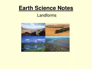
Earth Notes
Earth Notes. Chapter 2 ~ Section 2. Forces of Change. The Earth’s Interior. Inner Core – about 4,000 miles below the surface of the Earth Outer Core – 1,400 miles thick, temperature reaches 8500 °F. Earth’s Interior (con’t). Mantle : layer of hot, dense rock – MAGMA.

Earth Notes
E N D
Presentation Transcript
Earth Notes Chapter 2 ~ Section 2 Forces of Change
The Earth’s Interior Inner Core – about 4,000 miles below the surface of the Earth Outer Core – 1,400 miles thick, temperature reaches 8500°F
Earth’s Interior (con’t) • Mantle: layer of hot, dense rock – MAGMA
Earth’s Interior (con’t) • Crust: rocky shell forming Earth’s surface. • The crust is broken into slabs of rock called plates. • Natural forces interact with the crust, creating landforms on the surface of the earth. • Below the oceans, the crust is about 5 miles thick. Below the continents it averages 22 miles in thickness.
Earth’s Interior (con’t) • Plates - float on a melted layer in the upper mantle - carry the earth’s oceans and continents
The Plate Tectonic Theory • The lithosphere — the earth’s crust and upper layer of the mantle — is broken into a number of large, moving plates.
The Plate Tectonic Theory • The plates slide very slowly over a hot, pliable layer of mantle. • The earth’s oceans and continents ride atop of the plates. • It’s along the plate boundaries that most earthquakes and volcanoes occur due to friction and pressure that produces heat.
Plate Movement Plate movement: creates oceans and mountain ranges
Plate Movement • Continental Drift: the theory that the continents were once joined and then slowly drifted apart
Plate Movement Pangaea: gigantic super continent which eventually broke apart
Observe an animation of the breakup of Pangaea • http://www.classzone.com/books/earth_science/terc/content/visualizations/es0806/es0806page01.cfm?chapter_no=visualization
Examine an animation of plate movement predicted for the future • http://www.classzone.com/books/earth_science/terc/content/visualizations/es0807/es0807page01.cfm?chapter_no=visualization
Ring of Fire • A circle of volcanic mountains surrounding the Pacific Ocean • It is one of the most earthquake-prone & volcano-prone areas on the planet. • Hot Spots are hot regions deep within the mantle that produce magma, which rises to the surface. Volcanic island chains form as oceanic plates drift over the hot spot. • Example: Hawaiian Islands • http://www.classzone.com/books/earth_science/terc/content/visualizations/es0904/es0904page01.cfm?chapter_no=visualization
Volcanoes • Form when magma inside the earth breaks through the crust. Lava flows and may produce a large, cone-shaped mountain • They often form along plate boundaries • Magma splits the earth’s surface when plates collide
Fault—a break in the earth’s crust. Movement along a fault can send out shock waves, causing an earthquake.
A devastating fire followed the 1906 earthquake in San Francisco
The San Fernando earthquake of 1971 collapsed freeway overpasses in southern California
Converging/Collision Zone • Plates collide and push slowly against each other and form a collision or converging zone. • If 2 oceanic plates collide, 1 slides under the other. Islands often form this way. • If 2 continental plates collide, mountains are formed. Example: Himalayas
Spreading Zone Plates pull away from each other and form a spreading zone. These areas are likely to have earthquakes, volcanoes, and rift valleys (a large split along the crest of a mountain). http://www.classzone.com/books/earth_science/terc/content/visualizations/es0804/es0804page01.cfm?chapter_no=visualization
Subduction They meet, or CONVERGE and form a subduction zone. *If an oceanic plate collides with a continental plate, the heavier oceanic plate will slide under the lighter, continental plate. This results in volcanic mountain building and earthquakes.
External Forces • What other forces can create landforms? • Weathering – a process that breaks down rock at or near the surface into smaller pieces. - This is a VERY slow process – thousands to millions of years. • Mechanical (or Physical) Weatheringoccurs when rock freezes – it can cause Frost Wedging, a crack in the rock caused by freezing.
Chemical Weathering– alters the rock’s chemical makeup by changing the minerals. This can actually change one kind of rock into another. • Important forces in Chemical Weathering are moisture and carbon dioxide. • Through this process caves are created. • Acid Rain causes another type of chemical weathering that destroys forests, pollutes water and kills wildlife.
Over thousands of years, areas with limestone rocks can develop caves. • Groundwater dissolves a network of tunnels in the rock. If the water table is lowered by a change in climate or tectonic uplift of the area, groundwater drains out of the tunnels, leaving the caverns exposed to air. http://www.classzone.com/books/earth_science/terc/content/visualizations/es1405/es1405page01.cfm?chapter_no=visualization
EROSION • Erosion is the movement of weathered materials including gravel, soil and sand. • The most common agents of erosion are water, wind and glaciers.
WATER AND EROSION • Moving Water (rain, rivers, streams and oceans) is the greatest agent of erosion. • Sediment – small particles of soil, sand, and gravel - is carried by the moving water and works like sandpaper to grind away rocks.
ErosionSullivan Falls Rickett’s Glen State Park Pennsylvania
Sediment • Sediment from the River Rhône flowing into Lake Geneva.
Sediment • http://www.classzone.com/books/earth_science/terc/content/visualizations/es0604/es0604page01.cfm?chapter_no=visualization
Floodplains Sediment creates new landforms such as floodplains & deltas. Deltas form at the mouth of a river
Wind Erosion • The second major cause of erosion is wind, especially where there is little water and few plants. • Wind Erosion can devastate one area while benefiting another – HOW? • Loess – windblown deposits of mineral-rich dust