Download
1 / 18
180 likes | 318 Vues
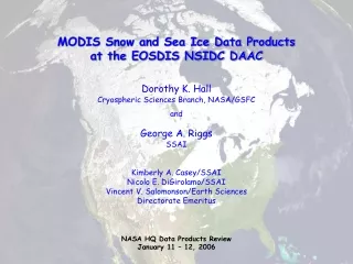
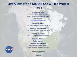
Overview of the MODIS Snow - Ice Project Part 1. Dorothy K. Hall Cryospheric Sciences Branch NASA / Goddard Space Flight Center Greenbelt, Md. dorothy.k.hall@nasa.gov

E N D
Overview of the MODIS Snow - Ice Project Part 1 Dorothy K. Hall CryosphericSciences Branch NASA / Goddard Space Flight Center Greenbelt, Md. dorothy.k.hall@nasa.gov George A. RiggsSSAI and Cryospheric Sciences Branch Nicolo E. DiGirolamoSSAI and Cryospheric Sciences Branch Jeffrey A. Miller Wyle & Cryospheric Sciences Branch James L. Foster Sujay Kumar SoniYatheendradasHydrological Sciences Branch NASA / Goddard Space Flight Center MODIS Science Team Meeting Land Team College Park, Md. 18 May 2011
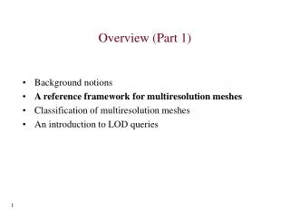
Outline Product Usage Three New & Related Products Re-Launched Website [modis-snow-ice.gsfc.nasa.gov] Science Results Collection 6 (C6) Changes – Part 2 - George Riggs
4,500,000 Terra & Aqua Snow-Sea Ice Granules Distributed in 2010 Number of Granules Source: Doug Fowler / NSIDC Also see Bibliography of MODIS Snow and Sea Ice Papers, updated 5-9-11 – see “Publications” on Website
Snow by both sensors Snow by AMSR-E, MODIS cloud or no data Snow by MODIS, AMSR-E no snow No snow by MODIS or AMSR-E but cloud obscured No snow: no snow by MODIS in clear view, but AMSR-E detects snow Snow free land by both MODIS and AMSR-E Three New Products Have Been Developed Daily Cloud-Gap-Filled Snow Map 1 Daily Blended MODIS-AMSR-E Snow Map (funded mostly by the Air Force Weather Agency) 2 Hall et al., 2010 Foster et al., 2011
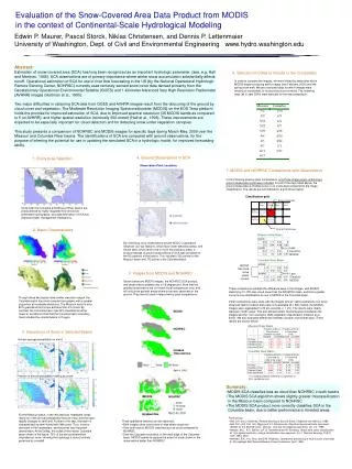
Mean-Monthly IST of the Greenland Ice Sheet for 2010 3 MODIS Climate-Data Record (CDR) of the Surface Temperature of the Greenland Ice Sheet , 2000 - 2010 • Uses MODIS ice-surface temperature (IST) algorithm currently used for sea ice IST algorithm • CDR to be available for downloading in summer 2011 • Related product developed with NASA Cryospheric Sciences Program funding
Science and Modeling Applications Snow-cover depletion curves for the Wind River Range, Wyo., 2000 – 2010 from MODIS CGF snow-cover data MOD10 and CGF snow-cover products used to correct modeled SWE and snow depth fields in data-assimilation modeling Percent of Basin Snow Covered Model runs by Sujay Kumar / GSFC Code 614.3 Day of Year Hall et al., 2011
Overview of the MODIS Snow - Ice Project Snow Algorithms and Products for C6 Part II George Riggs MODIS Science Team Meeting 18 – 20 May 2011 College Park, MD
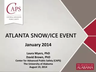
Overview C6 changes, are response to users’ feed back regarding accuracy and errors reported for various applications of the MODIS snow products , and our evaluation of MODIS snow products. Revised C6 snow algorithms Adapt to the L2G lite storage format New C6 snow products Two groups affected by C6 changes production -- down stream products that use MOD10* products, new products, and NSIDC EOS-DAAC users – applications using primarily MOD10A1 and higher levels
Learned from Users • Usage: [listing of papers that use MODIS snow products at modis-snow-ice.gsfc.nasa.gov/] • MOD10A1 is most often used in applications, MOD10CMG for global scale modeling, e.g. Noah land surface model • Though both the snow covered area (SCA) and fractional snow cover (FSC)maps available, the SCA is most often used • QA data used infrequently • Comparison: • MOD10A1 compared to other snow covered area algorithms/products and surface station data • Snow errors: • Snow/cloud confusion at snow cover edge • Snow/cloud confusion in other situations associated with cloud cover, producing snow commission or omission errors • Snow errors in less than ideal viewing conditions • Disappearance of snow cover during summer in mountains
Summary Major C6 Revisions • Sequence of snow products will continue in C6 • MOD10_L2 snow algorithm C6 revised to improve snow cover detection • MOD10A1 algorithm revised to use L2G lite format • MOD10SR – new independent product to be made using MOD09GA input • Supersede the MOD10A1 • MOD10 CGF – new L3 cloud gap filled (CGF) products added to sequence of products
Investigation & Evaluation relevant to users’ feedback • Investigated using more data/information from inputs to reduce snow errors of omission and commission in some situations • Evaluated using MOD09GA as input to the snow algorithm and running it at L3 • Using MOD09GA, daily surface reflectance, resulted in similar SCA and FSC maps compared to MOD10A1 that originated from MOD02HKM TOA input. • Improvements gained with MOD09GA are; decreased snow/cloud confusion in some situations, done by use of both MOD35 and MOD09 cloud flags (snow/cloud confusion might also be decreased at L2 by use of individual cloud spectral test results, previous investigation done) decrease in snow commission errors associated with cloud fringes and/or shadows slightly increased accuracy in low illumination and low surface reflectance situations. • Disappearance of summer snow in mountains is caused by low (10%) visible reflectance screen that prevented snow detection. Removing that screen allows detection of summer snow cover in mountains.
Great Plains snow edge mapping 1 December 2001 tile h10v04 MOD10A1 SCA MOD10A1FSC MOD09GA bands 1,4,6 MOD10SR FSC MOD10SR SCA MOD10SR -- combined usage of MOD_35 and MOD09 flags to alleviate snow/cloud confusion at edge of snow cover in MOD10A1 snow maps
MOD10SR C6 MOD10A1 C5 Improved snow detection using MOD09GA input to MOD10SR Snow cover underestimation using SCA (binary) has been reported, for example Molotch, N.P. and Margulis S.A. 2010. Response to comment by… Advances in Water Resources 33:231-239, doi:10.1016/j.advwatres.2009.11.008 MOD10A1.A2002126.h09v05 (6 May) Rio Grande headwaters Improved snow detection with MOD10SR SCA SCA FSC FSC
MOD09GA.2010187.h08v05 July 6, 2010 MOD10SR C6 No low visible reflectance screen MOD10A1 C5 With low visible reflectance screen SCA FSC LEGEND SNOW LAND CLOUD INLAND WATER OCEAN NO DATA Disappearance of summer snow in mountains is caused by low (10%) visible reflectance screen that prevented snow detection. Removing that screen allows detection of summer snow cover in mountains. (Caveat, snow commission errors can be made on unmasked water bodies without that screen. Other screens for water bodies implemented; being tested.)
New Daily Snow Product MOD10SR C6 • Revised implementation of the MODIS snow algorithm in response to user feedback on use of the MOD10A1 product • The snow algorithm will be run at L3 in processing sequence but will use MOD09GA input. • SCA algorithm and FSC regression equation are not changed. Low visible reflectance screen dropped, replaced by other screen(s) • Use MOD35 and MOD09 cloud flags for cloud/masking and apply more snow/cloud discrimination screens • FSC will be the first SDS in the product • Supersede M0D10A1 because of improved snow maps, SCA and FSC, for users. • Independent of any other MOD10* products in sequence • New ESDT, MOD10SR, is independent of other MOD10* PGEs and ESDTs Will require a new PGE in MODAPS and ESDT at NSIDC EOS-DAAC
L2G LITE storage affect on MOD10A1 Change in observation selection technique L2G lite selection algorithm essentially the same as MOD10A1 but with added criterion for clear over cloud observation. Differences can occur in orbit overlap region. MOD10L2G lite science test pending. Change MOD10A1 C6 to use only the first layer in MOD10L2G lite. Eliminates an algorithm step and may decrease cloud cover in regions of orbit overlap. MOD09GA lite storage used in this analysis; 1 Dec 2001, tile h10v04, covering Great Plains. MOD10A1 C5 FSC MOD10L2G C5 FSC First layer MOD09GA ORBIT POINTER First layer MOD10SR C6 FSC First layer
The land/water mask exhibits day to day changes in L3 products Noted by users and NSIDC in MOD10A1 Land/water mask subset extracted from MOD09GA tile h09v05 2006 106 2006 107 2006 108 Land/water mask is static but mapping through product levels causes day to day changes in location of a lake (blue) or boundary (black) in a tile. Pixel mapping error through product levels affects applications and analysis done by users.
Summary Major C6 Revisions • Sequence of snow products will continue in C6 • MOD10_L2 snow algorithm C6 revised to improve snow cover detection • MOD10A1 algorithm revised to use L2G lite format • MOD10SR – new independent product to be made using MOD09GA input • Supersede the MOD10A1 • MOD10 CGF – new L3 products added to sequence of products