Mobile GIS with Collector
110 likes | 289 Vues
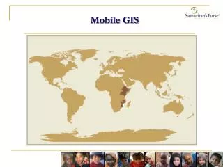
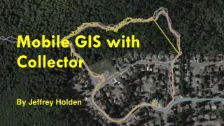
Mobile GIS with Collector. By Jeffrey Holden. Do you collect Locations ?. Trails and Routes Roads Timber Harvest Polygons Sample Points Weed Restoration Areas. What is collector ?. ESRI app for collection of field data on Mobile devices Data is stored on ArcGIS Online. You will need.

Mobile GIS with Collector
E N D
Presentation Transcript
Mobile GIS with Collector By Jeffrey Holden
Do you collect Locations? Trails and Routes Roads Timber Harvest Polygons Sample Points Weed Restoration Areas
What is collector? ESRI app for collection of field data on Mobile devices Data is stored on ArcGIS Online
You will need • ArcGIS Online Account Mobile device or many • Caching after March • Internet Connection
Accuracy • Accuracy within 20 feet • As good or better than currently used Garmin or Trimble devices • Best in open • Good in forest
Demo Collect Field Data Digitize a point Stream a line Stream around a polygon Edit attributes on the map
Setup Geodatabase in ArcCatalog Create geodatabase with the features, domains and pick lists.
In ArcMap Symbolize layers Set visible scales Add descriptions
Create Service Connect to ArcGIS Online Share Map as a Service
ArcGIS Online Add Service to map Add any other services to map as Web Services Share the map to a group available to collector users
Conclusion? • Mobile GIS on smart phones is ready. • We need to learn the new techniques. • Questions?