Download
1 / 20
340 likes | 716 Vues
Mobile GIS. Presentation Outline. What is GISGPS and Mobile GIS? What we are looking for The Options GPSGIS Demo with Survey Questions. GIS – Geographic Information System. A computer based system for: Capturing Storing Analyzing Querying Displaying Disseminating

E N D
Presentation Outline • What is GIS\GPS and Mobile GIS? • What we are looking for • The Options • GPS\GIS Demo with Survey • Questions
GIS – Geographic Information System A computer based system for: • Capturing • Storing • Analyzing • Querying • Displaying • Disseminating geographic data to provide a snapshot of reality.
GPS – Global Positioning System • GPS is a worldwide radio-navigation system formed from a constellation of 24 satellites and their ground stations. • GPS uses these "man-made stars" as reference points to calculate positions accurate to a matter of meters or even centimeters with certain units • In a sense it's like giving every square meter on the planet a unique address.
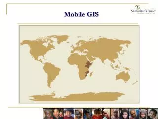
What is Mobile GIS? Mobile GIS is the use and collection of geographic data in the field on mobile devices
Mobile GIS Components • Required • Hand-held computer • Global Positioning System (GPS) • GIS software and applications • Spatial Data • Beneficial • Wireless communication network • Server-side geographic analysis processing capabilities
What we are looking for? • Quick way to conduct survey • Have data available quickly • Keep track of historical data • Compare and analyze data across different years • Ease of use • Low cost • Spatial aspect (mapping)
Options • Paper Survey ( In use now) • Laptop • GPS Enabled laptop • GPS Enabled pocket PC • Smart Phone
Paper Survey • The Good • Easy to use • Not affected by technology issues • The Bad • Stacks of paper • Time involves in data entry • Difficult to compare and analyze data • Data inaccuracy
Laptop Computer • The Good • Easy to use • Available • Can transfer data quickly between field and office • The Bad • No GPS • Time involve in data entry • Difficult to compare and analyze data • Expensive • Battery life • Not for field use • Data inaccuracy
GPS Enabled Laptop Computer • The Good • Easy to use • Can transfer data quickly between field and office • GPS integrated • Integrated with GIS • Data already processed and ready to use. • Designed for field use • The Bad • Heavy • Size • Very Expensive • Battery life
GPS Enabled Pocket PC • The Good • Easy to use • Can transfer data quickly between field and office • GPS enabled • Integrated with GIS • Data processed and ready to use • Rugged • Data Security • Windows mobile – Word, Excel, Email (outlook) • Easy to share with other organizations • The Bad • Battery Life • Initial setup and development • Price
GPS Enabled SmartPhone(Blackberry, iPhone) • The Good • Easy to use • Can transfer data quickly between field and office using wireless network • GPS enabled • Can be integrated with GIS • Inexpensive hardware • The Bad • Data security • Initial setup and development • Expensive data plans • Not designed for adverse conditions • The possibility of large phone bills
Trimble Juno SB/SC • Integrated 2-5m GPS • 533MHz/128 MB RAM/128 MB Storage • Integrated Bluetooth and Wireless • Windows Mobile 6.1 • Lowest Priced Trimble Unit • Integrated Camera • Optional Cellular
ArcPad 8 • Customizable – interface and for other uses • Intuitive User Interface • GPS Capability • Collect and Edit Data in the Field
Data Maintenance Cycle • Check Data Out • ArcGIS Desktop • Data Collection • Feature Editing • Field Surveys • Check Data In • Physically with ArcGIS Desktop 3. Field to GIS 1. GIS to Field 2. Field Update
The workflow Demo and walk through of the process (Video)
Expected Results • Quicker data collection • Quicker data integration • Data available for analysis weekly • The ability for the monitoring and evaluation of the project • The ability to compare and contrast historical data
Potential Problems • Battery life • Damage in the field • Loss of data