Download
1 / 25
250 likes | 477 Vues
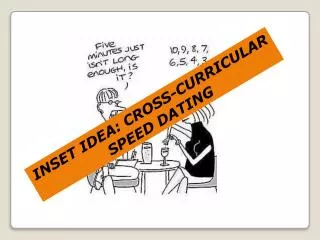
Cross-Curricular Initiatives. Jane Whittle – Nottinghamshire Primary Teacher. Initial Assessment of Ideas. Asking children what they think geography is can be a way of highlighting their prior knowledge and experience.

E N D
Cross-Curricular Initiatives Jane Whittle – Nottinghamshire Primary Teacher
Initial Assessment of Ideas • Asking children what they think geography is can be a way of highlighting their prior knowledge and experience. • It also gives an opportunity to assess how the National Curriculum entitlement is being met through the school planning. • Remember to say geography!
Doing a Splat Board KS2 • Splat Board = a paper format for children to off load any ideas they have on the specific subject. Use of the word splat is to denote that it is not a neat polished sentence based piece of work - it is a space for children to make a non-judgemental response with their ideas.
Geography in the Classroom • The next four pictures show evidence of ways in which geography has been integrated into my classroom
Edwalton Estates is a display of work on the language of estate agents. Having worked on this the children went into the school farm and wrote adverts for the animals thus integrating with the environment explicitly. Edwalton Estates
During our Literacy topic on Quest Myths, the children spent time looking at story maps. In order to support visual understanding, we drew different objects out of a hat to become part of the story setting. This brought about interesting discussion of geographical knowledge such as where Volcanoes are located. Quest Myths
The children lying down are looking at part of a geography climate trail around the classroom. Having posters and questions on the ceiling reminds children that geography is everywhere! The display encourages children to form enquiry questions using the 5W’s – Who, What, Why, When, How. Climate Trail
Cross-Curricular work The next two activities, • Mapping Spring in the Wood and • Mapping for School Linking detail cross-curricular activities using fieldwork.
Geography Club Starting a geography club has allowed for the subject to be the talk of the playground and the group are extremely enthusiastic to spread the word of geography positively and make displays which represent that enthusiasm.
Mapping Evidence of Spring • Begins with a blank outline map • Searching for evidence of Spring • Individual interpretation using keys • Development of vocabulary • Extension: What will the wood be like in one month’s time?
The Exercise • The children were given a simple base map of the woods of the school. We then walked around the wood looking for evidence of spring whilst orientating our maps to mark on this evidence. The maps were purely the children’s own interpretations and therefore gave children an opportunity to discuss their reasons for their map design and what they had found.
The Outcome • Some children chose to draw what they saw, others chose to use symbols and a key and some chose a proportional representation. To extend the activity we will be going back around the wood with a tracing overlay to demonstrate the growth of spring since the original map.
Cross-Curricular Benefits • The scientific vocabulary which stemmed from this activity was fascinating and fits well with the Science objectives for Habitats and Plants work. To develop the element of thinking skills the extension question was asked in order to develop children’s discussion with the use of evidence from their maps.
Begins with the use of Journey Sticks to make an affective map of the school locality. The children then create enquiry questions relating to their map. These are sent with the maps for the school linking classes to use – answering questions, observations, free play Mapping Project 2– School Linking Activity
This mapping project is based on cross-curricular work with a link school and is transferable to any country or location. It begins with the use of journey sticks to create a map – see www.geographyteachingtoday.orgfor more details on journey sticks. Also http://www.geography.org.uk/download/GA_Conf06Whittle.ppt# 1 • The children then create enquiry questions to go with their maps and these are sent to the link school classes who use the questions and the maps to explore the link school immediate locality.
Cross-Curricular Aspects • The mapping work can be taken further through Literacy and the use of traditional stories to make Journey Sticks and Affective Maps. • Locational Vocabulary – positioning. • School Linking Experience – the notion of togetherness – a new community for learning.
Literacy Link • Literacy Link: The project can extend beyond mapping the locality to using traditional stories from the link locality to create story maps. The children could consider the path of the main character and make a journey stick of what they might find on the way. This can be extended to make the map affective through emoticons of how the character feels throughout the story – promoting aspects of inference and deduction.
Vocabulary • Vocabulary: Using the maps is an ideal way to fulfil the positioning vocabulary required in Numeracy and gives a realistic context for applying new language.
Global Citizenship • Global Citizenship: Through joint projects, a new community of enquiry is being established in which children can begin to understand that they are working towards the same goal. The project has also shown the positive responses of using children’s work as a stimuli and the personal gratification this brings.