Emerging satellite sources
This workshop discusses the pivotal role of Earth Observation (EO) satellites in disaster management, emphasizing their usage across all phases of disaster response—from preparedness to recovery. It highlights the current landscape of EO technologies and user requirements, focusing on the need for continuous data delivery, vulnerability mapping, and socio-economic impact assessment. By exploring existing mechanisms like the International Charter and initiatives such as Sentinel Asia and UNSPIDER, the session seeks to refine EO capabilities to better support emergency operations and improve decision-making for disaster resilience.

Emerging satellite sources
E N D
Presentation Transcript
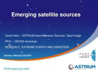
Emerging satellite sources David Hello – ASTRIUM Geoinformation Services | Spot Image IPCC – GEOSS workshop SESSION 5: EXTREME EVENTS AND DISASTERS Geneva, February 3rd 2011
Introduction and rationale • Workshop motto « provide guidance on how GEOSS can improve the delivery of multi-disciplinary data and data products to the climate impacts, adaptation, and vulnerability research community » • I’m not a scientist … sorry. Point of view of someone involved in emergency operations. • EO can support all phases of the disasters management and some mechanisms already exist at International or Regional level to foster and ease the use of EO data for Disaster Management • The focus has been so far given on EO contribution to « emergency response » (so called Rapid Mapping) but … • From the users’ perspective, EO-based analysis may be even more relevant for pre and post crisis phases: • assessment of socio-economic vulnerabilities • assessment of socio-economic impacts in the long term • What future satellite should bring in addition to what exist today ?
Table of content • Introduction and reminder of Earth Observation contribution to Disaster Management • The current landscape • What are users’ requirements ? • What are the current data sources ? What are the EO-based International mechanisms to support Disaster Management ? • Do EO-based services fulfil users’ requirements ? • The near and the far future • What are Earth Observation satellites key features ? How can they evolve ? • What the next generation of EO satellites should bring ? • Conclusions
CRISIS POST DISASTER PREVENTION / PREPARDNESS • Structural parameters • - DEM • - Vegetal cover • Soil cover • Vulnerability mapping • Population • Infrastructures • … • Dynamic parameters • Vegetation wetness • Global monitoring • Rapid Mapping • Disaster mapping • Rapid damage assessment • Detailed damage assessment • Socio-economic impact • Environmental impact • Global assessments • - e.g. Burn Scar Mapping User databases Input to risk analysis models Input to forecasting models Information support to rescue operations Impact assessments Experience feedback Contribution of EO to disaster management • Still some Research & Development work to do in particular regarding alert systems, vulnerability assessment etc.
Summary of users(*) requirements/feedback « Glocal » = Detailed views , everywhere, without notice and… free of charge! • On-demand rush mode • Reactive delivery • Reference maps : 6 hours • Damage maps : 24 hours (or less !) with daily updates • On-demand “background” production • Preparedness and prevention • Post-disaster assessment • Mainly information products, sometimes imagery • For decision-making at headquarters • For support to operations (in-field) • Qualified performance and commitment on delivery • Early warning and alert • Dynamic situation monitoring • updated on a daily basis or higher • Integration in GIS environment (*) Civil Protection authorities + Humanitarian Aid actors e.g. UN bodies
The International Charter Space and Major Disasters Funded in 1999 by CNES and ESA Joint by: ASC (Canada) NOAA (USA) ISRO (Inde) CONAE (Argentine) JAXA (Japon) USGS (US) BNSC/DMCii (UK) CNSA (China) The International Charter is agreement (on a best effort basis) between international space agencies to supply emergency organizations, with a timely, free and coordinated access to EO data in case of major disaster
Other emergency support mechanisms • Sentinel Asia • Sentinel Asia is a voluntary basis initiative led by the APRSAF (Asia-Pacific Regional Space Agency Forum) to support disaster management activity in the Asia-Pacific region by applying the WEB-GIS technology and space based technology, such as earth observation satellites data. • UNSPIDER – SpaceAid • SpaceAid is UN-SPIDER’s framework to facilitate fast and efficient access to space-based information for countries, international and regional organizations. This includes all types of information provided by earth observation satellites, communication satellites and global navigation satellite systems. • SERVIR • Enabling the use of earth observations and models for timely decision making to benefit society
SAFER and the GMES Emergency Response Service • SAFER project co-funded by the European Commission (FP7 program) – Coordinated by Astrium Services | GEO • SAFER is preparing the future European Emergency Response Service (to be fully funded by EC from 2012 onwards) • SAFER Focal Point on call duty 24/7 • Rapid Mapping Service Providers on call duty 24/7 • EO coordinated data access 24/7 (through ESA)
5 2 4 1 3 Emergency Service – Geographic Location (2010)
Pakistan Flood (August, 2010) GERS#48 #52 #54 ICRC 6 GERS#048 2 1 3 4 WFP Products Samples (GERS054) Flood Extent evolution between August 24th and August 27th – Sindh Province, Shahdadkot city. Details of Affected Villages – Damaged network infrastructure Product delivered 8 hours after EO data acquisition (August, 27th) 5 ICRC 9 GERS#054 WFP 7 10 GERS#052 WFP 8
Preparedness and Recovery mapping Example in East Asia Natural Hazards: Callout Key: Floods Storm Surge Earthquake Volcanic Eruption Tsunami Preparedness: Geographic Reference Maps Recovery: Situation Maps
Geographic reference map / Dam failure impact Modelisation of the impact of a natural dam failurefollowing a landslide (Hunza river, Pakistan, March 2010) Crucial need for in-situ / ancillary data to complement EO data ! Detailed reference map over Abidjan (Ivory Coast)User = WHO
Current limitations and required improvements(lesson learnt after 2 years of operations) • Response time for Emergency Response (target: 24h) • current performance to be improved • Main delays in image acquisition (see next slide) • Tasking and data acquisition still to be improved • Product delivery, incl. to in-field operatives • Commitment on delivery • No guarantee on delivery or timing. • Delivery mainly to the headquarters. Increasing demand of the in-field operatives and for integration in GIS tools. • Revisit and situation monitoring • in case of long duration events. • Increasing demand for pre and post disaster analysis • E.g. for complex vulnerability analysis (Xynthia storm in France in 2010) • Increasing demand for high and very high resolution images and products
Responsiveness of Earth Observation systems Informationproduct available Activationof the operationalchain Event Uplink Downlink Early warningsignals oranticipation Product distributionto users (Headquartersand in-field units) Satellitetasking First good imageavailable Activationdecision byuser
The near future … Provisional launch table of Earth Observation satellites
Key features of Earth Observation satellitesthat can be adapted/improved • Orbits • Resolution andcoverage • Spectral bands • Reactivity andavailability • Revisit frequency • Acquisition time • Night acquisition • All-weather acquisition • 3D • Specification ofgeoinformation products (accuracy, etc.) ACCURACY REACTIVITY / RESPONSIVENESS AVAILABILITY
Improvement of revisit on new VHR satellites • CMG (= Control Momentum Gyroscope) to reorient the satellite and increase the field of regard
Multiple tasking plans per day(e.g. 3 for Pléiades, 6 for Spot 6 &7) Kiruna Toulouse Kerguelen 13:40 UT 6:00 UT 23:00 UT 13:40 UT
Monopass collection scenarios Typically15 targets over 1,000 km within a +/-30 deg corridor for Pléiades, 600 km-long strips with Spot 6 & 7 Up to 1 sq. deg. with Pléiades, 120 x 120 or 60 x 180 km with Spot 6 & 7 In a single pass, up to 6,000 sq.km pairs 2,000 sq.km triplets with Pléiades To follow linear targets such as coasts, borders, roads, pipelines, rivers (Pléiades only)
The far future … Geostationary EO satellite • Enhanced availability • The GEO satellite observes only over the areas of interest • GEO located instruments can use any transient opportunity provided by clouds absence • Short revisit times • Continuous data downlink • ESA has recently performed three studies on optical EO from GEO: • Low to medium resolution observation in “Alternative GMES architecture”. Resolution 500 m. • Medium to high resolution observation in “GeoOculus”. Resolution 20 m over Europe. • Very high resolution observation in “Towards 1-m from GEO”. Resolution 4 m over Europe • BUT … HR from GEO has well known disadvantages e.g. degraded resolution and radiometry, distortion as the line of observation moves away from Nadir etc.
Conclusions • On the Space component side • The continuity of EO missions needs off course to be insured in order to fulfill users’ requirements on a sustainable way (current trend = increase number of disasters + increased severity ) • The development of new missions/sensors to better fit with users’ expectations worldwide is a key success factor • On the application side • The future GMES Emergency Response Service (as well as other GMES services e.g. land, ocean, climate, security, atmosphere) is a good candidate to contribute to map climate impacts as well as socio-economic vulnerabilities based on EO analysis • GMES products are deamed to be fully and freely accessible for scientific work ! • Don’t forget in-situ data ! • Census data, socio-economic statistics • Some GMES initiatives in progress (e.g. GISC/EEA)
Contact David HELLO Head of Risk and Crisis management department +33 5 62 19 63 48 +33 6 70 82 51 40 david.hello@spotimage.fr www.emergencyresponse.eu