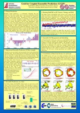
ACCESS Global Ensemble Prediction System
ACCESS Global Ensemble Prediction System. Michael Naughton, David Smith, Asri Sulaiman Bureau of Meteorology CAWCR Earth System Modelling Program BMTC Met Course Lecture 3 Sep 2014. Outline. Rationale of ensemble prediction Description of ACCESS-GE system

ACCESS Global Ensemble Prediction System
E N D
Presentation Transcript
ACCESS Global Ensemble Prediction System Michael Naughton, David Smith, Asri Sulaiman Bureau of Meteorology CAWCR Earth System Modelling Program BMTC Met Course Lecture 3 Sep 2014
Outline • Rationale of ensemble prediction • Description of ACCESS-GE system • AGREPS home page and ACCESS-GE daily products • ACCESS-GE verifications • Ex-TC Oswald Jan 2013 Queensland flooding • EPSgram examples • recent NSW rain event, Melbourne Jan 2014 heatwave • TC strike probability and multi-tracks examples • Details of the MOGREPS method • Summary
Outline • Rationale of ensemble prediction • Description of ACCESS-GE system • AGREPS home page and ACCESS-GE daily products • ACCESS-GE verifications • Ex-TC Oswald Jan 2013 Queensland flooding • EPSgram examples • recent NSW rain event, Melbourne Jan 2014 heatwave • TC strike probability and multi-tracks examples • Details of the MOGREPS method • Summary
Motivation for Ensemble Prediction • NWP forecasts greatly improved but are still uncertain • Internal and external users can make better decisions when uncertainty information is provided • Ensemble prediction is a good way to estimate forecast uncertainty The Centre for Australian Weather and Climate ResearchA partnership between CSIRO and the Bureau of Meteorology
Service requirements for probability forecasts • Thunderstorms – probability of conditions favourable to severe weather • Heat wave warnings – probability of exceeding critical heat stress index based on temperature, humidity, and wind speed • Precipitation – probabilities of exceeding critical accumulation thresholds • Wind – probability of gales – crucial for tropical regions • Waves – probabilities of exceeding critical wave heights • Tropical cyclones – strike probability The Centre for Australian Weather and Climate ResearchA partnership between CSIRO and the Bureau of Meteorology
Benefits for the Bureau • Uncertainty information for forecasters • More reliable and accurateforecasts • Probabilistic predictions for a wide range of meteorological parameters • Inclusion of uncertainty / probability information in automated forecasts enhances efficiency of end-to-end forecasting service • Provision of ensemble-based uncertainty information to customers • Extension to downstream applications such as flood forecasting, continuous streamflow, transport (dust, smoke, volcanic ash, etc.), fire spread, and storm surge • Hybrid data assimilation The Centre for Australian Weather and Climate ResearchA partnership between CSIRO and the Bureau of Meteorology
Outline • Rationale of ensemble prediction • Description of ACCESS-GE system • AGREPS home page and ACCESS-GE daily products • ACCESS-GE verifications • Ex-TC Oswald Jan 2013 Queensland flooding • EPSgram examples • recent NSW rain event, Melbourne Jan 2014 heatwave • TC strike probability and multi-tracks examples • Details of the MOGREPS method • Summary
NWP Ensemble Prediction methodologies Multi-model ensemble (Poor Man’s Ensemble) – form ensemble from deterministic forecasts from available local and overseas models • PME precip forecasts on BoM WATL site • OCF & GOCF used operationally in BoM public weather forecasts Single-centre EPS systems – run by almost all major international Met Centres Global: • BoM: GASP-EPS (2002-2010), AGREPS (2007-present) • ECEPS (1993-present), US-EPS (1993-present), CMC-EPS (1998-present), JMA-EPS (2001-present), KMA-EPS (2001-present), UK-MOGREPS (2005-present; oper 2008) Australian Region: • LAPS-EPS: research system (2002-2005) • Many overseas regional ESP systems Multi-EPS systems – form ensemble from ensemble forecasts from multiple centres • TIGGE – Thorpex Interactive Grand Global Ensemble (research) • NAEFS – North American Ensemble Forecast System (operational) Time-lagged ensembles – form ensemble from consecutive runs Statistical ensembles – e.g. STEPS The Centre for Australian Weather and Climate ResearchA partnership between CSIRO and the Bureau of Meteorology
Ensemble Prediction System Techniques EPS systems typically run 10-50 ensemble members at about half the resolution of deterministic systems Initial conditions perturbations • Singular Vectors – EC / JMA • Breeding / EKF / ETKF – US-NCEP / KMA / UK / BoM • Ensemble DA – CMC Model Perturbations • Stochastic physics schemes – EC, BoM (LAPS), UK • Multiple physics schemes –CMC The Centre for Australian Weather and Climate ResearchA partnership between CSIRO and the Bureau of Meteorology
ACCESS-R12 km ACCESS-G 40km (N320) – G2 25km (N512) ACCESS-GE 60km (N216) ACCESS-GE global ensemble prediction system • 24-member ensemble designed for medium-range forecasting • Based on UKMO MOGREPS • Global ensemble to 10 days • Global ETKF for initial condition perts • Stochastic model perturbations ACCESS-C C1: 4km C2: 1.5km Currently running 12Z daily at 60 km, 70 levels (N216L70) Proposed for operational implementation in APS2 Science Plan
AGREPS plans • Hybrid Data Assimilation • Combination of flow-dependent and climatological error covariances; plan to incorporate Met Office hybrid DA approach into upcoming ACCESS NWP suites • Ensembles for high resolution ACCESS-C systems are also planned, from APS3 (2016) onwards
Outline • Rationale of ensemble prediction • Description of ACCESS-GE system • AGREPS home page and ACCESS-GE daily products • ACCESS-GE verifications • Ex-TC Oswald Jan 2013 Queensland flooding • EPSgram examples • recent NSW rain event, Melbourne Jan 2014 heatwave • TC strike probability and multi-tracks examples • Details of the MOGREPS method • Summary
AGREPS home page: CAWCR>ESM>Projects The Centre for Australian Weather and Climate ResearchA partnership between CSIRO and the Bureau of Meteorology
AGREPS Chart Browser The Centre for Australian Weather and Climate ResearchA partnership between CSIRO and the Bureau of Meteorology
AGREPS EPSgramBrowser ~ 80 cities produced, available online in simple window The Centre for Australian Weather and Climate ResearchA partnership between CSIRO and the Bureau of Meteorology
Outline • Rationale of ensemble prediction • Description of ACCESS-GE system • AGREPS home page and ACCESS-GE daily products • ACCESS-GE verifications • Ex-TC Oswald Jan 2013 Queensland flooding • EPSgram examples • recent NSW rain event, Melbourne Jan 2014 heatwave • TC strike probability and multi-tracks examples • Details of the MOGREPS method • Summary
ACCESS-GE - Verification Against AnalysisFebruary 2014 MSLP T850 Aust Trop NH SH Ensemble mean skill better than deterministic ACCESS-G after first couple/few days ACCESS-G E-Control E-Mean E-Spread The Centre for Australian Weather and Climate ResearchA partnership between CSIRO and the Bureau of Meteorology`
Verification – Spread-skill c.f. other centres AGREPS N216 ECMWF NCEP JMA MSLP August 2012 Southern Hemisphere
Verification – Spread-skill c.f. other centres AGREPS N216 ECMWF NCEP JMA T850 August 2012 Southern Hemisphere
Outline • Rationale of ensemble prediction • Description of ACCESS-GE system • AGREPS home page and ACCESS-GE daily products • ACCESS-GE verifications • Ex-TC Oswald Jan 2013 Queensland flooding • EPSgram examples • recent NSW rain event, Melbourne Jan 2014 heatwave • TC strike probability and multi-tracks examples • Details of the MOGREPS method • Summary
Queensland & NSW flooding – ex-TC Oswald 22-29 Jan 2013 This event followed the monsoon onset in mid-January. TC Oswald formed in the western part of Gulf of Carpentaria around 20 January. It existed briefly as TC until it made landfall and moved across the Cape York peninsula as a tropical low. Ex-TC Oswald then progressed over the following week down the Queensland coast and through to the northern NSW as far as the Sydney region, before moving off to the east on 29 January.
Queensland & NSW flooding – ex-TC Oswald 22-29 Jan 2013 Floodwaters cover the central Queensland city of Bundaberg in the wake of ex-tropical cyclone Oswald, January 29, 2013. ABC: Audience submitted: John McDermott abc.net.au/news/2013-01-27/queensland-floods-as-oswald-moves-south/4486174
Queensland & NSW flooding – ex-TC Oswald 22-29 Jan 2013 The Fitzroy River floods and fills the surrounding landscape, January 29, 2013. ABC Capricornia abc.net.au/news/2013-01-27/queensland-floods-as-oswald-moves-south/4486174
Queensland & NSW flooding – ex-TC Oswald 22-29 Jan 2013 Canadian astronaut Chris Hadfield takes a picture of floodwater on the Burnett River running out to sea at Bundaberg on January 29, 2013. Twitter: @Cmdr_Hadfield abc.net.au/news/2013-01-27/queensland-floods-as-oswald-moves-south/4486174
Queensland & NSW flooding – ex-TC Oswald22-29 Jan 2013 Initial period – NWP forecasts of initial period of transit of tropical low to east coast • Deterministic 5-day forecasts from 20 January showed large variation in location of low centre • UK & ACCESS forecasts favoured movement to east • ECMWF and US had low staying further west • AGREPS and EC-EPS captured different possibilities amongst ensemble members, with EC_EPS ensemble mean still further west than AGREPS • Actual movement was east then south-east • Forecasts for 25 January converged at 3-day period
5 day forecasts from 20 Jan 2013 12Z runs NMOC chart comparisons
5 day forecasts from 20 Jan 2013 12Z runs APS2 NMOC chart comparisons
5 day forecasts from 20 Jan 2013 12Z runs APS2 N512 APS1 N320
Queensland & NSW flooding – 22-29 Jan 2013 AGREPS 8W, 4C, 10E, 2- ECMWF 36W, 6C, 9E
Queensland & NSW flooding – ex-TC Oswald22-29 Jan 2013 Ensemble forecasts of high rainfall period of the event • Ensemble forecasts predicted rainfall event to travel down the Queensland coast • 4-day forecasts from AGREPS and EC-EPS identified probability of high rainfall for 27 January • 2-day forecasts strengthened the forecast probability
Central Queensland flooding – 27 Jan 20134-day EPS forecasts Ensemble forecasts of Central Queensland coast heavy rainfall period. AGREPS and EC-EPS ensemble means and precip-probabilities both picked up likelihood of heavy rain event 4 days ahead
Central Queensland flooding – 27 Jan 20134-day EPS forecasts AGREPS ECMWF-EPS

