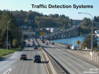
Regional Traffic Signal GIS/Google Earth
90 likes | 257 Vues
Regional Traffic Signal GIS/Google Earth. Introduction Many jurisdictions now use Synchro for traffic signal timing Provides opportunity for regional compilation and analysis of data Looking to display data on GIS and Google Earth

Regional Traffic Signal GIS/Google Earth
E N D
Presentation Transcript
Regional Traffic Signal GIS/Google Earth Introduction Many jurisdictions now use Synchro for traffic signal timing Provides opportunity for regional compilation and analysis of data Looking to display data on GIS and Google Earth To be integrated into the regional Congestion Management Process
Regional Traffic Signal GIS/Google Earth • District of Columbia Available (Some Intersections have information missing) • VDOT NOVA Available • MDSHA Partial Coverage (PG, Charles) • Arlington 50% Coverage (Excel) • Alexandria Partial Coverage (Excel) • Montgomery County No Information Received • City of Fairfax No Information Received • Other Cities/ Small Systems No Information Received • We now have data for an estimated 50% of the region’s signals Status of Data Availability
Regional Traffic Signal GIS/Google Earth Demonstration of GIS Maps and Google Earth
Regional Traffic Signal GIS/Google Earth Issue 1: Suggested Color Coding to Display Level of Service (LOS) LOS A Green LOS B Green LOS C Green LOS D Green LOS E Yellow LOS F Red
Regional Traffic Signal GIS/Google Earth Issue 2 : What Information is Appropriate to Be Displayed? • Delay • V/C Ratio • Traffic Volume • Fuel Used • CO, NOx, VOC Emission • Etc.
Regional Traffic Signal GIS/Google Earth Issue 3: Pedestrian Factor • Current data does not always indicate if or how pedestrian information is handled • Is an explanatory factor to what signal timing is chosen • Will be of interest to the TPB and others • Is this information available? What format?
Regional Traffic Signal GIS/Google Earth Issue 4: Data Format • For Synchro 6.0 or before we can handle: • Direct Synchro data files • Excel • Other Text Format • For Synchro 7.0 or later, we can only handle exported text files: • File (Menu) -> Create Report -> Save Text
Regional Traffic Signal GIS/Google Earth Issue 5: Time Frame of the Database • Need to have meta data on when the run was done (e.g. are we comparing a 2005 analysis to a 2008 analysis?) • Goal is to have information that is similar in time frame • What time of day should we display? • AM Peak • PM Peak • Non-Peak • Weekday • Weekend • Special Events
Regional Traffic Signal GIS/Google Earth • Obtain information not yet received to the extent possible • Refine mapping and graphics on GIS and Google Earth • Explore ways to integrate and cross-compare signals data to other available data (e.g., COG travel forecasting data) displayed on the same GIS network • Subcommittee reviews and endorsement of data • Determine how data can be integrated into the Congestion Management Process Next Steps