The Biosphere
The Biosphere. The Order of Things…. Subatomic Particles Atoms molecules macromolecules Organelles Cells tissues Organs Organisms (Ecological Order…) Populations Communities Ecosystems Biomes Biosphere. Biogeography.

The Biosphere
E N D
Presentation Transcript
The Order of Things…. • Subatomic Particles Atoms molecules macromolecules Organelles Cells tissues Organs Organisms • (Ecological Order…) Populations Communities Ecosystems Biomes Biosphere
Biogeography The study of the distribution of organisms and the processes that underlie distribution patterns (a central question – evolutionary and ecological answer -
Factors that Affect Distribution • Geologic history • Topography • Climate • Species interactions
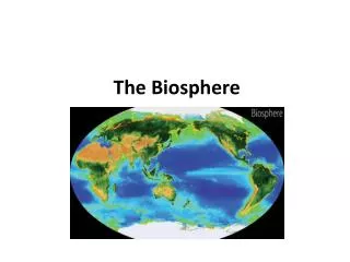
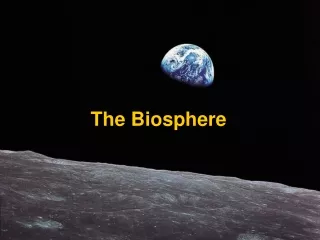
Biosphere • Sum total of the places in which organisms live • Includes portions of the hydrosphere, lithosphere, and atmosphere
Climate • Average weather condition in a region • Affected by: • amount of incoming solar radiation • prevailing winds • elevation • precipitation
The Atmosphere • Three layers • Outer mesosphere • Middle stratosphere (includes ozone layer) • Inner troposphere (where air is warmed by the greenhouse effect)
Ozone Layer • Region 17 to 27 kilometers above sea level in the stratosphere • Molecules of ozone absorb most layers of ultraviolet light • Protects living organisms from excess exposure to UV light 3O2- 2O3 (ozone)
Warming the Atmosphere • Solar energy warms the atmosphere and sets global air circulation patterns in motion Figure 49.4 Page 890
Rotation and Wind Direction • Earth rotates faster under the air at the equator than it does at the poles • Deflection east and west Figure 49.4 Page 890
Global Wind Patterns Trade winds, doldrums, and horse latitudes Red Arrows Indicate Very Strong Winds
Seasonal Variation • Northern end of Earth’s axis tilts toward sun in June and away in December • Difference in tilt causes differences in sunlight intensity and day length • The greater the distance from the equator, the more pronounced the seasonal changes
Ocean Currents • Upper waters move in currents that distribute nutrients and affect regional climates Figure 49.6 Page 892
Rain Shadow • Air rises on the windward side, loses moisture before passing over the mountain Figure 49.7 Page 893
Monsoons • A monsoon is defined as a seasonal shift in wind direction, being derived from the Arabic word "mausim", meaning season. Affect continents north and south of warm-water oceans • Can cause seasonal variation in rains
Coastal Breezes • Breeze blows in direction of warmer region • Direction varies with time of day Night Afternoon Figure 49.8 Page 893
Biogeographic Realms • Eight areas in which plants and animals are somewhat similar • Maintain their identity because of climate and physical barriers that tend to maintain isolation between species
Biomes • Regions of land characterized by habitat conditions and community structure • Distinctive biomes prevail at certain latitudes and elevations • A biogeographic realm generally composed of many biomes
Olympic NP • The most famous temperate rainforest is in the Olympic National Park of Washington state. • It is locates on the western slope of an Olympic mountain where it gets about 200 inches of rain per year.
Temperate Rainforest Great Smoky Mountains NP • Each 1,000 feet of elevation gained is the equivalent of moving 250 miles north. This creates a temperature gradient combined with • additional precipitation (GT 100 inches per year) classifies small sections of the Park as a temperaterainforest. http://www.great.smoky.mountains.national-park.com/info.htm
Forests in the Great Smoky Mountains • Five forest types dominate the Great Smoky Mountains. • The spruce-fir forest caps the Park's highest elevations. (4500 – 5500 ft) • A northern hardwood forest dominates the middle to upper elevations from 3,500- 5,000 feet. • Drier ridges in and around the Park hold a pine-oak forest. • A hemlock forest often grows along stream banks. • The cove hardwood forest lines the valleys throughout the Park.
Hot Spots • Portions of biomes that show the greatest biodiversity • Conservationists are working to inventory and protect these regions • 24 hot spots hold more than half of all terrestrial species
Conservation International’s Definition • Conservation International defines hotspots as "regions that harbor a great diversity of endemic species and, at the same time, have been significantly impacted and altered by human activities."
Hotspots Map http://www.usaid.gov/locations/asia_near_east/sectors/env/biodiversity_eastasia.html
Ecoregions • Large areas of globally important biomes or water provinces • Currently vulnerable to extinction • Targeted by World Wildlife Fund for special study and conservation efforts
WWF global 2000 Project • “WWF has ranked the terrestrial Global 200 ecoregions by their conservation status - classifying those ecoregions that are considered critical, endangered, or vulnerable as a result of direct human impacts, and those that are relatively stable or intact. Nearly half (47%) of the terrestrial ecoregions are considered critical or endangered; another quarter (29%) are vulnerable; and only a quarter (24%) are relatively stable of intact.” http://www.panda.org/about_wwf/where_we_work/ecoregions/global200/pages/mapdownload.htm#map3
Soil Characteristics • Amount of humus • pH • Degree of aeration • Ability to hold or drain water • Mineral content
Soil Profiles • Layer structure of soil • Soil characteristics determine what plants will grow and how well Rainforest Desert Grassland Figure 49.12 Page 896
Deserts • Less than 10 centimeters annual rainfall, high level of evaporation • Tend to occur at 30 degrees north and south and in rain shadows • One-third of land surface is arid or semiarid
Temperate Grasslands Precipitation less than 60 centimeters per year and greater than 10 cm per year Temperature range -5 to 20 C0 (usually)
Dry Shrublands and Woodlands • Semiarid regions with cooler, wet winters and hot, dry summers • Tend to occur in western or southern coastal regions between latitudes of 30 and 40 degrees
Savannas • “A savanna is a rolling grassland, dotted with trees, which can be found between a tropical rainforest and desert biomes.” • “There are actually two very different seasons in a savanna; a very dry season (winter), and a very wet season (summer).” http://www.rain.org/global-garden/biomes/BIOME_SA.HTM
Forest Biomes Tall trees form a continuous canopy • Evergreen broadleaves in tropical latitudes • Deciduous broadleaves in most temperate latitudes • Evergreen conifers at high temperate elevations and at high latitudes