HYDROLOGIC DATA
This guide outlines the essential processes for analyzing and synthesizing hydrologic data necessary for effective computation in engineering applications. It emphasizes the importance of identifying and acquiring accurate data from multiple sources, including federal agencies like the USGS and NWS, as well as local planning and environmental agencies. Field surveys are highlighted as primary data sources, along with historical records and the National Water Data Exchange (NAWDEX) for accessing and managing water-related information.

HYDROLOGIC DATA
E N D
Presentation Transcript
BACKGROUND • Analysis and synthesis of data is required to perform any hydrologic computation. • The engineer needs to: • Identify and define the data needed for an application • Identify sources of data • Acquire data and review the data for accuracy
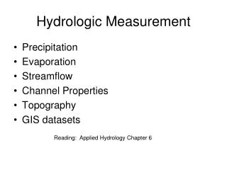
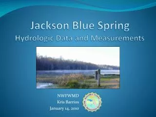
Site investigation and field surveys • Field surveys are the primary sources of hydrologic data • Typical data include drainage boundaries, flow directions, high water marks, assessments of the performance of nearby drainage structures, assessments of stream stability and scour potential, significant changes in land use, etc.
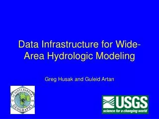
Federal Data Bases • U.S. Geological Survey (USGS) • U.S. Army Corps of Engineers • National Weather Service (NWS) • U.S. Soil Conservation Service (SCS) • Federal Emergency Management Agency • Environmental Protection Agency
State and Local Agencies • Environmental Protection Agencies • State Highway Departments • Planning Agencies • Universities
Other Data Sources • Certain types of data are needed so frequently that some state agencies have compiled them into a single drainage manual. • Historical Records or accounts are recorded in newspapers, magazines, or by state historic societies or universities.
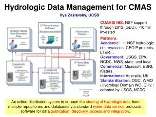
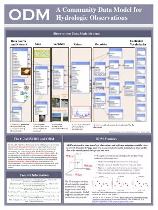
The National Water Data Exchange (NAWDEX) • Was created to assist users of water data in the identification, location, and acquisition of needed data • Maintains two major files • Water Data Sources Directory • Organizations that collect data • Types of water data collected and availability • Master Water Data Index
Streamflow Data • Network of Streamgages • USGS compiles and publishes the data in Water Supply Papers • WATSTORE = Water Data Storage and Retrieval System
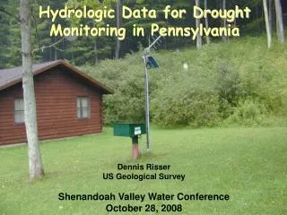
Precipitation Data • Climatological data are collected by the National Weather Service • NWS Raingage Network • Weather Service Forecast Offices • River Forecast Centers • The National Climate Data Center (NCDC) collects and processes, and disseminates data
Soil Data • The Natural Resources Conservation Service (NRCS) formerly the SCS, publishes generalized soil maps for each state and a detailed soil map for each county. • SCS County Extension Offices can supply the soils data.
Land Use Data • Form of Data - Topographic maps, aerial photographs, zoning maps, and Landsat Images • Sources of Data - State, Regional or municipal planning organizations, U.S. Geological Survey, Natural Resource Economic Division
Adequacy of Data • How Accurate is the Data? • Will it meet my purpose? • Can I add to the data base?