Data Interoperability in the Hydrologic Sciences The CUAHSI Hydrologic Information System
210 likes | 408 Vues
Data Interoperability in the Hydrologic Sciences The CUAHSI Hydrologic Information System. David Tarboton, David Maidment, Ilya Zaslavsky, Dan Ames, Jon Goodall , Rick Hooper, Jeff Horsburgh, David Valentine, Tim Whiteaker, Tom Whitenack Kim Schreuders. CUAHSI HIS Sharing hydrologic data.

Data Interoperability in the Hydrologic Sciences The CUAHSI Hydrologic Information System
E N D
Presentation Transcript
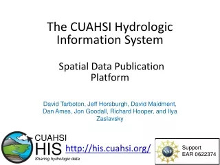
Data Interoperability in the Hydrologic SciencesThe CUAHSI Hydrologic Information System David Tarboton, David Maidment, Ilya Zaslavsky, Dan Ames, Jon Goodall, Rick Hooper, Jeff Horsburgh, David Valentine, Tim Whiteaker, Tom Whitenack Kim Schreuders CUAHSI HIS Sharing hydrologic data Support EAR 0622374
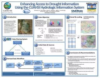
Consortium of Universities for the Advancement of Hydrologic Science, Inc. Hydrologic Information System Hydrologic Measurement Facility Hydrologic Modeling Hydrologic Education Outreach An organization representing more than one hundred United States universities, receives support from the National Science Foundation to develop infrastructure and services for the advancement of hydrologic science and education in the U.S. http://www.cuahsi.org/
What is the CUAHSI HIS? UT-Austin, SDSC/UCSD, Utah State U, Idaho State U, Drexel U, U of So. Carolina, CUAHSI PI: D. R. Maidment (UT-Austin) Partners: Academic: many research watersheds, CZO… Government: USGS, EPA, NCDC, NWS, state and local Commercial: Microsoft, ESRI, Kisters International: Australia, UK Standardization: OGC, WMO (Hydrology Domain WG); adopted by USGS, NCDC, Army Corps of Eng. • An online distributed system to support thesharing of hydrologic data from multiple repositories and databases via standardweb service protocols • Software for datapublication, discovery, access and integration
HydroServer • Publication of point observations and geospatial datasets • Distributed data with local control for data publishers Data Discovery and Integration HydroCatalog Find Metadata Search Service and Data Theme Metadata Data Carts Publish Metadata Services Service Registration Catalog Harvesting Bind Data Services Water Data Services Spatial Data Services HydroServer HydroDesktop Data Analysis and Synthesis Data Publication
Point Observations Data Internet Applications Ongoing Data Collection Historical Data Files ODM Database GetSites GetSiteInfo GetVariableInfo GetValues GIS Data WaterML WaterOneFlow Web Service OGC WMS, WFS, WCS Data presentation, visualization, and analysis through Internet enabled applications HydroServer
Observations-Network Information Model NWIS Daily Values Data Service Network NWIS Sites San Marcos River at Luling, TX Sites Discharge, stage (Daily or instantaneous) Variables Observation 18,700 cfs, 3 July 2002 {Value, Time, Qualifier} • A data source operates an observation network • A network is a set of observation sites • A site is a point location where one or more variables are measured • A variable is a property describing the flow or quality of water • A value is an observation of a variable at a particular time • A qualifier is a symbol that provides additional information about the value
Observations Data Model (ODM) Streamflow Groundwater levels Precipitation & Climate Soil moisture data Flux tower data Water Quality • A relational database at the single observation level • Metadata for unambiguous interpretation • Traceable heritage from raw measurements to usable information • Promote syntactic and semantic consistency • Cross dimension retrieval and analysis Horsburgh, J. S., D. G. Tarboton, D. R. Maidment, and I. Zaslavsky (2008), A relational model for environmental and water resources data, Water Resources Research, 44, W05406, doi:10.1029/2007WR006392.
Set of query functions ReturnsdatainWaterML WaterML and WaterOneFlow WaterML is an XML language for communicating water data WaterOneFlow is a set of web services based on WaterML
HydroServer Service Interface Publish point data Publish metadata Publish spatial data Manager Interface Browser Interface HydroServer View server portal WaterOneFlow Web Service Capabilities Web Service Spatial Data Services HydroServer Website WaterOneFlow Web Service WaterOneFlow Web Service Load and Edit data ODM Tools and Data Loaders Observation DataModel View spatial data Geo Spatial Database Map Website Observation DataModel Observation DataModel Spatial Data File HydroServer Capabilities Database Capabilities Configuration Tool Configure server View point data Time Series Analyst Website
HIS Central - HydroCatalog • Central metadata catalog supporting data discovery Data Discovery and Integration HydroCatalog Find Metadata Search Service and Data Theme Metadata Data Carts Publish Metadata Services Service Registration Catalog Harvesting Bind Data Services Water Data Services Spatial Data Services HydroServer HydroDesktop Data Analysis and Synthesis Data Publication
HIS Central HydroCatalog Content 65+ public web services 13,000+ variables 1.96+ million sites 23.3 million observation time series Referencing 5+ billion data values Available via HIS Centraldiscovery services Map integrating NWIS, STORET, & Climatic Sites Available via GetValues requests Metadata for most services are harvested weekly
HydroCatalog Data Publisher Interface Interactively test WaterOneflow Services Register, View and Manage Services View and Manage Ontology Mappings Data Service Interface Search Client Interface Validate WaterOneFlow Services Web Service Registry Website Validation Services Semantic Annotation Website Collect Metadata Metadata Harvester Provide Client Search over Services and Observation Metadata Metadata catalog database Search Web Service Log service use Logging Service Hydrologic Ontology Ontology Web Service Get Concepts and Mappings Monitor Service Monitoring Services HydroCatalog • A web service application programmers interface to the metadata catalog • Semantic annotations and a domain ontology aid in discovery
HydroDesktop • Discover, download, visualize, and analyze hydrologic data Data Discovery and Integration HydroCatalog Find Metadata Search Service and Data Theme Metadata Data Carts Publish Metadata Services Service Registration Catalog Harvesting Bind Data Services Water Data Services Spatial Data Services HydroServer HydroDesktop Data Analysis and Synthesis Data Publication
HydroDesktop – Data Access and Analysis Thematic keyword search Integration from multiple sources Search on space and time domain
HydroDesktop Plugins HydroDesktop Core & Shared Libraries Export to CSV Graph View • Interact with user • Interact with other programs Object Model Theme DataValue … Site Variable Series Method HydroR User Interface Hydro Modeler Help Table View • Get from/ save to disk Fetch Basemap Database Abstraction Layer DotSpatial Library Search Data Repository Manager Metadata Cache Manager Other Libraries XML HydroCatalog Search & Ontology Web Service Search Metadata Cache DB Data Repository DB WaterML 1.0 1.1 Project File Data Repository DB WaterOneFlow Web Service Application Settings XML Metadata Cache DB Project File Data Repository DB Metadata Cache DB Project File
Collaborative Open Source Development • HydroServer – http://hydroserver.codeplex.com • HydroDesktop – http://hydrodesktop.codeplex.com • HydroCatalog – http://hydrocatalog.codeplex.com • Source Code • Downloads • Discussion Forums • Issue Tracker
Toward a Standard SOA for Water Data • Operationalizing the CUAHSI HIS • Encourage broad implementation by software providers and broad uptake by data publishers • Determine optimal web service interfaces and data encodings Catalog Find???? Publish???? Bind???? Desktop Server
These standards have been developed over the past 10 years …. …. by 400 companies and agencies working within the OGC Open Geospatial Consortium Web Service Standards • Map Services • Web Map Service (WMS) • Web Feature Service (WFS) • Web Coverage Service(WCS) • Catalog Services for the Web (CS/W) • Observation Services • Observations and Measurements Model • Sensor Web Enablement (SWE) • Sensor Observation Service (SOS) OGC Hydrology Domain Working Group evolving WaterML into an International Standard http://www.opengeospatial.org/projects/groups/waterml2.0swg
Summary • CUAHSI HIS • Cyberinfrastructure for managing and publishing observational data • Overcomes syntactic and semantic heterogeneity using a standard data model, transmission language, controlled vocabularies, and ontology • End-to-end infrastructure- from publication to discovery, access, and analysis • Supports a national network of academic partners, and links to many important federal water data repositories • Maintains national registry of services with searchable metadata • Already deployed at multiple locations, leveraged by other projects, free and open source • New Developments • HydroDesktop and associated plugins for data discovery, download, and analysis • WaterML 2.0 is an emerging OGC standard language for communicating water observations data from academic and government sources • New OGC Concept Development Study to define best practices for web service interfaces and data encodings
Thank you! CUAHSI HIS Sharing hydrologic data Support EAR 0622374