CUAHSI: Integrating Hydrologic Data and Models for Water Science Advancement
310 likes | 414 Vues
Discover how CUAHSI HIS facilitates the interaction between water environment and solid earth. Explore WaterOneFlow web services and Open MI hydrologic model interfacing system to access water data and models easily. Join the Consortium of Universities for the Advancement of Hydrologic Science to advance water science through collaborative efforts. Gain insights into water quantity, quality, soil water, rainfall and snow modeling, meteorology, and remote sensing. Make use of the CUAHSI Hydrologic Data Access System for streamflow data and access web portals for hydrological information. Beneficial for researchers, scientists, and academics in the field of Earth and Atmospheric Sciences. Visit cuahsi.org/his for more details.

CUAHSI: Integrating Hydrologic Data and Models for Water Science Advancement
E N D
Presentation Transcript
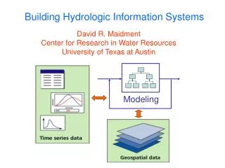
CUAHSI Hydrologic Information Systems David R. Maidment Center for Research in Water Resources University of Texas at Austin and Ilya Zaslavsky, David Tarboton and Michael Piasecki
CUAHSI Hydrologic Information Systems • Introduction to CUAHSI HIS • WaterOneFlow web services • Open MI hydrologic model interfacing system
CUAHSI Hydrologic Information Systems • Introduction to CUAHSI HIS • WaterOneFlow web services • Open MI hydrologic model interfacing system
Continental Water Dynamics GEON describes structure of the solid earth How do the water environment and the solid earth interact?
CUAHSI-Hydrologic Information Systems UCAR • CUAHSI –Consortium of Universities for the Advancement of Hydrologic Science, Inc • Formed in 2001 as a legal entity • Program office in Washington (5 staff) • Supported by the National Science Foundation Unidata Atmospheric Sciences Earth Sciences Ocean Sciences CUAHSI NSF Geosciences Directorate HIS
CUAHSI Member Institutions 109 Universities as of July 2006
CUAHSI Hydrologic Information Systems • Introduction to CUAHSI HIS • WaterOneFlow web services • Open MI hydrologic model interfacing system
Water Data Water quantity and quality Soil water Rainfall & Snow Modeling Meteorology Remote sensing
NWISWeb site output # agency_cd Agency Code # site_no USGS station number # dv_dt date of daily mean streamflow # dv_va daily mean streamflow value, in cubic-feet per-second # dv_cd daily mean streamflow value qualification code # # Sites in this file include: # USGS 02087500 NEUSE RIVER NEAR CLAYTON, NC # agency_cd site_no dv_dt dv_va dv_cd USGS 02087500 2003-09-01 1190 USGS 02087500 2003-09-02 649 USGS 02087500 2003-09-03 525 USGS 02087500 2003-09-04 486 USGS 02087500 2003-09-05 733 USGS 02087500 2003-09-06 585 USGS 02087500 2003-09-07 485 USGS 02087500 2003-09-08 463 USGS 02087500 2003-09-09 673 USGS 02087500 2003-09-10 517 USGS 02087500 2003-09-11 454 Time series of streamflow at a gaging station
CUAHSI Hydrologic Data Access System http://river.sdsc.edu/HDAS NCDC NASA EPA NWS USGS Observatory Data A common data window for accessing, viewing and downloading hydrologic information
Observation Stations Map for the US Ameriflux Towers (NASA & DOE) NOAA Automated Surface Observing System USGS National Water Information System NOAA Climate Reference Network
NWIS Station Observation Metadata Describe what has been measured at this station
Web Page Scraping http://nwis.waterdata.usgs.gov/nwis/discharge?site_no=02087500&agency_cd=USGS&.... Programmatically construct a URL string as produced by manual use of the web page Parse the resulting ASCII file
CUAHSI Web Services Web Application: Data Portal • Your application • Excel, ArcGIS, Matlab • Fortran, C/C++, Visual Basic • Hydrologic model • ……………. • Your operating system • Windows, Unix, Linux, Mac Internet Simple Object Access Protocol Web Services Library
Series and Fields Features Series – ordered sequence of numbers Point, line, area, volume Discrete space representation Time series – indexed by time Frequency series – indexed by frequency Surfaces Fields – multidimensional arrays Continuous space representation Scalar fields – single value at each location Vector fields – magnitude and direction Random fields – probability distribution
North American Regional Reanalysis of Climate Evaporation Precipitation Variation during the day, July 2003 NetCDF format mm / 3 hours
Data Sources NASA Storet Ameriflux Unidata NCDC Extract NCAR NWIS Transform CUAHSI Web Services Excel Visual Basic ArcGIS C/C++ Load Matlab Fortran Access Java Applications http://www.cuahsi.org/his/ Some operational services
CUAHSI Observations Data Model (ODM) Stores local observational data and metadata about remote data sources
Federal State Local Academic Water OneFlow • Like Geospatial OneStop, we need a “Water OneFlow” – a common window for water data and models • Advancement of water science is critically dependent on integration of waterinformation
CUAHSI Hydrologic Information Systems • Introduction to CUAHSI HIS • WaterOneFlow web services • Open MI hydrologic model interfacing system
Project sponsored by the European Commission to promote integration of water models • Software standards for model linking • Uses model core as an “engine” • http://www.openMI.org
OpenMI – Links Data and Simulation Models Simple River Model Trigger (identifies what value should be calculated) CUAHSI Observations Data Model as an OpenMI component
User interface Typical model architecture Model application Application User interface + engine Engine Simulates a process – flow in a channel Accepts input Provides output Model An engine set up to represent a particular location e.g. a reach of the Thames Write Input data Run Read Engine Write Output data
Rainfall Runoff Model River Model Linking modelled quantities
User interface User interface Input data Input data Rainfall runoff River GetValues(..) Output data Output data Data transfer at run time
Models for the processes Rainfall(database) RR (Sobek-Rainfall -Runoff) River (InfoWorks RS) Sewer (Mouse)
3 Rainfall.GetValues 7 RR.GetValues 6 Sewer.GetValues Data exchange Rainfall(database) 4 RR (Sobek-Rainfall -Runoff) 2RR.GetValues 1 Trigger.GetValues 5 8 River (InfoWorks-RS) call Sewer (Mouse) 9 data
Conclusions • CUAHSI Hydrologic Information System synthesizes water data and models • WaterOneFlow web services provide a common data window on water observational data from many sources • The observational data can be linked to simulation models using the OpenMI model interfacing system