Download

1 / 43
430 likes | 573 Vues
The CUAHSI Hydrologic Information System (HIS) is an internet-based platform designed to facilitate the sharing of hydrologic data. The system is composed of interconnected hydrologic databases and servers that utilize web services to enable data publication, discovery, and access. With contributions from various universities and research institutions, HIS supports a standardized approach to managing diverse hydrologic information, empowering researchers and policymakers through better data-driven decisions. For more information, visit [CUAHSI HIS](http://his.cuahsi.org/).

E N D
Sharing Data Using the CUAHSI Hydrologic Information System David Tarboton Utah State University CUAHSI HIS Sharing hydrologic data http://his.cuahsi.org/ Support EAR 0622374
The CUAHSI Hydrologic Information System Team • University of Texas at Austin – David Maidment, Tim Whiteaker, James Seppi, Fernando Salas, Jingqi Dong, Harish Sangireddy • San Diego Supercomputer Center – IlyaZaslavsky, David Valentine, Tom Whitenack, Matt Rodriguez • Utah State University – David Tarboton, Jeff Horsburgh, Kim Schreuders, Stephanie Reeder • University of South Carolina – Jon Goodall, Anthony Castronova • Idaho State University – Dan Ames, Ted Dunsford, JiříKadlec, Yang Cao, Dinesh Grover • Drexel University/CUNY – Michael Piasecki • CUAHSI Program Office – Rick Hooper, Yoori Choi, Jennifer Arrigo, Conrad Matiuk • ESRI – Dean Djokic, Zichuan Ye • Users Committee – Kathleen Mckee, Jim Nelson, Stephen Brown, Lucy Marshall, Chris Graham, Marian Muste CUAHSI HIS Sharing hydrologic data http://his.cuahsi.org/ Support EAR 0622374
What is CUAHSI? Consortium of Universities for the Advancement of Hydrologic Science, Inc. • 111 US University members • 7 affiliate members • 17 International affiliate members • (as of October 2011) Infrastructure and services for the advancement of hydrologic science and education in the U.S. Support EAR 0753521 http://www.cuahsi.org/
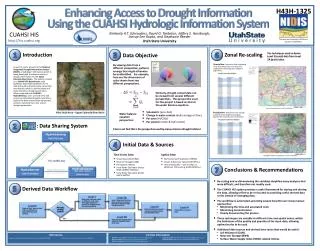
CUAHSI HIS The CUAHSI Hydrologic Information System (HIS) is an internet based system to support the sharing of hydrologic data. It is comprised of hydrologic databases and servers connected through web services as well as software for data publication, discovery and access. HydroServer – Data Publication HydroCatalog Data Discovery Lake Powell Inflow and Storage HydroDesktop – Combining multiple data sources HydroDesktop – Data Access and Analysis
Water quality Water quantity Hydrologic Data Challenges Rainfall and Meteorology Soil water • From dispersed federal agencies • From investigators collected for different purposes • Different formats • Points • Lines • Polygons • Fields • Time Series Groundwater GIS Data Heterogeneity
The way that data is organized can enhance or inhibit the analysis that can be done I have your information right here … Picture from: http://initsspace.com/
Hydrologic Science It is as important to represent hydrologic environments precisely with data as it is to represent hydrologic processes with equations Physical laws and principles (Mass, momentum, energy, chemistry) Hydrologic Process Science (Equations, simulation models, prediction) Hydrologic conditions (Fluxes, flows, concentrations) Hydrologic Information Science (Observations, data models, visualization Hydrologic environment (Physical earth)
Data models capture the complexity of natural systems • ArcHydro – A model for Discrete Space-Time Data • NetCDF (Unidata) - A model for Continuous Space-Time data • CUAHSI Observations Data Model: What are the basic attributes to be associated with each single data value and how can these best be organized? Terrain Flow Data Model used to enrich the information content of a digital elevation model Time, T Time, TSDateTime Coordinate dimensions {X} D TSValue Space, FeatureID Space, L Variable dimensions {Y} Variables, TSTypeID Variables, V
return request return request NAWQA request return request return NAM-12 return request NWIS return request return request return request NARR Data Searching – What we used to have to do Searching each data source separately Michael Piasecki Drexel University
NAWQA NWIS NARR ODM What HIS enables Searching all data sources collectively GetValues GetValues GetValues GetValues generic request GetValues GetValues Michael Piasecki Drexel University GetValues GetValues
Web Paradigm Catalog(Google) Catalog harvest Search Web Server (CNN.com) Browser (Firefox) Access
CUAHSI Hydrologic Information System Services-Oriented Architecture Data Discovery and Integration HydroCatalog Search Services Metadata Services WaterML, Other OGC Standards HydroServer HydroDesktop Data Analysis and Synthesis Data Publication Data Services ODM Geo Data Information Model and Community Support Infrastructure
Video Demo http://his.cuahsi.org/movies/JacobsWellSpring/JacobsWellSpring.html
What are the basic attributes to be associated with each single data value and how can these best be organized?
“When” Time, T t A data value vi (s,t) “Where” s Space, S Vi “What” Variables, V CUAHSI Observations Data Model Groundwater levels Streamflow • A relational database at the single observation level (atomic model) • Stores observation data made at points • Metadata for unambiguous interpretation • Traceable heritage from raw measurements to usable information • Standard format for data sharing • Cross dimension retrieval and analysis Precipitation & Climate Soil moisture data Flux tower data Water Quality
Data Storage – Relational Database Values Sites Value Date Site Variable Site Name Latitude Longitude Simple Intro to “What Is a Relational Database”
CUAHSI Observations Data Model http://his.cuahsi.org/odmdatabases.html Horsburgh, J. S., D. G. Tarboton, D. R. Maidment and I. Zaslavsky, (2008), A Relational Model for Environmental and Water Resources Data, Water Resour. Res., 44: W05406, doi:10.1029/2007WR006392.
Site Attributes SiteCode, e.g. NWIS:10109000 SiteName, e.g. Logan River Near Logan, UT Latitude, Longitude Geographic coordinates of site LatLongDatum Spatial reference system of latitude and longitude Elevation_m Elevation of the site VerticalDatum Datum of the site elevation Local X, Local Y Local coordinates of site LocalProjection Spatial reference system of local coordinates PosAccuracy_m Positional Accuracy State, e.g. Utah County, e.g. Cache
Feature Observations Data Model Waterbody Watershed HydroPoint HydroID HydroID HydroID HydroCode HydroCode HydroCode * FType DrainID FType Name AreaSqKm Name AreaSqKm JunctionID JunctionID JunctionID NextDownID * * ComplexEdgeFeature SimpleJunctionFeature HydroEdge HydroJunction HydroJunction HydroJunction 1 HydroID 1 HydroID HydroID HydroID HydroCode HydroCode HydroCode HydroCode ReachCode NextDownID NextDownID NextDownID Name LengthDown LengthDown LengthDown LengthKm HydroNetwork DrainArea DrainArea DrainArea LengthDown FType FType FType FlowDir Enabled Enabled Enabled FType AncillaryRole AncillaryRole AncillaryRole EdgeType Enabled EdgeType Flowline Shoreline Independent of, but can be coupled to Geographic Representation e.g. Arc Hydro ODM 1 Sites 1 SiteID SiteCode SiteName OR Latitude Longitude … CouplingTable 1 SiteID HydroID 1
ValueAccuracy A numeric value that quantifies measurement accuracy defined as the nearness of a measurement to the standard or true value. This may be quantified as an average or root mean square error relative to the true value. Since the true value is not known this may should be estimated based on knowledge of the method and measurement instrument. Accuracy is distinct from precision which quantifies reproducibility, but does not refer to the standard or true value. ValueAccuracy Low Accuracy, but precise Accurate Low Accuracy
Loading data into ODM OD Data Loader • Interactive OD Data Loader (OD Loader) • Loads data from spreadsheets and comma separated tables in simple format • Scheduled Data Loader (SDL) • Loads data from datalogger files on a prescribed schedule. • Interactive configuration • SQL Server Integration Services (SSIS) • Microsoft application accompanying SQL Server useful for programming complex loading or data management functions SDL SSIS
6 5 7 4 1 3 2 At last … Work from Out to In And don’t forget … CUAHSI Observations Data Model http://www.cuahsi.org/his/odm.html
Importance of the Observations Data Model Provides a common persistence model for observations data Syntactic consistency (File types and formats) Semantic consistency Language for observation attributes (structural) Language to encode observation attribute values (contextual) Publishing and sharing research data Metadata to facilitate unambiguous interpretation Enhance analysis capability
Set of query functions ReturnsdatainWaterML WaterML and WaterOneFlow WaterML is an XML language for communicating water data WaterOneFlow is a set of web services based on WaterML GetSites GetSiteInfo GetVariableInfo GetValues WaterOneFlow Web Service
WaterML as a Web Language Discharge of the San Marcos River at Luling, TX June 28 - July 18, 2002 USGS Streamflowdata in WaterML language This is the WaterMLGetValues response from NWIS Daily Values
These standards have been developed over the past 10 years …. …. by 400 companies and agencies working within the OGC Open Geospatial Consortium Web Service Standards • Map Services • Web Map Service (WMS) • Web Feature Service (WFS) • Web Coverage Service(WCS) • Catalog Services for the Web (CS/W) • Observation Services • Observations and Measurements Model • Sensor Web Enablement (SWE) • Sensor Observation Service (SOS) OGC Hydrology Domain Working Group evolving WaterML into an International Standard http://www.opengeospatial.org/projects/groups/waterml2.0swg
Sensor Observations Service: Get Observation Observed Property := “Wind_Speed“ Sampling Time Result Feature of Interest 23 m/s 16.9.2010 13:45 uom Procedure (ID := “DAVIS_123“) Observation
HydroServer – Data Publication Point Observations Data Internet Applications Ongoing Data Collection Historical Data Files ODM Database GetSites GetSiteInfo GetVariableInfo GetValues GIS Data WaterML WaterOneFlow Web Service OGC Spatial Data Service from ArcGIS Server Data presentation, visualization, and analysis through Internet enabled applications
HydroCatalog Service Registry Hydrotagger • Search over data services from multiple sources • Supports concept based data discovery WaterML Harvester Water Metadata Catalog GetSites GetSiteInfo GetVariableInfo GetValues WaterOneFlow Web Service Search Services CUAHSI Data Server 3rd Party Server e.g. USGS Discovery and Access Hydro Desktop http://hiscentral.cuahsi.org
Overcoming Semantic Heterogeneity • ODM Controlled Vocabulary System • ODM CV central database • Online submission and editing of CV terms • Web services for broadcasting CVs ODM VariableNameCV Variable Name From Jeff Horsburgh
Dynamic controlled vocabulary moderation system ODM Data Manager ODM Website ODM Tools ODM Controlled Vocabulary Moderator XML Master ODM Controlled Vocabulary Local ODM Database ODM Controlled Vocabulary Web Services Local Server http://his.cuahsi.org/mastercvreg.html From Jeff Horsburgh
HydroDesktop – Data Access and Analysis Thematic keyword search Integration from multiple sources Search on space and time domain
HydroModeler An integrated modeling environment based on the Open Modeling Interface (OpenMI) standard and embedded within HydroDesktop Allows for the linking of data and models as “plug-and-play” components In development at the University of South Carolina by Jon Goodall, Tony Castronova, Mehmet Ercan, Mostafa Elag, and Shirani Fuller
Dry Creek Experimental Watershed (DCEW) (28 km2 semi-arid steep topography, Boise Front) 37 Water Data Services on HIS Central from 12 Universities • University of Maryland, Baltimore County • Montana State University • University of Texas at Austin • University of Iowa • Utah State University • University of Florida • University of New Mexico • University of Idaho • Boise State University • University of Texas at Arlington • University of California, San Diego • Idaho State University 68 Sites 24 Variables 4,700,000+ values Published by Jim McNamara, Boise State University
Water Agencies and Industry • USGS, NCDC , Corps of Engineers publishing data using HIS WaterML • OGC Hydrology Domain Working Group evaluating WaterML as OGC standard • ESRI using CUAHSI model in ArcGIS.com GIS data collaboration portal • Kisters WISKI support for WaterML data publication • Australian Water Resources Information System Water Accounting System has adopted aspects of HIS • NWS West Gulf River Forecast Center Multi-sensor Precipitation Estimate published from ODM using WaterML
CUAHSI Water Data Services Catalog 69 public services 18,000 variables 1.9 million sites 23 million series 5.1 billion data values (as of June 2011) The largest water datacatalog in the world maintained at the San Diego Supercomputer Center
Open Development Model • http://hydrodesktop.codeplex.com • http://hydroserver.codeplex.com • http://hydrocatalog.codeplex.com
Summary • Data Storage in an Observations Data Model (ODM) and publication through HydroServer • Data Access through internet-based Water Data Services using a consistent data language, called WaterML from HydroDesktop • Data Discovery through a National Water Metadata Catalog and thematic keyword search system at Central HydroCatalog(SDSC) • Integrated Modeling and Analysis within HydroDesktop This approach based on standards provides a general foundation and approach for integration and sharing of hydrologic data around the world.