Download
1 / 24
240 likes | 332 Vues
Meet the dedicated staff members at the Nanjing Branch of Remote Sensing Application Center. Explore their expertise in agricultural remote sensing applications. Discover their work in soil classification, digital soil mapping, crop recognition, and more!

E N D
Introduction of Major Interest and Expertise Lin Qiu 24/03/2011
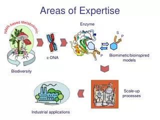
Content 1.Organization 2. Staff 3. Major Interest and Expertise
Organization Nanjing Branch of Remote Sensing application center Agricultural remote sensing application & research group Ministry of Agriculture Jiangsu academy of agricultural sciences
Staff members All of us: Ground data collection, Processing and visual interpretation of remote sensing image Ling Sun: programming, establishment of information system, Modeling of rotation cycle Zhiming Wang: nitrogen and carbon cycle in soil, landuse change Bingbai Li: crop simulation models, heat damage of rice, crop recognition with rada image JingJingWang: aquatic vegetation monitoring with spectrometer Lin Qiu: Soil classification,Digital soil mapping crop recognition method with high resolution image, quantity of soil macro nutrients in field based on Vis-Nir spectroscopy
Ground data collection 60,000 Km
result Result of early rice in 2010 • Groud quadrat: -3.05% • Image interpretation: -4.98%。
result Result of late rice & one season rice in 2010 • Image Interpretation -0.78% • Ground quadrat -2.56%
Water hyacinth monitoring with field spectrometer and image 16/11/2010
Soil classification & Digital soil mapping <?xml version="1.0" encoding="gb2312" standalone="no"?> <rulebase xmlns="http://www.ruleml.org/0.86/xsd" xsi:schemaLocation="http://www.ruleml.org/0.86/xsd ruleml-0_86-nafdatalog.xsd" xmlns:xsi="http://www.w3.org/2001/XMLSchema-instance" direction="forward"> <_rbaselab> <ind>水耕人为土土类判断</ind> </_rbaselab> <!--*********************潜育水耕人为土土类*****************************--> <fact> <_rlab> <ind>Slot1</ind> </_rlab> <_head> <atom> <_opr> <rel>有</rel> </_opr> <ind>土壤</ind> <ind>水耕人为土中在矿质土表至cm范围内部分土层(≥10cm)</ind> <ind>潜育特征</ind> </atom> </_head> </fact>
坡度 高程 平面曲率 剖面曲率 Soil classification & Digital soil mapping


![[Expertise] and Definition](https://cdn3.slideserve.com/5425337/expertise-and-definition-dt.jpg)