Download
1 / 44
490 likes | 1.64k Vues
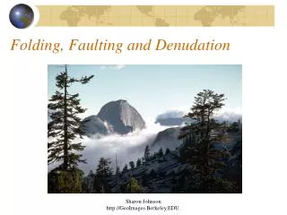
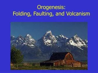
Orogenesis: Folding, Faulting, and Volcanism. Folding. response to compression or shear. Faulting. Definition: fractures where some type of displacement (movement) has occurred. Three types normal reverse/thrust

E N D
Folding • response to compression or shear
Faulting • Definition: fractures where some type of displacement (movement) has occurred. • Three types • normal • reverse/thrust • transform (strike-slip) Carmel Valley Fault, CA
Landforms - Normal Faulting • Fault escarpment Owens Valley, CA Sierra Nevada, CA Grand Tetons, WY
Normal Faulting • Horst and graben (“hill” and “grave”) • Death Valley/ Panamint Ranges
San Andreas fault System • How long is it? About 600 miles (1000 km) • Relative motion of the Pacific Plate? @ 2 inches (5 cm) northwest per year. (We’ll be off the coast of San Francisco in 12 million years!)
Transform Plate Boundary • Features: • shallow, linear rift valleys Carrizo Plain, central CA • San Andreas Lake (Crystal Springs Reservoir) • - looking south along fault • - San Francisco water supply • - geology vegetation
Temblor Range Dragon’s Back Transform Plate Boundary • Activity: • shallow to moderate earthquakes • little to no volcanism Carrizo Plain, CA (view to the east)
The Geography of Earthquakes • Globally: primarily at plate boundaries • Intraplate earthquakes do occur!
The Geography of Earthquakes • USA: 1977-1997 earthquake events • USA: every state except ND, FL
Earthquakes • Earthquakes are the shaking or vibration of the ground as a result of rocks suddenly breaking along a fault. • Focus (hypocenter) = rupture point • Epicenter = point on surface above focus • Foreshocks • Aftershocks
Process: the earthquake cycle (elastic rebound theory) • Earthquakes are a ‘release of energy’ in the form of a seismic wave (vibrates the crust). • Plate movement strain builds rocks “locked together” (frictional bond) • Rocks bend hit limit --> rupture/break • Cycle repeats ”start-stop” motion along fault
Seismic Waves • Some of the waves that are generated by an earthquake travel within the earth and other travel along the surface. • Waves traveling within the earth are known as body waves. • Surface waves cause the most damage to buildings during an earthquake.
Surface Waves • Surface waves can set up liquefactionin alluvium. This is where the most extensive damage to buildings occurs. • Liquefaction: wavelike, almost liquid, rolling of surface • Alluvium: fine material deposited by water over many years.
Measuring Earthquakes • seismograph: records the vibrations of the crust (Richter Scale) • seismogram: tracing record • Modified Mercalli Scale (I-VII)measures damage
Major California Earthquakes • Fort Tejon, 1857 - 8.0 magnitude • San Francisco, 1906 - 7.9 magnitude • 1933 Long Beach - 6.3 magnitudeDestroyed Glendale College Buildings! • San Fernando, 1971 - 6.6 • Northridge, 1994 - 6.7 • Hector Mine, 1999 - 7.1
Fort Tejon, 1857 California’s largest ever! • TIME: January 9, 1857 • LOCATION: about 72 km (45 miles) northeast of San Luis Obispo • MAGNITUDE: Mw 8.0 (approx.) • TYPE OF FAULTING: right-lateral strike-slip • FAULT RUPTURED: San Andreas fault • LENGTH OF SURFACE RUPTURE: about 360 km (225 miles) • MAXIMUM SURFACE OFFSET: about 9 meters (30 feet)
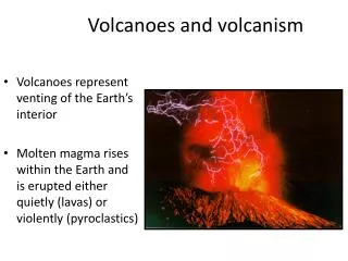
The Geography of Volcanism • Three major zones of volcanic activity • convergent plate boundaries • divergent plate boundaries • hot spots
Volcano Classification • active: has erupted in recorded history. (Kilauea, Hi, Mt. Etna, Italy, Mt. Lassen) • dormant: has not been seen to erupt in history, but shows evidence of recent activity. (Mammoth Mtn, CA or Crater Lake, OR) • extinct: no sign of recent or historic activity (Mt. Kilimanjaro, East Africa)
Volcanoes: Explosive • Composite cones (stratovolcano) • pointed, steep-sided, tall volcanoes • “Composite”: layers of pyroclastics and lava (mostly felsic) • Explosive and dangerous; found in subduction zones
Landforms: Explosive Arenal, Costa Rica
Hot Spots • Isolated columns of hot magma rising slowly within the aesthenosphere (mantle). • Melts overlying crust, “burning a hole through” • Can be underneath continents or ocean plates.
Landforms: Effusive • Shield volcanoes • large, rounded volcanoes with a gentle slope • central vent • flat terrain (or can not build up dome) • constructed by a series of basalt flows over time.
Hot Spots • Loihi • building, but still 1000 m below surface • will eventually replace the Big Island
The Geography of Volcanism • Volcanism primarily submarine. • several thousand volcanoes are continental (about 600 are active) • over 50,000 in the Pacific ocean alone
(Selected) Major Historic Eruptions • Krakatoa (1883), Indonesia • eruption obliterates an entire group of islands, leaving a submerged caldera. • blast heard for thousands of miles • ash reaches mesosphere (80km / 50 mi) • tsunami’s kill about 40,000 people
Mammoth Lakes • part of Long Valley Caldera • Eruption 760,000 years ago • 500 x more material ejected than Mt. St. Helens!
Mammoth Mtn next? • Active, moving magma at about 3 km depth • 1200 tons of CO2 per day coming up through the soil tree kills • earthquake swarms • little surface deformation • Classification? dormant