Download
1 / 125
1.66k likes | 2.35k Vues
Introduction to PostGIS. Paul Ramsey. Spatial Objects for PostgreSQL. Adds support for geographic objects to the PostgreSQL object-relational database PostgreSQL already has “geometric types” but native geometries are too limited for GIS data and analysis. PostGIS Overview / History.

E N D
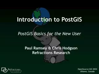
Introduction to PostGIS Paul Ramsey
Spatial Objects for PostgreSQL • Adds support for geographic objects to the PostgreSQL object-relational database • PostgreSQL already has “geometric types” but native geometries are too limited for GIS data and analysis
PostGIS Overview / History • June 2001 –Version 0.1 • Spatial types tied to GiST • July 2001 – Version 0.5 • Tie-in to UMN MapServer • Wider ability to visualize data • May 2007 – Version 1.2 • Full support for OpenGIS SF-SQL • Performance increases • Analysis and transformation functions
Why PostGIS? • Because databases are better than files • Unified Storage, Management, Access • SQL Everywhere • Transactional Integrity • Multiple Users, Multiple Edits
LAN uDig Internet Mapserver QGIS OpenIMF GeoServer PostGIS WebClient GRASS MapGuide ArcGIS uDig PostGIS in the Spatial Stack
Who is using PostGIS? • Lots of people … • 1400 mailing list members • 14K visits/month10K visitors/month • 100 source code downloads per day100 windows binary downloads per day • 970K Google search results • Great Google trends …
Who is using PostGIS? • North Dakota State Water Commission in Bismark uses PostGIS as the cost-effective foundation for managing the use of state-wide water resources. PostGIS tied unobtrusively into their existing desktop systems and pre-empted a costly migration to an ArcIMS/ArcSDE system.
Who is using PostGIS? • The Ministry of Sustainable Resource Management (British Columbia, Canada) uses PostGIS to store, manage and analyze their Digital Road Atlas, a large and complex road network database.
Who is using PostGIS? • Institut Géographique National (IGN France) uses PostGIS to underpin a system containing more than 100 million spatial objects, including a 3D national database of roads, rails, hydrography, vegetation, buildings and administrative boundaries.
Who is using PostGIS? • InfoTerra (United Kingdom) uses PostGIS to store >600 million features of topographic data. Sits at the back-end of their online DataStore. Notable load times of 12 hours for the entire data-suite ~14000 features per second. More notable savings of ~£1000000 per annum.
Workshop Summary • Installation (PostgreSQL and PostGIS) • System Configuration • Creating and Loading Data • Creating Indexes • Query Tuning • Spatial SQL
2.1 – PostgreSQL Installation • Windows Installer • PostgreSQL 8.2.4 • PgAdmin III • Install as Service to allow automatic database start on boot • Demonstrate Installation …
2.1 – PostgreSQL Installation • Directories created during installation: • \bin - Executables • \include - Include files for compilation • \lib - DLL shared library files • \share - Extensions
2.1 – PostgreSQL Installation • Tools included with the install: • PgAdmin III • psql Command Line
2.2 – PostGIS Installation • PostGIS bundled with PostgreSQL lags the current release by a few versions • Current release is 1.3.1 (1.1.x is bundled with PostgreSQL) • Our Lab • Already has PostgreSQL installed • Already has PostGIS installed • We need to create an empty spatial database
2.2 – PostGIS Installation • A PostgreSQL instance has one software version and one network port (5432) • An instance contains many databases • Connection string specifies a database“-h host –U user –d database –p password” • A database contains many schemas • public • A schema contains many tables • public.geometry_columns • A table contains many tuples
2.3 – Spatially Enable PostgreSQL • Connect to the instance • User “postgres”, password “postgres” • Create a new database in our local instance • Select “template_postgis” as the template • Connect to the database • Check for the spatial system tables • spatial_ref_sys • geometry_columns
2.3.1 – Without template_postgis • Create a new database • Select “template1” as the template • Connect to the database • Load/run the PostGIS extension (lwpostgis.sql) • Load/run the PostGIS spatial reference systems (spatial_ref_sys.sql)
2.3.1 – Without template_postgis • Run PG Admin III …
2.3.1 – UNIX Installation Note PostGIS requires PL/PgSQL createlang plpgsql –d postgis –U postgres psql -f lwpostgis.sql –d postgis –U postgres psql -f spatial_ref_sys.sql –d postgis –U postgres
3 Using PostGIS PostGIS Workshop.txtCheat sheet of SQL commands for this workshop - avoid typing!
3.1 – Simple Spatial SQL “Manually” create geometries create table points (pt geometry, name varchar); insert into points values ('POINT(0 0)', 'Origin'); insert into points values ('POINT(5 0)', 'X Axis'); insert into points values ('POINT(0 5)', 'Y Axis'); select name, ST_AsText(pt), ST_Distance(pt, 'POINT(5 5)') from points;
3.1 – Simple Spatial SQL • name | astext | distance • --------- + -------------- + ------------------ • Origin | POINT(0 0) | 7.071067 • X Axis | POINT(5 0) | 5 • Y Axis | POINT(0 5) | 5 • (3 rows)
3.2 OGC Metadata Tables • GEOMETRY_COLUMNS • F_TABLE_CATALOG = ‘’ • F_TABLE_SCHEMA = ‘public’ • F_TABLE_NAME = ‘bc_roads’ • F_GEOMETRY_COLUMN = ‘the_geom’ • COORD_DIMENSION = 2 • SRID = 3005 • TYPE = ‘MULTILINESTRING’
3.2 OGC Metadata Tables • SPATIAL_REF_SYS • SRID = 3005 • AUTH_NAME = ‘EPSG’ • AUTH_SRID = 3005 • SRTEXT = ‘PROJCS["NAD83 / BC Albers”, … ]’ • PROJ4TEXT = ‘+proj=aea …’
3.3 – Loading Shape Files • Shape File (Misnomer! 3+ Files!) • .shp = geometry • .dbf = attributes (string, number, date) • .shx = utility index • PostGIS/PostgreSQL Table • Columns can be geometry • Columns can be attributes • One Shape File = One PostGIS Table
3.3 – Loading Shape Files Run cmd.exe pg_setenv.bat
3.3 – Loading Shape Files • shp2pgsql [opts] shapefiletablename • shp2pgsql –i –s 3005 –D bc_pubs.shp bc_pubs > bc_pubs.sql • Read in .shp file • Write out .sql file • Load .sql file into PostgreSQL • using psql • using PgAdmin
3.3 – Loading Shape Files • shp2pgsql -s 3005 bc_pubs.shp public.bc_pubs > bc_pubs.sql
3.3 – Loading Shape Files notepad bc_pubs.sql
3.3.1 – Command Line Options -D = Use “dump” format -i = Do not use “bigint”, even for long numbers -s <#> = Use this SRID -W <encoding> = Use this character encoding -a = Run in append mode
3.3 – Loading Shape Files • pg_shpsql.bat • shp2pgsql -i -D -s 3005 bc_hospitals.shp bc_hospitals > bc_data.sql • shp2pgsql -i -D -s 3005 bc_municipality.shp bc_municipality >> bc_data.sql • shp2pgsql -i -D -s 3005 bc_voting_areas.shp bc_voting_areas >> bc_data.sql • shp2pgsql -i -D -s 3005 bc_pubs.shp bc_pubs >> bc_data.sql • shp2pgsql -i -D -s 3005 bc_roads.shp bc_roads >> bc_data.sql
3.3 – Loading Shape Files • psql –d postgis –U postgres –f bc_data.sql
3.4 Viewing Data in PostGIS • Quick desktop viewing options • uDig • QGIS • gvSIG • CadCorp SIS* • FME Viewer* • Web based application options • MapGuide • Mapserver • Geoserver
3.4 Viewing Data in PostGIS • Program Files uDig 1.1-RC11 uDig
3.4 Viewing Data in PostGIS • File New Layer
3.5.1 Creating Spatial Indexes • PostGIS implements R-Tree indexes on top of the GiST indexing system • Organizes data into nesting rectangles for fast searching • CREATE INDEX bc_roads_gidx ON bc_roads USING GIST (the_geom); • (now create indexes on the other tables too…)
3.5.2 Using Spatial Indexes • Indexes are brought into play when PostgreSQL recognizes an “operator” in the SQL statement. For example: • SELECT * FROM mytable WHERE myname = ‘Paul’ = is an operator • SELECT * FROM mytable WHERE age < 2 < is an operator