Download
1 / 16
160 likes | 323 Vues
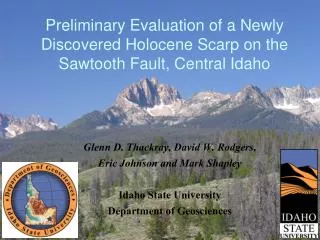
Preliminary Evaluation of a Newly Discovered Holocene Scarp on the Sawtooth Fault, Central Idaho. Glenn D. Thackray, David W. Rodgers, Eric Johnson and Mark Shapley Idaho State University Department of Geosciences. Significant findings.

E N D
Preliminary Evaluation of a Newly Discovered Holocene Scarp on the Sawtooth Fault, Central Idaho Glenn D. Thackray, David W. Rodgers, Eric Johnson and Mark Shapley Idaho State University Department of Geosciences
Significant findings • The Sawtooth Fault is a very active range-bounding normal fault • The fault has experienced 2-3 postglacial events with 2-4 m average offset • A segment boundary may divide the fault into 40 km and 15-25 km segments
Faults Red: Holocene Orange: Late Quaternary Yellow: Quaternary Green: Tertiary HL BP Breckenridge et al., 2003 Note Borah etc faults Sawtooth fault: Late Q
Earthquake epicenters Data Source: USGS Years of record: 1872-1993 LiDAR datasets in two range front areas.
LiDAR derived topography, Redfish Lake area, converted to Bare-Earth DEM with 1 m resolution 5000 m
LiDAR-derived scarp profiles Holocene surface • Offset of Holocene fluvial surface • 2.5 m offset (avg. 2-3 m) • 1 event inferred 2.5 m offset • Offset of Late Pleistocene deglacial surface (ca. 11.5-14 ka) • 6 m offset (avg. 4-8 m) • 2-3 events inferred • ca. 0.3-0.5 m/ka offset rate Late Pleistocene surface 6 m offset
10 km Field observations fault scarp documented fault scarp not documented Scarp is consistently 5-8 m high where observed in latest Pleistocene surfaces ? 10 km
Fault scarp reconnaissance • Fault scarp is 5-8 m high in de-glacial landscapes in most locations visited • Fault scarp generally slopes 30-35o and is composite, with no readily apparent younger scarp in most locations • Fault scarp appears to be a single strand in most areas Outstanding questions • Is the fault scarp segmented? • When were the most recent events?
10 km Possible fault segment boundary -range front is less dramatic in this area -scarp is less apparent or absent in this area -scarp is less continuous south of this area -40 km and 15-25 km segments ? fault scarp documented fault scarp not documented 10 km
10 km Post-glacial fault history • Lake sediments provide potential paleoseismic archives • Three lakes contain observed disturbance event stratigraphy • Most recent event occurred in mid-Holocene time 10 km
Earthquake epicenters >M4.5 Data Source: USGS Years of record: 1872-1993 Potential Hazards 1. Stanley (6 km, pop. 300), high summer visitation 2. Large, moraine-dammed lakes have high summer usage 3. Sun Valley (40 km, pop. 1500+) 4. Boise metropolitan area (100 km, pop. 400,000)
Conclusions • The Sawtooth Fault has experienced 2-3 events since 11-14 ka • The scarp indicates 2-4 m offset per event • Active fault length is 55-65 km, with a possible segment boundary separating fault segments of 40 km and 15-25 km • Lake sediments provide an apparent paleoseismic record, with the most recent event in mid-Holocene time • The fault activity may present significant hazards to population centers, including Boise
Acknowledgments • LiDAR acquisition funded by Idaho NASA EPSCoR program • LiDAR data processed by David Streutker and Nancy Glenn, ISU • Portions of field mapping and fault scarp profiling completed by Joshua Keeley and Chris Kemp, ISU