NWS Alert System: Communicate, Monitor, Stay Safe!
280 likes | 401 Vues
Learn how to activate communication channels and receive severe weather updates via NOAA Radio, EAS, and spotter activation. Stay prepared with the latest news from NWS and engage in community safety measures.

NWS Alert System: Communicate, Monitor, Stay Safe!
E N D
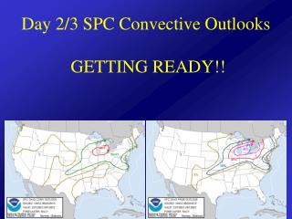
Presentation Transcript
COMMUNICATION Wilmington, OH NWS (Secondary) North Webster, IN NWS (Primary)
RECEIVING DATA EAS 8 EMWIN 2 AMATUER RADIO 4 EMA WEATHER CHANNEL or LOCAL TV 8 BARON 2, GR level 2, Stormlab/Interwarn 2 NOAA Wx Radio 8
Spotter Activation 4 CountiesAmateur RadioFire DepartmentsLaw Enforcement
NWS CHAT- 5 Directors 3/10/2011 7:04:35 AM) The topic is: WFO Northern Indiana IWX Chatroom (10/14/2012 5:00:56 PM) nwsbot: IWX issues STRONG THUNDERSTORMS MOVING TOWARD HILLSDALE COUNTY for Hillsdale [MI] and Steuben [IN] till 5:30 PM EDT (10/14/2012 5:04:55 PM) nwsbot: IWX issues Severe Thunderstorm Warning [wind: 60 MPH, hail: 1.00 IN] for Berrien, Cass [MI] and La Porte, St. Joseph [IN] till 5:45 PM EDT (10/14/2012 5:05:48 PM) media-ryan.d.wichman: IWX - what are your thoughts on that Hillsdale county storm? Showing a TVS on our end, but doesn't look overly impressive overall. (10/14/2012 5:07:53 PM) nwsiwx-courtney.obergfell: Ryan, it's showing some weak rotation in the lowest levels. Think the TVS may be trigged from higher levels (10/14/2012 5:12:20 PM) media-greg.shoup: Estimating wind gusts up to about 35 mph here ++R (10/14/2012 5:13:18 PM) media-greg.shoup: Sorry west of downtown FW Hilligas rd (10/14/2012 5:13:35 PM) nwsiwx-courtney.obergfell: Thanks Greg (10/14/2012 5:13:36 PM) em-larry.camp: Branch County Skywarn on standby and monitoring (10/14/2012 5:13:40 PM) nwsbot: IWX continues Severe Thunderstorm Warning [wind: 60 MPH, hail: 1.00 IN] for Berrien, Cass [MI] and La Porte, St. Joseph [IN] till 5:45 PM EDT (10/14/2012 5:13:51 PM) media-ryan.d.wichman: Thanks Courtney! (10/14/2012 5:14:43 PM) nwsiwx-courtney.obergfell: No reports out of the Hillsdale storm so far either Ryan. have SPS out on it (10/14/2012 5:29:07 PM) nwsbot: IWX cancels Severe Thunderstorm Warning for La Porte, St. Joseph [IN] (10/14/2012 5:29:07 PM) nwsbot: IWX continues Severe Thunderstorm Warning [wind: 60 MPH, hail: 1.00 IN] for Berrien, Cass [MI] till 5:45 PM EDT (10/14/2012 5:43:18 PM) nwsbot: IWX expires Severe Thunderstorm Warning for Berrien, Cass [MI] (10/14/2012 5:50:07 PM) nwsbot: IWX issues Short-term Forecast (NOW) (10/14/2012 5:59:36 PM) nwsbot: IWX issues Short-term Forecast (NOW) (10/14/2012 6:30:08 PM) nwsbot: IWX issues Marine Weather Statement (MWS) ... SPECIAL MARINE WARNING WILL EXPIRE AT 630 PM EDT/530 PM CDT/ ...
2 EMA’s activate 6 “911” centers activate Public Understands Siren Tones?? Counties activate differently!! Steady Tone Tornado Warning Wail Tone Enemy Attack No Siren –all clear SIRENS
NIXLE & FAX - 1 • Nixle ConnectOver 5,000 agencies use Nixle Connect to communicate with residents by text message and email at no cost
9-1-1 Dispatchers Very little time to handle weatherUnlikely that they can get any timely reports to the NWS
THE PARTNERSHIP EMA MEDIA NWS SPOTTERS
Nearly every mode of communication failed……. BUT, cell phone users were getting updates from Facebook, Twitter, EMA, National Weather Service, Newspaper, Radio & Television Websites