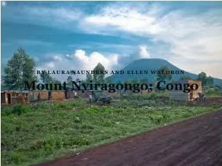
Mount Nyiragongo; Congo
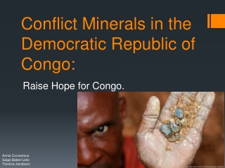
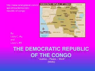
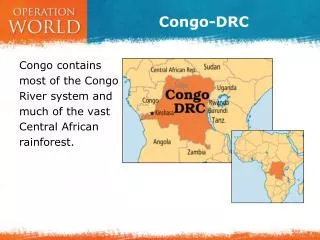
Mount Nyiragongo; Congo. By Laura Saunders and Ellen Waldron. The Democratic Republic of Congo is a country located in Central Africa. It borders the Central African Republic and South Sudan to the north; Uganda, Rwanda, and Burundi in the east; Zambia and Angola to the south.

Mount Nyiragongo; Congo
E N D
Presentation Transcript
Mount Nyiragongo; Congo By Laura Saunders and Ellen Waldron
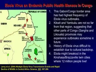
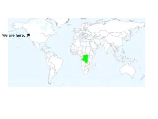
The Democratic Republic of Congo is a country located in Central Africa. It borders the Central African Republic and South Sudan to the north; Uganda, Rwanda, and Burundi in the east; Zambia and Angola to the south. It is the second largest country in Africa by area and the eleventh largest in the world. With a population of over 75 million, the Democratic Republic of the Congo is the nineteenth most populous nation in the world, the fourth most populous nation in Africa. About the Democratic Republic of Congo.
Mount Nyiragongo is a highly active volcano in the Democratic Republic of the Congo. 50,000 people live at the foot of the volcano due to the fertile farmland formed from volcanic soil. Villagers are aware of the danger but are prepared to take the risk. Gomais home to 460, 000 people, so need protecting. The radio stated that there is was risk but there was a huge risk… Background Information.
Weeks before the 2002 eruption tremors and small earthquakes were felt. These were early signs of an eruption, but nothing was done. Residents only started to take notice when they saw small plumes of smoke from Mount Nyiragongo. Background Information
On January 17th 2002 mount Nyiragongo erupted causing widespread devastation. The eruption produced lava fountain projections of 60m high. The lava flow was heading straight for the town. Villagers had less than 5 minutes to escape! The Eruption!
Rivers of lava poured down the volcano's flanks into a valley to the south, destroying 14 villages. Stream of lava flowed across the runway at Goma airport, igniting aviation fuel stores. Lava reached Goma, cutting the town in half and causing widespread devastation. About 300,000 people fled into neighbouring Rwanda . Lava reached Lake Kivu, raising fears it would disturb methane on the lake bed. The Immediate effects.
Villagers had less than 5 minutes to evacuate their homes. 300,000 people evacuated to Ruanda and left living on the streets. 1,200 people left homeless. 100 people killed. Homes were destroyed within 10 minutes and 20% of the homes in village were destroyed. Parts of the city were covered by up to 3m of lava. No prior warning meant no shelter or electricity for evacuees. Acid rain and no fresh water meant they had to boil the acid rain water. Few tools for rescue support so many struggled to dig out survivors and the dead. What were the social effects of the eruption?
80% of commercial infrastructure was destroyed. The lava flows destroyed 20% of the homes in the village. Goma became reliant on aid from MEDCs. What were the economic effects of the eruption?
The constant plume of toxic gasses meant that there is more than twice the amount of pollution than the whole of France in Goma. Acid rain damaged the land and wildlife in the area. The boiling lava flows destroyed everything in their paths; including habitats and wildlife. What were the environmental effects of the eruption?
Aid agencies were already in place in the east which provided shelter and food for evacuees. Volcanic observatory funded to monitor volcanic activity to allow quicker evacuation of the area. Scientists measured the composition and the temperature of Volcano. Scientists monitored Mount Nyiragongo every 2 months . In the future, should be able to predict eruptions 3 weeks in advance and give warnings to local residents. Bank s provided money to start up small businesses again. Primary school children educated about volcanoes and their behaviour. What were the responses to the disaster?
Security problems- Scientists at risk from armed robbers whilst monitoring the area. 100km/h winds on the slopes for the scientists. Constant plume of gases meant twice as much pollution as France. Many MEDCs were reluctant to provide aid due to the political conflict in the Congo. Struggle to implement effective recovery or future protective measures, putting them at more risk. What were the risks and problems?